Property Record
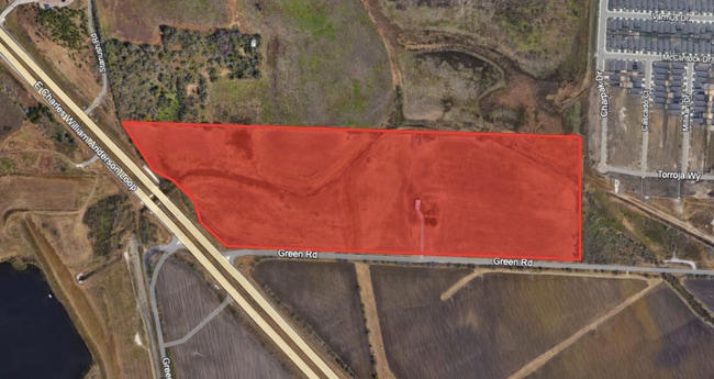
10225 Green Rd, Converse, TX 78109
Property Detail
10225 Green Rd
San Antonio-New Braunfels, TX
CB 5088 P-12D ABS 308 REFER TO: 05088-000-0128
05088-000-0128
BEXAR
Privatepreserveopenspacevacantlandforestlandconservation
Texas
AE The base floodplain where base flood elevations are provided. AE Zones are now used on new format FIRMs instead of A1-A30 Zones.
126
2024
51.33 AC
2025
South
131802
San Antonio
NEARBY LISTINGS FOR SALE OR LEASE
DEMOGRAPHICS near 10225 Green Rd
1 mile
3 mile
5 mile
2025 Total Population
3,568
23,314
92,529
2030 Population
4,249
25,905
99,393
Pop Growth 2025-2030
+ 19.09%
+ 11.11%
+ 7.42%
Average Age
35
35
36
2025 Total Households
1,208
7,511
30,240
HH Growth 2025-2030
+ 19.21%
+ 11.30%
+ 7.54%
Median Household Inc
$94,551
$98,039
$83,882
Avg Household Size
3.00
3.10
3.00
2025 Avg HH Vehicles
2.00
2.00
2.00
Median Home Value
$335,264
$314,128
$266,136
Median Year Built
2011
2010
2005
Nearby Places
Map Layers
Map Styles
 Street
 Aerial
Layers
 Traffic
 Biking
Places
Listings with unknown addresses are not visible on the map
- Restaurants
- Banks
- Shops
- Fitness
- Groceries
PUBLIC TRANSPORTATION
AIRPORT
San Antonio International
Drive
Walk
Distance
San Antonio International
27 min
19.1 mi
SALE & LEASE HISTORY
LISTING DATE
SALE/LEASE

Feb 19, 2025
For Sale
Nearby Properties
Address
Land Use
TOTAL SIZE
Lot Size
Zoning
Address
Land Use
TOTAL SIZE
Lot Size
Zoning
116,536 SF
13.84 AC
Address
Land Use
TOTAL SIZE
Lot Size
Zoning
97,064 SF
20 AC
Address
Land Use
TOTAL SIZE
Lot Size
Zoning
28.60 AC
Address
Land Use
TOTAL SIZE
Lot Size
Zoning
232,554 SF
13.19 AC
Address
Land Use
TOTAL SIZE
Lot Size
Zoning
35.72 AC
Address
Land Use
TOTAL SIZE
Lot Size
Zoning
336,913 SF
17.28 AC
Address
Land Use
TOTAL SIZE
Lot Size
Zoning
83,178 SF
22.50 AC
Address
Land Use
TOTAL SIZE
Lot Size
Zoning
67,642 SF
22.18 AC
Address
Land Use
TOTAL SIZE
Lot Size
Zoning
76,900 SF
21.81 AC
Address
Land Use
TOTAL SIZE
Lot Size
Zoning
64,010 SF
13.50 AC
Address
Land Use
TOTAL SIZE
Lot Size
Zoning
46,076 SF
16.51 AC
Address
Land Use
TOTAL SIZE
Lot Size
Zoning
92.04 AC
Address
Land Use
TOTAL SIZE
Lot Size
Zoning
1,608 SF
216.29 AC
Address
Land Use
TOTAL SIZE
Lot Size
Zoning
784 SF
234.55 AC
Address
Land Use
TOTAL SIZE
Lot Size
Zoning
29,876 SF
28.83 AC
Address
Land Use
TOTAL SIZE
Lot Size
Zoning
104,121 SF
8.96 AC
Address
Land Use
TOTAL SIZE
Lot Size
Zoning
102.05 AC
Address
Land Use
TOTAL SIZE
Lot Size
Zoning
92,448 SF
3.27 AC
Address
Land Use
TOTAL SIZE
Lot Size
Zoning
1,016 SF
122.23 AC
Address
Land Use
TOTAL SIZE
Lot Size
Zoning
1,568 SF
115 AC
Address
Land Use
TOTAL SIZE
Lot Size
Zoning
1,288 SF
126.07 AC
Address
Land Use
TOTAL SIZE
Lot Size
Zoning
208.90 AC
Address
Land Use
TOTAL SIZE
Lot Size
Zoning
38,747 SF
1.45 AC
Address
Land Use
TOTAL SIZE
Lot Size
Zoning
52,000 SF
45.52 AC
Address
Land Use
TOTAL SIZE
Lot Size
Zoning
8,220 SF
115.41 AC
Address
Land Use
TOTAL SIZE
Lot Size
Zoning
Address
Land Use
TOTAL SIZE
Lot Size
Zoning
24.45 AC
Address
Land Use
TOTAL SIZE
Lot Size
Zoning
37,021 SF
13.85 AC
Address
Land Use
TOTAL SIZE
Lot Size
Zoning
992 SF
97.07 AC
Address
Land Use
TOTAL SIZE
Lot Size
Zoning
142.46 AC
The World's #1 Commercial Real Estate Marketplace
Connect with us
© 2026 CoStar Group
The information above has been obtained from sources believed reliable. While we do not doubt its accuracy we have not verified it and make no guarantee, warranty or representation about it. It is your responsibility to independently confirm its accuracy and completeness. Any projections, opinions, assumptions, or estimates used are for example only and do not represent the current or future performance of the property. The value of this transaction to you depends on tax and other factors which should be evaluated by your tax, financial, and legal advisors. You and your advisors should conduct a careful, independent investigation of the property to determine to your satisfaction the suitability of the property for your needs.