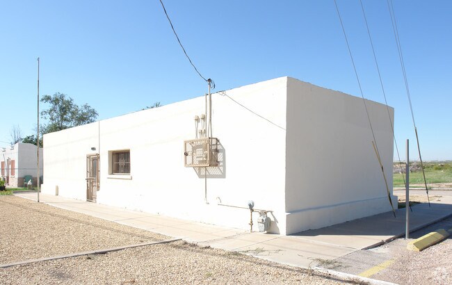
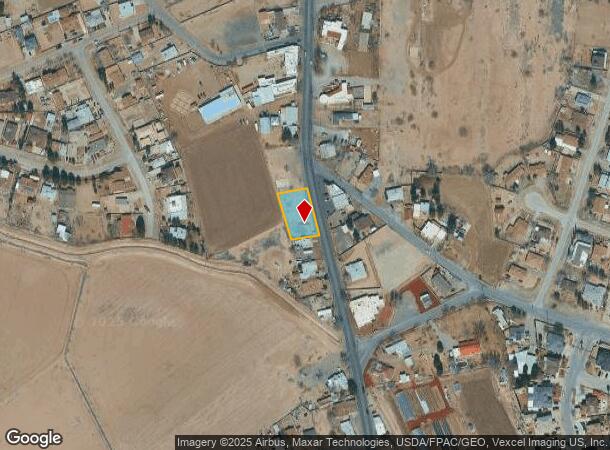
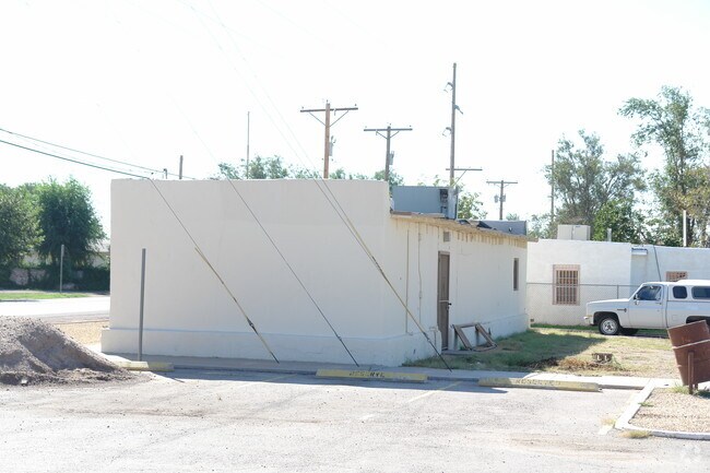
Property Record
10226 Socorro Rd, El Paso, TX 79927
NEARBY LISTINGS FOR SALE OR LEASE
Property Detail
10226 Socorro Rd
El Paso, TX
Socorro
S533-000-0210-0250
21 SOCORRO TR 2-A (0.3258 AC)
Governmentalpublicusegeneral
El Paso
0
Texas
2025
0.33 AC
010401
East
1,102 SF
El Paso
DEMOGRAPHICS near 10226 Socorro Rd
1 Mile
3 Mile
5 Mile
2024 Total Population
6,112
40,535
101,979
2029 Population
6,139
41,064
103,291
Pop Growth 2024-2029
+ 0.44%
+ 1.31%
+ 1.29%
Average Age
39
37
37
2024 Total Households
1,929
12,708
32,280
HH Growth 2024-2029
+ 0.31%
+ 1.27%
+ 1.22%
Median Household Inc
$38,719
$40,956
$43,490
Avg Household Size
3.10
3.10
3.10
2024 Avg HH Vehicles
2.00
2.00
2.00
Median Home Value
$119,490
$113,230
$124,523
Median Year Built
1987
1988
1991
Nearby Places
Map Layers
Map Styles
 Street
 Aerial
- Restaurants
- Banks
- Shops
- Fitness
- Groceries
PUBLIC TRANSPORTATION
AIRPORT
El Paso International
DRIVE
WALK
Distance
El Paso International
31 min
15.6 mi
Nearby Properties
Address
Land Use
TOTAL SIZE
Lot Size
Zoning
Address
Land Use
TOTAL SIZE
Lot Size
Zoning
770,870 SF
44.65 AC
Address
Land Use
TOTAL SIZE
Lot Size
Zoning
393,206 SF
66.48 AC
SU
Address
Land Use
TOTAL SIZE
Lot Size
Zoning
123,306 SF
53.62 AC
M1
Address
Land Use
TOTAL SIZE
Lot Size
Zoning
392,214 SF
29.67 AC
Address
Land Use
TOTAL SIZE
Lot Size
Zoning
89,251 SF
9.39 AC
AM
Address
Land Use
TOTAL SIZE
Lot Size
Zoning
400,929 SF
30.05 AC
Address
Land Use
TOTAL SIZE
Lot Size
Zoning
652,080 SF
32.64 AC
Address
Land Use
TOTAL SIZE
Lot Size
Zoning
656,540 SF
36.94 AC
M1S
Address
Land Use
TOTAL SIZE
Lot Size
Zoning
127,840 SF
17.66 AC
Address
Land Use
TOTAL SIZE
Lot Size
Zoning
334,161 SF
20.28 AC
Address
Land Use
TOTAL SIZE
Lot Size
Zoning
230,263 SF
27.25 AC
C3S
Address
Land Use
TOTAL SIZE
Lot Size
Zoning
179,391 SF
8.23 AC
SD
Address
Land Use
TOTAL SIZE
Lot Size
Zoning
347,235 SF
33.50 AC
A2
Address
Land Use
TOTAL SIZE
Lot Size
Zoning
215,378 SF
9.60 AC
M1
Address
Land Use
TOTAL SIZE
Lot Size
Zoning
475,547 SF
26.82 AC
Address
Land Use
TOTAL SIZE
Lot Size
Zoning
210,863 SF
10 AC
M1S
Address
Land Use
TOTAL SIZE
Lot Size
Zoning
84,207 SF
20 AC
Address
Land Use
TOTAL SIZE
Lot Size
Zoning
177,370 SF
10.47 AC
C4
Address
Land Use
TOTAL SIZE
Lot Size
Zoning
41,778 SF
4.37 AC
A2S
Address
Land Use
TOTAL SIZE
Lot Size
Zoning
136,597 SF
10.14 AC
Address
Land Use
TOTAL SIZE
Lot Size
Zoning
165,637 SF
7.64 AC
M1
Address
Land Use
TOTAL SIZE
Lot Size
Zoning
66,948 SF
3.21 AC
C4
Address
Land Use
TOTAL SIZE
Lot Size
Zoning
90,432 SF
4.05 AC
C1S
Address
Land Use
TOTAL SIZE
Lot Size
Zoning
128,319 SF
5.92 AC
A2S
Address
Land Use
TOTAL SIZE
Lot Size
Zoning
82,683 SF
8.86 AC
C4S
Address
Land Use
TOTAL SIZE
Lot Size
Zoning
79,386 SF
10 AC
M1
Address
Land Use
TOTAL SIZE
Lot Size
Zoning
33,792 SF
9.42 AC
RF
Address
Land Use
TOTAL SIZE
Lot Size
Zoning
155,725 SF
7.65 AC
C4C
Address
Land Use
TOTAL SIZE
Lot Size
Zoning
109,666 SF
11.43 AC
M1S
Address
Land Use
TOTAL SIZE
Lot Size
Zoning
114,637 SF
9.03 AC
C4
The World's #1 Commercial Real Estate Marketplace
Connect with us
© 2025 CoStar Group
The information above has been obtained from sources believed reliable. While we do not doubt its accuracy we have not verified it and make no guarantee, warranty or representation about it. It is your responsibility to independently confirm its accuracy and completeness. Any projections, opinions, assumptions, or estimates used are for example only and do not represent the current or future performance of the property. The value of this transaction to you depends on tax and other factors which should be evaluated by your tax, financial, and legal advisors. You and your advisors should conduct a careful, independent investigation of the property to determine to your satisfaction the suitability of the property for your needs.