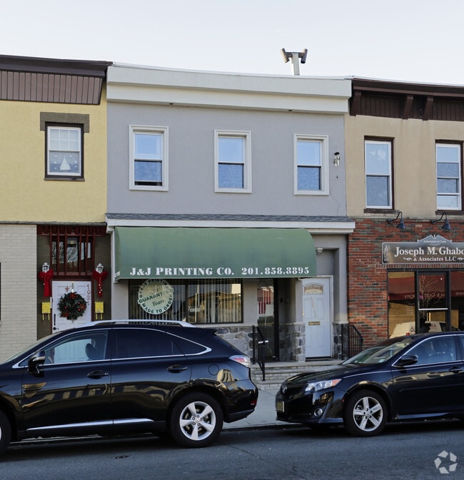
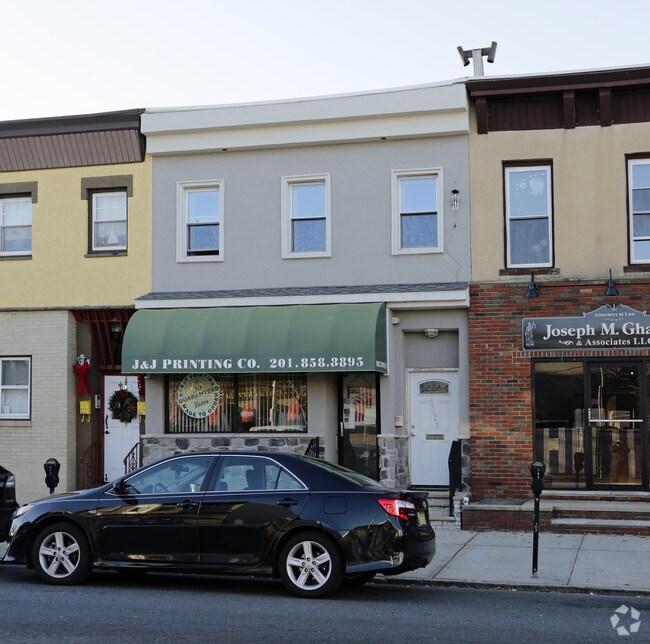
Property Record
1023 Broadway, Bayonne, NJ 07002
NEARBY LISTINGS FOR SALE OR LEASE
Property Detail
1023 Broadway
01-00053-0000-00020
Hudson
Retailwithmorethanonenonretailuse
New Jersey
X
20
34013C0200F
0.05 AC
2024
Hudson Waterfront
2025
Northern New Jersey
010200
New York-Jersey City-White Plains, NY-NJ
2,760 SF
DEMOGRAPHICS near 1023 Broadway
1 Mile
3 Mile
5 Mile
2024 Total Population
32,826
164,737
568,383
2029 Population
31,464
156,568
551,791
Pop Growth 2024-2029
(4.15%)
(4.96%)
(2.92%)
Average Age
40
39
38
2024 Total Households
12,182
60,910
220,096
HH Growth 2024-2029
(4.79%)
(5.38%)
(3.09%)
Median Household Inc
$72,246
$64,991
$77,986
Avg Household Size
2.60
2.60
2.50
2024 Avg HH Vehicles
1.00
1.00
1.00
Median Home Value
$396,557
$391,740
$498,144
Median Year Built
1958
1958
1967
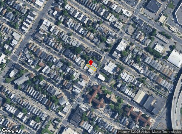
Nearby Places
Map Layers
Map Styles
 Street
 Aerial
- Restaurants
- Banks
- Shops
- Fitness
- Groceries
PUBLIC TRANSPORTATION
TRANSIT/SUBWAY
45Th Street (22nd Street-Hoboken Terminal - Hudson-Bergen Light Rail (Hudson-Bergen Light Rail))
DRIVE
WALK
Distance
45Th Street (22nd Street-Hoboken Terminal - Hudson-Bergen Light Rail (Hudson-Bergen Light Rail))
3 min
7 min
0.4 mi
34Th Street (22nd Street-Hoboken Terminal - Hudson-Bergen Light Rail (Hudson-Bergen Light Rail))
DRIVE
WALK
Distance
34Th Street (22nd Street-Hoboken Terminal - Hudson-Bergen Light Rail (Hudson-Bergen Light Rail))
3 min
18 min
1.0 mi
AIRPORT
Newark Liberty International
DRIVE
WALK
Distance
Newark Liberty International
8 min
5.5 mi
LaGuardia
DRIVE
WALK
Distance
LaGuardia
34 min
17.8 mi
John F Kennedy International
DRIVE
WALK
Distance
John F Kennedy International
44 min
26.0 mi
Freight Ports
GCT Bayonne
DRIVE
WALK
Distance
GCT Bayonne
7 min
2.1 mi
Nearby Properties
Address
Land Use
TOTAL SIZE
Lot Size
Zoning
Address
Land Use
TOTAL SIZE
Lot Size
Zoning
229.72 AC
Address
Land Use
TOTAL SIZE
Lot Size
Zoning
98.48 AC
Address
Land Use
TOTAL SIZE
Lot Size
Zoning
131.26 AC
Address
Land Use
TOTAL SIZE
Lot Size
Zoning
4.51 AC
Address
Land Use
TOTAL SIZE
Lot Size
Zoning
Address
Land Use
TOTAL SIZE
Lot Size
Zoning
1.15 AC
Address
Land Use
TOTAL SIZE
Lot Size
Zoning
Address
Land Use
TOTAL SIZE
Lot Size
Zoning
216 AC
Address
Land Use
TOTAL SIZE
Lot Size
Zoning
22.49 AC
HC
Address
Land Use
TOTAL SIZE
Lot Size
Zoning
Address
Land Use
TOTAL SIZE
Lot Size
Zoning
Address
Land Use
TOTAL SIZE
Lot Size
Zoning
75.51 AC
Address
Land Use
TOTAL SIZE
Lot Size
Zoning
69.45 AC
Address
Land Use
TOTAL SIZE
Lot Size
Zoning
108.75 AC
Address
Land Use
TOTAL SIZE
Lot Size
Zoning
63.35 AC
Address
Land Use
TOTAL SIZE
Lot Size
Zoning
2.54 AC
Address
Land Use
TOTAL SIZE
Lot Size
Zoning
12.50 AC
Address
Land Use
TOTAL SIZE
Lot Size
Zoning
30.92 AC
Address
Land Use
TOTAL SIZE
Lot Size
Zoning
3.27 AC
Address
Land Use
TOTAL SIZE
Lot Size
Zoning
17.60 AC
Address
Land Use
TOTAL SIZE
Lot Size
Zoning
Address
Land Use
TOTAL SIZE
Lot Size
Zoning
28.47 AC
I-H
Address
Land Use
TOTAL SIZE
Lot Size
Zoning
114.66 AC
BMHO
Address
Land Use
TOTAL SIZE
Lot Size
Zoning
89.40 AC
R1
Address
Land Use
TOTAL SIZE
Lot Size
Zoning
29.10 AC
Address
Land Use
TOTAL SIZE
Lot Size
Zoning
115.33 AC
IH
Address
Land Use
TOTAL SIZE
Lot Size
Zoning
Address
Land Use
TOTAL SIZE
Lot Size
Zoning
22.91 AC
Address
Land Use
TOTAL SIZE
Lot Size
Zoning
74.35 AC
TDD
Address
Land Use
TOTAL SIZE
Lot Size
Zoning
30.70 AC
The World's #1 Commercial Real Estate Marketplace
Connect with us
© 2025 CoStar Group
The information above has been obtained from sources believed reliable. While we do not doubt its accuracy we have not verified it and make no guarantee, warranty or representation about it. It is your responsibility to independently confirm its accuracy and completeness. Any projections, opinions, assumptions, or estimates used are for example only and do not represent the current or future performance of the property. The value of this transaction to you depends on tax and other factors which should be evaluated by your tax, financial, and legal advisors. You and your advisors should conduct a careful, independent investigation of the property to determine to your satisfaction the suitability of the property for your needs.