Property Record
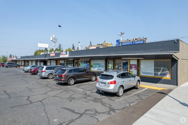
10231 Ne Clackamas St, Portland, OR 97220


NEARBY LISTINGS FOR SALE OR LEASE
Property Detail
10231 Ne Clackamas St
Portland-Vancouver-Hillsboro, OR-WA
Powers Add
R249654
POWERS ADD, BLOCK 1 TL 2200, UND 1/3 INT
Commercialnec
Multnomah
ARE
Oregon
53011C0525D
0.58 AC
2025
Gateway
2025
Portland
008100
DEMOGRAPHICS near 10231 Ne Clackamas St
1 Mile
3 Mile
5 Mile
2024 Total Population
19,241
160,677
398,799
2029 Population
18,848
156,759
389,687
Pop Growth 2024-2029
(2.04%)
(2.44%)
(2.28%)
Average Age
41
41
40
2024 Total Households
7,750
62,714
158,638
HH Growth 2024-2029
(2.23%)
(2.75%)
(2.54%)
Median Household Inc
$55,978
$68,932
$74,723
Avg Household Size
2.30
2.40
2.40
2024 Avg HH Vehicles
2.00
2.00
2.00
Median Home Value
$411,888
$441,843
$469,852
Median Year Built
1968
1962
1962
Nearby Places
Map Layers
Map Styles
 Street
 Aerial
- Restaurants
- Banks
- Shops
- Fitness
- Groceries
PUBLIC TRANSPORTATION
TRANSIT/SUBWAY
Gateway North Max Station (MAX Red Line - TriMet)
DRIVE
WALK
Distance
Gateway North Max Station (MAX Red Line - TriMet)
2 min
7 min
0.4 mi
Gateway/Ne 99Th Transit Center (MAX Blue Line - Tri-County Metropolitan Transportation District of Oregon Rail (TriMet Rail), MAX Green Line - Tri-County Metropolitan Transportation District of Oregon Rail (TriMet Rail), MAX Red Line - Tri-County Metropolitan Transportation District of Oregon Rail (TriMet Rail))
DRIVE
WALK
Distance
Gateway/Ne 99Th Transit Center (MAX Blue Line - Tri-County Metropolitan Transportation District of Oregon Rail (TriMet Rail), MAX Green Line - Tri-County Metropolitan Transportation District of Oregon Rail (TriMet Rail), MAX Red Line - Tri-County Metropolitan Transportation District of Oregon Rail (TriMet Rail))
3 min
9 min
0.5 mi
E 102Nd (MAX Blue Line - Tri-County Metropolitan Transportation District of Oregon Rail (TriMet Rail))
DRIVE
WALK
Distance
E 102Nd (MAX Blue Line - Tri-County Metropolitan Transportation District of Oregon Rail (TriMet Rail))
2 min
15 min
0.8 mi
COMMUTER RAIL
Portland (Amtrak Cascades - Amtrak, Coast Starlight - Amtrak, Empire Builder - Amtrak)
DRIVE
WALK
Distance
Portland (Amtrak Cascades - Amtrak, Coast Starlight - Amtrak, Empire Builder - Amtrak)
14 min
7.4 mi
AIRPORT
Portland International
DRIVE
WALK
Distance
Portland International
13 min
5.6 mi
Freight Ports
Port of Portland
DRIVE
WALK
Distance
Port of Portland
16 min
9.5 mi
SALE & LEASE HISTORY
LISTING DATE
SALE/LEASE

May 02, 2018
For Lease
Mar 31, 2021
For Lease
Feb 08, 2023
For Sale
Dec 10, 2021
For Lease
Nearby Properties
Address
Land Use
TOTAL SIZE
Lot Size
Zoning
Address
Land Use
TOTAL SIZE
Lot Size
Zoning
273,811 SF
6.39 AC
NULL
Address
Land Use
TOTAL SIZE
Lot Size
Zoning
236,035 SF
13.01 AC
R7
Address
Land Use
TOTAL SIZE
Lot Size
Zoning
1,024 SF
15.92 AC
OS
Address
Land Use
TOTAL SIZE
Lot Size
Zoning
197,027 SF
28.54 AC
R7H
Address
Land Use
TOTAL SIZE
Lot Size
Zoning
296,039 SF
11.70 AC
R5
Address
Land Use
TOTAL SIZE
Lot Size
Zoning
183,664 SF
8.96 AC
R5
Address
Land Use
TOTAL SIZE
Lot Size
Zoning
361,549 SF
39.26 AC
IR
Address
Land Use
TOTAL SIZE
Lot Size
Zoning
356,805 SF
27.10 AC
EG2
Address
Land Use
TOTAL SIZE
Lot Size
Zoning
140,000 SF
14.53 AC
R7
Address
Land Use
TOTAL SIZE
Lot Size
Zoning
250,280 SF
23.86 AC
IR
Address
Land Use
TOTAL SIZE
Lot Size
Zoning
31,878 SF
15.95 AC
IG2
Address
Land Use
TOTAL SIZE
Lot Size
Zoning
54,676 SF
190.32 AC
OS
Address
Land Use
TOTAL SIZE
Lot Size
Zoning
42,839,055 SF
19.25 AC
CI1
Address
Land Use
TOTAL SIZE
Lot Size
Zoning
152,575 SF
5.32 AC
EG1
Address
Land Use
TOTAL SIZE
Lot Size
Zoning
64,673 SF
NULL
Address
Land Use
TOTAL SIZE
Lot Size
Zoning
100,217 SF
1.99 AC
R5
Address
Land Use
TOTAL SIZE
Lot Size
Zoning
181,493 SF
3.70 AC
CM1
Address
Land Use
TOTAL SIZE
Lot Size
Zoning
205,034 SF
0.38 AC
RM1
Address
Land Use
TOTAL SIZE
Lot Size
Zoning
184,000 SF
18.88 AC
EG2
Address
Land Use
TOTAL SIZE
Lot Size
Zoning
58,843 SF
4.53 AC
EG2
Address
Land Use
TOTAL SIZE
Lot Size
Zoning
361,241 SF
1.80 AC
CI2
Address
Land Use
TOTAL SIZE
Lot Size
Zoning
53.15 AC
IG2
Address
Land Use
TOTAL SIZE
Lot Size
Zoning
230,105 SF
3.08 AC
CI2
Address
Land Use
TOTAL SIZE
Lot Size
Zoning
118,040 SF
10.29 AC
EG2
Address
Land Use
TOTAL SIZE
Lot Size
Zoning
489,695 SF
23.76 AC
IG2P
Address
Land Use
TOTAL SIZE
Lot Size
Zoning
369,835 SF
6.67 AC
IRD
Address
Land Use
TOTAL SIZE
Lot Size
Zoning
99,100 SF
1.31 AC
CS
Address
Land Use
TOTAL SIZE
Lot Size
Zoning
21,200 SF
16.03 AC
OS
Address
Land Use
TOTAL SIZE
Lot Size
Zoning
53,774 SF
3 AC
Address
Land Use
TOTAL SIZE
Lot Size
Zoning
174,624 SF
1.68 AC
CM2
The World's #1 Commercial Real Estate Marketplace
Connect with us
© 2025 CoStar Group
The information above has been obtained from sources believed reliable. While we do not doubt its accuracy we have not verified it and make no guarantee, warranty or representation about it. It is your responsibility to independently confirm its accuracy and completeness. Any projections, opinions, assumptions, or estimates used are for example only and do not represent the current or future performance of the property. The value of this transaction to you depends on tax and other factors which should be evaluated by your tax, financial, and legal advisors. You and your advisors should conduct a careful, independent investigation of the property to determine to your satisfaction the suitability of the property for your needs.