Property Record
1024 Club View Dr, Gallatin, TN 37066
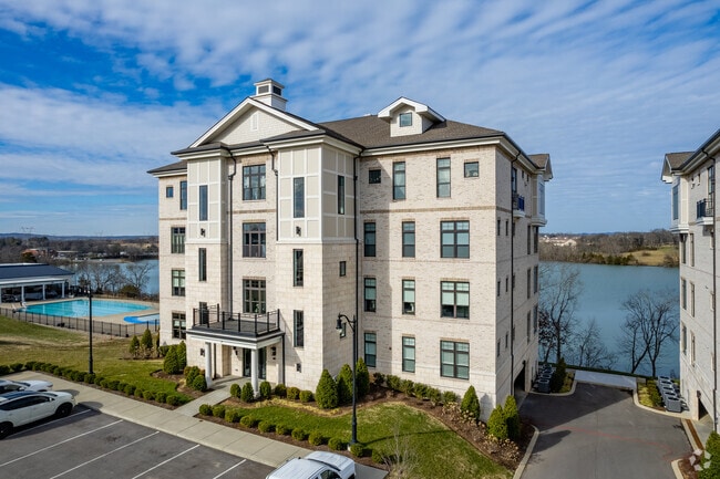
Property Detail
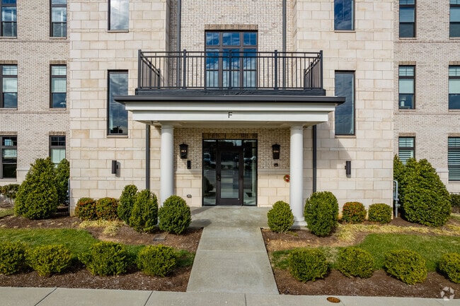
1024 Club View Dr
083147 00708
BLD E UNIT 202 REVERY POINT CONDO 4551-184
Countyproperty
Sumner
AE The base floodplain where base flood elevations are provided. AE Zones are now used on new format FIRMs instead of A1-A30 Zones.
Tennessee
2025
1.30 AC
2025
Rivergate/Hendersonville
021203
Nashville
2,109 SF
Nashville-Davidson--Murfreesboro--Franklin, TN
NEARBY LISTINGS FOR SALE OR LEASE
DEMOGRAPHICS near 1024 Club View Dr
1 mile
3 mile
5 mile
2025 Total Population
6,224
27,596
77,227
2030 Population
6,701
29,781
83,335
Pop Growth 2025-2030
+ 7.66%
+ 7.92%
+ 7.91%
Average Age
43
42
40
2025 Total Households
2,575
11,136
29,459
HH Growth 2025-2030
+ 7.84%
+ 8.14%
+ 8.05%
Median Household Inc
$103,494
$102,198
$96,069
Avg Household Size
2.40
2.50
2.60
2025 Avg HH Vehicles
2.00
2.00
2.00
Median Home Value
$700,237
$654,510
$525,988
Median Year Built
2010
2009
2003
Nearby Places
Map Layers
Map Styles
 Street
 Aerial
Layers
 Traffic
 Biking
Places
Listings with unknown addresses are not visible on the map
- Restaurants
- Banks
- Shops
- Fitness
- Groceries
PUBLIC TRANSPORTATION
AIRPORT
Nashville International
Drive
Walk
Distance
Nashville International
41 min
32.2 mi
Freight Ports
Port of Mobile
Drive
Walk
Distance
Port of Mobile
514 min
469.7 mi
Nearby Properties
Address
Land Use
TOTAL SIZE
Lot Size
Zoning
Address
Land Use
TOTAL SIZE
Lot Size
Zoning
1,050,750 SF
126.40 AC
Address
Land Use
TOTAL SIZE
Lot Size
Zoning
47,729 SF
28.52 AC
Address
Land Use
TOTAL SIZE
Lot Size
Zoning
145,460 SF
26.27 AC
Address
Land Use
TOTAL SIZE
Lot Size
Zoning
31,163 SF
24.37 AC
Address
Land Use
TOTAL SIZE
Lot Size
Zoning
10,208 SF
29.53 AC
ESTATEA
Address
Land Use
TOTAL SIZE
Lot Size
Zoning
27,317 SF
22.74 AC
Address
Land Use
TOTAL SIZE
Lot Size
Zoning
30,149 SF
21.02 AC
Address
Land Use
TOTAL SIZE
Lot Size
Zoning
28,308 SF
6.53 AC
Address
Land Use
TOTAL SIZE
Lot Size
Zoning
101,672 SF
16.53 AC
Address
Land Use
TOTAL SIZE
Lot Size
Zoning
27,816 SF
10.76 AC
MU
Address
Land Use
TOTAL SIZE
Lot Size
Zoning
29,160 SF
20.02 AC
Address
Land Use
TOTAL SIZE
Lot Size
Zoning
31,764 SF
MU
Address
Land Use
TOTAL SIZE
Lot Size
Zoning
30,673 SF
17.33 AC
Address
Land Use
TOTAL SIZE
Lot Size
Zoning
18,734 SF
12.33 AC
MU
Address
Land Use
TOTAL SIZE
Lot Size
Zoning
81,584 SF
5.99 AC
Address
Land Use
TOTAL SIZE
Lot Size
Zoning
15,189 SF
7.84 AC
Address
Land Use
TOTAL SIZE
Lot Size
Zoning
21,126 SF
7.67 AC
Address
Land Use
TOTAL SIZE
Lot Size
Zoning
205,182 SF
21.90 AC
CG
Address
Land Use
TOTAL SIZE
Lot Size
Zoning
Address
Land Use
TOTAL SIZE
Lot Size
Zoning
131,339 SF
18.22 AC
Address
Land Use
TOTAL SIZE
Lot Size
Zoning
99,333 SF
1.73 AC
ESTATEA
Address
Land Use
TOTAL SIZE
Lot Size
Zoning
156,213 SF
14.80 AC
PGC
Address
Land Use
TOTAL SIZE
Lot Size
Zoning
73,567 SF
9.99 AC
MRO
Address
Land Use
TOTAL SIZE
Lot Size
Zoning
1.27 AC
Address
Land Use
TOTAL SIZE
Lot Size
Zoning
63,334 SF
2.45 AC
Address
Land Use
TOTAL SIZE
Lot Size
Zoning
38,274 SF
9.27 AC
CPUD
Address
Land Use
TOTAL SIZE
Lot Size
Zoning
5,928 SF
6.50 AC
Address
Land Use
TOTAL SIZE
Lot Size
Zoning
34,548 SF
5.11 AC
MU
Address
Land Use
TOTAL SIZE
Lot Size
Zoning
24,740 SF
5.91 AC
CS
The World's #1 Commercial Real Estate Marketplace
Connect with us
© 2026 CoStar Group
The information above has been obtained from sources believed reliable. While we do not doubt its accuracy we have not verified it and make no guarantee, warranty or representation about it. It is your responsibility to independently confirm its accuracy and completeness. Any projections, opinions, assumptions, or estimates used are for example only and do not represent the current or future performance of the property. The value of this transaction to you depends on tax and other factors which should be evaluated by your tax, financial, and legal advisors. You and your advisors should conduct a careful, independent investigation of the property to determine to your satisfaction the suitability of the property for your needs.