Property Record
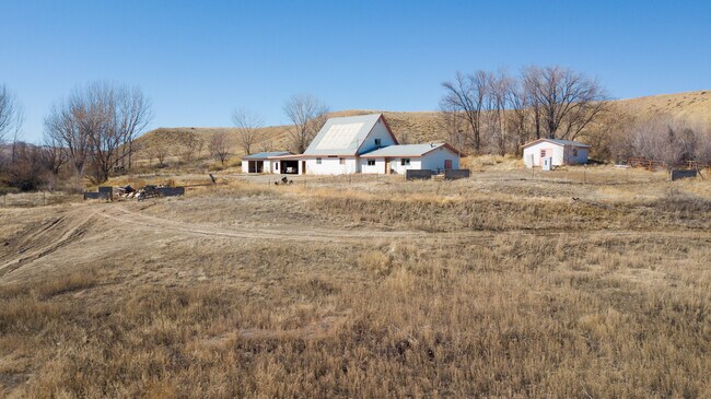
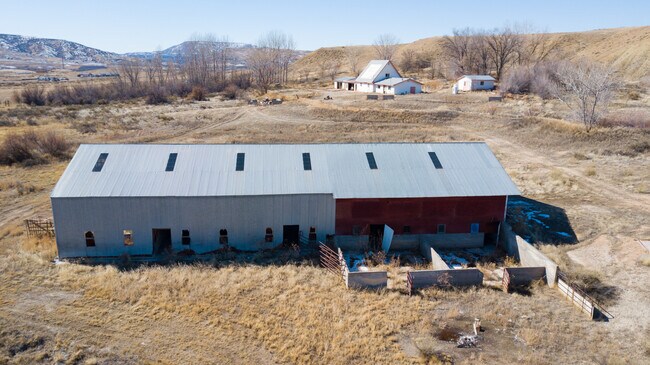
1024 P Rd, Mack, CO 81525

Property Detail
1024 P Rd
Grand Junction, CO
SE4SW4 & E2SE4SW4SW4 & SW4SE4 & W2SW4SE4SE4 & NW4SE4SE4 & NE4SE4 & E2NW4SE4 SEC 18 2N 3W
2691-183-00-138
Mesa
Farms
Colorado
B and X Area of moderate flood hazard, usually the area between the limits of the 100-year and 500-year floods.
138
2025
160 AC
2025
Colorado Northwest Area
001502
Other Market Areas
3,378 SF
NEARBY LISTINGS FOR SALE OR LEASE
-
-
View all Mack listings for sale on LoopNet.com
DEMOGRAPHICS near 1024 P Rd
1 mile
3 mile
5 mile
2025 Total Population
82
1,307
2,652
2030 Population
83
1,311
2,654
Pop Growth 2025-2030
+ 1.22%
+ 0.31%
+ 0.08%
Average Age
43
42
42
2025 Total Households
30
480
972
HH Growth 2025-2030
+ 3.33%
+ 0.63%
+ 0.21%
Median Household Inc
$108,333
$113,157
$112,706
Avg Household Size
2.70
2.70
2.70
2025 Avg HH Vehicles
3.00
3.00
3.00
Median Home Value
$600,000
$627,490
$639,591
Median Year Built
2001
2000
2000
Nearby Places
Map Layers
Map Styles
 Street
 Aerial
Layers
 Traffic
 Biking
Places
Listings with unknown addresses are not visible on the map
- Restaurants
- Banks
- Shops
- Fitness
- Groceries
PUBLIC TRANSPORTATION
AIRPORT
Grand Junction Regional
Drive
Walk
Distance
Grand Junction Regional
30 min
23.5 mi
Freight Ports
Port of Long Beach
Drive
Walk
Distance
Port of Long Beach
798 min
771.1 mi
SALE & LEASE HISTORY
LISTING DATE
SALE/LEASE

Mar 28, 2020
For Sale
Nearby Properties
Address
Land Use
TOTAL SIZE
Lot Size
Zoning
Address
Land Use
TOTAL SIZE
Lot Size
Zoning
36,913 SF
40.39 AC
Address
Land Use
TOTAL SIZE
Lot Size
Zoning
9,984 SF
3.50 AC
I-2
Address
Land Use
TOTAL SIZE
Lot Size
Zoning
8,020 SF
0.50 AC
B-2
Address
Land Use
TOTAL SIZE
Lot Size
Zoning
6,065 SF
23.48 AC
Address
Land Use
TOTAL SIZE
Lot Size
Zoning
3,082 SF
0.33 AC
B-2
Address
Land Use
TOTAL SIZE
Lot Size
Zoning
8,020 SF
0.50 AC
B-2
Address
Land Use
TOTAL SIZE
Lot Size
Zoning
5,760 SF
97 AC
Address
Land Use
TOTAL SIZE
Lot Size
Zoning
1,600 SF
26.38 AC
Address
Land Use
TOTAL SIZE
Lot Size
Zoning
4,652 SF
0.02 AC
Address
Land Use
TOTAL SIZE
Lot Size
Zoning
4,906 SF
5.01 AC
Address
Land Use
TOTAL SIZE
Lot Size
Zoning
1,404 SF
88.25 AC
Address
Land Use
TOTAL SIZE
Lot Size
Zoning
39.87 AC
Address
Land Use
TOTAL SIZE
Lot Size
Zoning
5,567 SF
11.03 AC
Address
Land Use
TOTAL SIZE
Lot Size
Zoning
7,187 SF
40 AC
Address
Land Use
TOTAL SIZE
Lot Size
Zoning
943 SF
0.15 AC
B-2
Address
Land Use
TOTAL SIZE
Lot Size
Zoning
3,553 SF
41.34 AC
Address
Land Use
TOTAL SIZE
Lot Size
Zoning
2,376 SF
2.85 AC
Address
Land Use
TOTAL SIZE
Lot Size
Zoning
4,349 SF
15 AC
Address
Land Use
TOTAL SIZE
Lot Size
Zoning
4,916 SF
11.80 AC
Address
Land Use
TOTAL SIZE
Lot Size
Zoning
2,280 SF
0.52 AC
Address
Land Use
TOTAL SIZE
Lot Size
Zoning
4,340 SF
40 AC
Address
Land Use
TOTAL SIZE
Lot Size
Zoning
6.33 AC
Address
Land Use
TOTAL SIZE
Lot Size
Zoning
4,483 SF
35 AC
Address
Land Use
TOTAL SIZE
Lot Size
Zoning
3,942 SF
29.28 AC
Address
Land Use
TOTAL SIZE
Lot Size
Zoning
1,856 SF
90.58 AC
Address
Land Use
TOTAL SIZE
Lot Size
Zoning
2,853 SF
50.30 AC
Address
Land Use
TOTAL SIZE
Lot Size
Zoning
4,436 SF
9.90 AC
Address
Land Use
TOTAL SIZE
Lot Size
Zoning
5,797 SF
23.71 AC
Address
Land Use
TOTAL SIZE
Lot Size
Zoning
6,127 SF
12.28 AC
The World's #1 Commercial Real Estate Marketplace
Connect with us
© 2026 CoStar Group
The information above has been obtained from sources believed reliable. While we do not doubt its accuracy we have not verified it and make no guarantee, warranty or representation about it. It is your responsibility to independently confirm its accuracy and completeness. Any projections, opinions, assumptions, or estimates used are for example only and do not represent the current or future performance of the property. The value of this transaction to you depends on tax and other factors which should be evaluated by your tax, financial, and legal advisors. You and your advisors should conduct a careful, independent investigation of the property to determine to your satisfaction the suitability of the property for your needs.