Property Record
Situs Not Available, Commerce City, CO 80022
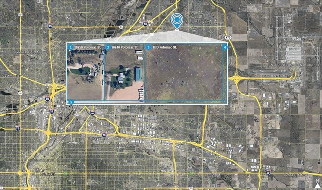
This Property Is For Sale
NEARBY LISTINGS FOR SALE OR LEASE
Property Detail
Situs Not Available
Denver-Aurora-Centennial, CO
Foxton Village
1723-18-2-06-001
SUB:FOXTON VILLAGE DESC: TRACT EE
Vacantlandnec
Adams
X
Colorado
08001C0339H
0.27 AC
2024
Northeast Denver
2025
Denver
988700
DEMOGRAPHICS near Situs Not Available
1 Mile
3 Mile
5 Mile
2024 Total Population
7,420
45,637
55,489
2029 Population
7,900
48,437
58,783
Pop Growth 2024-2029
+ 6.47%
+ 6.14%
+ 5.94%
Average Age
33
35
35
2024 Total Households
2,232
14,240
17,281
HH Growth 2024-2029
+ 6.72%
+ 6.43%
+ 6.24%
Median Household Inc
$137,887
$139,923
$137,194
Avg Household Size
3.30
3.20
3.20
2024 Avg HH Vehicles
2.00
2.00
2.00
Median Home Value
$543,851
$608,961
$611,340
Median Year Built
2009
2008
2008
Nearby Places
Map Layers
Map Styles
 Street
 Aerial
- Restaurants
- Banks
- Shops
- Fitness
- Groceries
PUBLIC TRANSPORTATION
COMMUTER RAIL
Thornton Crossroads - 104Th Station Track 1 (Union Station to Eastlake & 124th Station - Regional Transportation District)
DRIVE
WALK
Distance
Thornton Crossroads - 104Th Station Track 1 (Union Station to Eastlake & 124th Station - Regional Transportation District)
14 min
7.3 mi
61St & Pena Station Track 2 (Union Station to Denver Airport Station - Regional Transportation District)
DRIVE
WALK
Distance
61St & Pena Station Track 2 (Union Station to Denver Airport Station - Regional Transportation District)
15 min
9.0 mi
AIRPORT
Denver International
DRIVE
WALK
Distance
Denver International
19 min
13.0 mi
Freight Ports
Tulsa Port Of Catoosa
DRIVE
WALK
Distance
Tulsa Port Of Catoosa
726 min
707.1 mi
Nearby Properties
Address
Land Use
TOTAL SIZE
Lot Size
Zoning
Address
Land Use
TOTAL SIZE
Lot Size
Zoning
279,946 SF
11.55 AC
Address
Land Use
TOTAL SIZE
Lot Size
Zoning
999,780 SF
72.36 AC
Address
Land Use
TOTAL SIZE
Lot Size
Zoning
358,386 SF
76.08 AC
Address
Land Use
TOTAL SIZE
Lot Size
Zoning
276,395 SF
26.43 AC
A3
Address
Land Use
TOTAL SIZE
Lot Size
Zoning
631.25 AC
A3
Address
Land Use
TOTAL SIZE
Lot Size
Zoning
624.70 AC
A3
Address
Land Use
TOTAL SIZE
Lot Size
Zoning
624.02 AC
A3
Address
Land Use
TOTAL SIZE
Lot Size
Zoning
330,176 SF
17.12 AC
Address
Land Use
TOTAL SIZE
Lot Size
Zoning
298,200 SF
17.67 AC
Address
Land Use
TOTAL SIZE
Lot Size
Zoning
272,800 SF
16.44 AC
Address
Land Use
TOTAL SIZE
Lot Size
Zoning
64,750 SF
11.91 AC
Address
Land Use
TOTAL SIZE
Lot Size
Zoning
121,103 SF
13.47 AC
Address
Land Use
TOTAL SIZE
Lot Size
Zoning
231,205 SF
10.46 AC
Address
Land Use
TOTAL SIZE
Lot Size
Zoning
158,001 SF
20.40 AC
Address
Land Use
TOTAL SIZE
Lot Size
Zoning
Address
Land Use
TOTAL SIZE
Lot Size
Zoning
140,712 SF
18.29 AC
Address
Land Use
TOTAL SIZE
Lot Size
Zoning
207,682 SF
7.16 AC
Address
Land Use
TOTAL SIZE
Lot Size
Zoning
64,501 SF
29.37 AC
Address
Land Use
TOTAL SIZE
Lot Size
Zoning
121,275 SF
6.56 AC
Address
Land Use
TOTAL SIZE
Lot Size
Zoning
64,715 SF
10.38 AC
Address
Land Use
TOTAL SIZE
Lot Size
Zoning
106,530 SF
7.04 AC
Address
Land Use
TOTAL SIZE
Lot Size
Zoning
70,573 SF
6.42 AC
Address
Land Use
TOTAL SIZE
Lot Size
Zoning
33,989 SF
24.98 AC
Address
Land Use
TOTAL SIZE
Lot Size
Zoning
170,965 SF
15.31 AC
Address
Land Use
TOTAL SIZE
Lot Size
Zoning
63,989 SF
12.74 AC
Address
Land Use
TOTAL SIZE
Lot Size
Zoning
122,399 SF
14.29 AC
Address
Land Use
TOTAL SIZE
Lot Size
Zoning
89,219 SF
11.79 AC
Address
Land Use
TOTAL SIZE
Lot Size
Zoning
15,978 SF
33.38 AC
Address
Land Use
TOTAL SIZE
Lot Size
Zoning
55,810 SF
14.52 AC
Address
Land Use
TOTAL SIZE
Lot Size
Zoning
82,239 SF
7.02 AC
The World's #1 Commercial Real Estate Marketplace
Connect with us
© 2026 CoStar Group
The information above has been obtained from sources believed reliable. While we do not doubt its accuracy we have not verified it and make no guarantee, warranty or representation about it. It is your responsibility to independently confirm its accuracy and completeness. Any projections, opinions, assumptions, or estimates used are for example only and do not represent the current or future performance of the property. The value of this transaction to you depends on tax and other factors which should be evaluated by your tax, financial, and legal advisors. You and your advisors should conduct a careful, independent investigation of the property to determine to your satisfaction the suitability of the property for your needs.