Property Record
1025 Burton St, Beloit, WI 53511


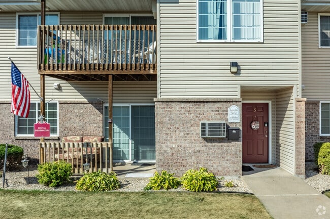
Property Detail
1025 Burton St
Janesville-Beloit, WI
LOT 1 CSM VOL 28 PGS 180-182
123-50005
ROCK
Commercialnec
Wisconsin
B and X Area of moderate flood hazard, usually the area between the limits of the 100-year and 500-year floods.
1
2025
6.19 AC
2025
Beloit
002100
Milwaukee/Madison
16,024 SF
NEARBY LISTINGS FOR SALE OR LEASE
-
-
View all Beloit listings for sale on LoopNet.com
DEMOGRAPHICS near 1025 Burton St
1 mile
3 mile
5 mile
2025 Total Population
6,774
44,908
63,138
2030 Population
6,802
45,220
63,732
Pop Growth 2025-2030
+ 0.41%
+ 0.69%
+ 0.94%
Average Age
39
39
40
2025 Total Households
2,722
17,517
24,696
HH Growth 2025-2030
+ 0.37%
+ 0.71%
+ 0.95%
Median Household Inc
$57,198
$60,845
$67,437
Avg Household Size
2.40
2.40
2.40
2025 Avg HH Vehicles
2.00
2.00
2.00
Median Home Value
$151,520
$167,002
$180,078
Median Year Built
1959
1958
1966
Nearby Places
Map Layers
Map Styles
 Street
 Aerial
Layers
 Traffic
 Biking
Places
Listings with unknown addresses are not visible on the map
- Restaurants
- Banks
- Shops
- Fitness
- Groceries
PUBLIC TRANSPORTATION
AIRPORT
Chicago/Rockford International
Drive
Walk
Distance
Chicago/Rockford International
48 min
34.0 mi
Freight Ports
Port Milwaukee
Drive
Walk
Distance
Port Milwaukee
92 min
75.5 mi
Nearby Properties
Address
Land Use
TOTAL SIZE
Lot Size
Zoning
Address
Land Use
TOTAL SIZE
Lot Size
Zoning
202,676 SF
19.31 AC
Address
Land Use
TOTAL SIZE
Lot Size
Zoning
103,761 SF
21.59 AC
Address
Land Use
TOTAL SIZE
Lot Size
Zoning
186,691 SF
17.06 AC
Address
Land Use
TOTAL SIZE
Lot Size
Zoning
3.39 AC
Address
Land Use
TOTAL SIZE
Lot Size
Zoning
3.47 AC
Address
Land Use
TOTAL SIZE
Lot Size
Zoning
3.65 AC
Address
Land Use
TOTAL SIZE
Lot Size
Zoning
361,947 SF
23.26 AC
Address
Land Use
TOTAL SIZE
Lot Size
Zoning
38,012 SF
2.74 AC
Address
Land Use
TOTAL SIZE
Lot Size
Zoning
9,208 SF
10.33 AC
Address
Land Use
TOTAL SIZE
Lot Size
Zoning
16,336 SF
9.06 AC
Address
Land Use
TOTAL SIZE
Lot Size
Zoning
32.79 AC
Address
Land Use
TOTAL SIZE
Lot Size
Zoning
89,678 SF
12.90 AC
Address
Land Use
TOTAL SIZE
Lot Size
Zoning
20.18 AC
Address
Land Use
TOTAL SIZE
Lot Size
Zoning
296,731 SF
18.14 AC
Address
Land Use
TOTAL SIZE
Lot Size
Zoning
90,285 SF
4.24 AC
Address
Land Use
TOTAL SIZE
Lot Size
Zoning
95,546 SF
8.60 AC
Address
Land Use
TOTAL SIZE
Lot Size
Zoning
2.98 AC
Address
Land Use
TOTAL SIZE
Lot Size
Zoning
131,218 SF
1.65 AC
Address
Land Use
TOTAL SIZE
Lot Size
Zoning
48,036 SF
1.26 AC
Address
Land Use
TOTAL SIZE
Lot Size
Zoning
125,000 SF
12.53 AC
Address
Land Use
TOTAL SIZE
Lot Size
Zoning
7.57 AC
Address
Land Use
TOTAL SIZE
Lot Size
Zoning
47,561 SF
0.58 AC
Address
Land Use
TOTAL SIZE
Lot Size
Zoning
10,456 SF
3.58 AC
Address
Land Use
TOTAL SIZE
Lot Size
Zoning
264,754 SF
6.49 AC
Address
Land Use
TOTAL SIZE
Lot Size
Zoning
82,412 SF
3.94 AC
Address
Land Use
TOTAL SIZE
Lot Size
Zoning
57,745 SF
9.57 AC
Address
Land Use
TOTAL SIZE
Lot Size
Zoning
9,403 SF
6 AC
Address
Land Use
TOTAL SIZE
Lot Size
Zoning
84,000 SF
7.15 AC
Address
Land Use
TOTAL SIZE
Lot Size
Zoning
13,972 SF
2.51 AC
Address
Land Use
TOTAL SIZE
Lot Size
Zoning
45,972 SF
0.64 AC
The World's #1 Commercial Real Estate Marketplace
Connect with us
© 2026 CoStar Group
The information above has been obtained from sources believed reliable. While we do not doubt its accuracy we have not verified it and make no guarantee, warranty or representation about it. It is your responsibility to independently confirm its accuracy and completeness. Any projections, opinions, assumptions, or estimates used are for example only and do not represent the current or future performance of the property. The value of this transaction to you depends on tax and other factors which should be evaluated by your tax, financial, and legal advisors. You and your advisors should conduct a careful, independent investigation of the property to determine to your satisfaction the suitability of the property for your needs.