Property Record
1025 Cranbrook Rd, Cockeysville, MD 21030
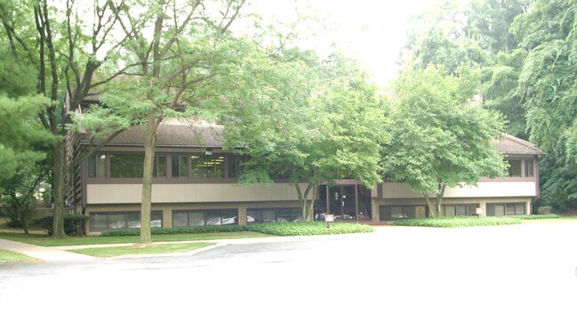
Property Detail
1025 Cranbrook Rd
08-1900007185
18.687 AC NES NW COR LAKESPRING WA
Apartment
Baltimore
DR35
Maryland
B and X Area of moderate flood hazard, usually the area between the limits of the 100-year and 500-year floods.
0.99 AC
2024
Route 83 Corridor North
2025
Baltimore
408507
Baltimore-Columbia-Towson, MD
NEARBY LISTINGS FOR SALE OR LEASE
DEMOGRAPHICS near 1025 Cranbrook Rd
1 mile
3 mile
5 mile
2025 Total Population
15,295
48,504
107,755
2030 Population
15,377
48,562
108,404
Pop Growth 2025-2030
+ 0.54%
+ 0.12%
+ 0.60%
Average Age
38
42
43
2025 Total Households
6,488
20,023
44,239
HH Growth 2025-2030
+ 0.51%
+ 0.09%
+ 0.72%
Median Household Inc
$77,500
$102,954
$106,202
Avg Household Size
2.30
2.30
2.30
2025 Avg HH Vehicles
2.00
2.00
2.00
Median Home Value
$499,576
$457,902
$488,256
Median Year Built
1974
1975
1976
Nearby Places
Map Layers
Map Styles
 Street
 Aerial
Transit
 Traffic
 Biking
Places
Listings with unknown addresses are not visible on the map
- Restaurants
- Banks
- Shops
- Fitness
- Groceries
PUBLIC TRANSPORTATION
AIRPORT
Baltimore/Washington International Thurgood Marshall
Drive
Walk
Distance
Baltimore/Washington International Thurgood Marshall
44 min
27.1 mi
Freight Ports
Port of Baltimore
Drive
Walk
Distance
Port of Baltimore
30 min
16.1 mi
Nearby Properties
Address
Land Use
TOTAL SIZE
Lot Size
Zoning
Address
Land Use
TOTAL SIZE
Lot Size
Zoning
217,147 SF
5.08 AC
MLIM
Address
Land Use
TOTAL SIZE
Lot Size
Zoning
720,989 SF
32.65 AC
Address
Land Use
TOTAL SIZE
Lot Size
Zoning
38.89 AC
DR16
Address
Land Use
TOTAL SIZE
Lot Size
Zoning
13,468 SF
32.08 AC
DR16
Address
Land Use
TOTAL SIZE
Lot Size
Zoning
28.74 AC
DR16
Address
Land Use
TOTAL SIZE
Lot Size
Zoning
362,686 SF
88.84 AC
MR
Address
Land Use
TOTAL SIZE
Lot Size
Zoning
330,145 SF
16.20 AC
Address
Land Use
TOTAL SIZE
Lot Size
Zoning
26.73 AC
DR16
Address
Land Use
TOTAL SIZE
Lot Size
Zoning
176,584 SF
31 AC
Address
Land Use
TOTAL SIZE
Lot Size
Zoning
125,398 SF
15.13 AC
BM
Address
Land Use
TOTAL SIZE
Lot Size
Zoning
44.76 AC
DR3.5
Address
Land Use
TOTAL SIZE
Lot Size
Zoning
138,000 SF
3.09 AC
Address
Land Use
TOTAL SIZE
Lot Size
Zoning
172,782 SF
5.35 AC
ML-IM
Address
Land Use
TOTAL SIZE
Lot Size
Zoning
14.49 AC
DR16
Address
Land Use
TOTAL SIZE
Lot Size
Zoning
94,534 SF
15.68 AC
BLCCC
Address
Land Use
TOTAL SIZE
Lot Size
Zoning
18.07 AC
DR3.5
Address
Land Use
TOTAL SIZE
Lot Size
Zoning
13.46 AC
DR16
Address
Land Use
TOTAL SIZE
Lot Size
Zoning
18.68 AC
DR3.5
Address
Land Use
TOTAL SIZE
Lot Size
Zoning
204,329 SF
25.45 AC
ML
Address
Land Use
TOTAL SIZE
Lot Size
Zoning
4,000 SF
23.97 AC
DR3.5
Address
Land Use
TOTAL SIZE
Lot Size
Zoning
106,612 SF
12.49 AC
BLRBR
Address
Land Use
TOTAL SIZE
Lot Size
Zoning
424,897 SF
38.53 AC
ML
Address
Land Use
TOTAL SIZE
Lot Size
Zoning
506.09 AC
Address
Land Use
TOTAL SIZE
Lot Size
Zoning
867,806 SF
48.59 AC
MLIM
Address
Land Use
TOTAL SIZE
Lot Size
Zoning
157,211 SF
2.98 AC
PUD
Address
Land Use
TOTAL SIZE
Lot Size
Zoning
311,952 SF
7.01 AC
ML-IM
Address
Land Use
TOTAL SIZE
Lot Size
Zoning
13.48 AC
DR16
Address
Land Use
TOTAL SIZE
Lot Size
Zoning
103,956 SF
2.77 AC
ML
Address
Land Use
TOTAL SIZE
Lot Size
Zoning
256,039 SF
5.98 AC
ML-IM
Address
Land Use
TOTAL SIZE
Lot Size
Zoning
17.23 AC
DR16
The World's #1 Commercial Real Estate Marketplace
Connect with us
© 2026 CoStar Group
The information above has been obtained from sources believed reliable. While we do not doubt its accuracy we have not verified it and make no guarantee, warranty or representation about it. It is your responsibility to independently confirm its accuracy and completeness. Any projections, opinions, assumptions, or estimates used are for example only and do not represent the current or future performance of the property. The value of this transaction to you depends on tax and other factors which should be evaluated by your tax, financial, and legal advisors. You and your advisors should conduct a careful, independent investigation of the property to determine to your satisfaction the suitability of the property for your needs.