Property Record
1025 E Front St, Buchanan, MI 49107


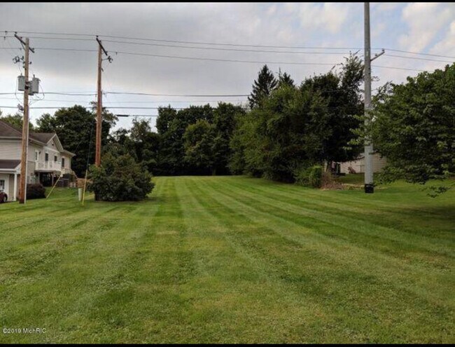
This Property Is For Sale
Property Detail
1025 E Front St
Niles, MI
LOT 65 RIVER SHORES EXC THE N 300'THEREOF
11-58-6770-0065-01-1
BERRIEN
Residentialacreage
Michigan
R-1 SIN
65
B and X Area of moderate flood hazard, usually the area between the limits of the 100-year and 500-year floods.
0.57 AC
2024
Michigan Southwest Area
2025
Other Market Areas
020200
NEARBY LISTINGS FOR SALE OR LEASE
-
-
View all Buchanan listings for sale on LoopNet.com
DEMOGRAPHICS near 1025 E Front St
1 mile
3 mile
5 mile
2025 Total Population
3,436
7,484
18,138
2030 Population
3,344
7,317
17,821
Pop Growth 2025-2030
(2.68%)
(2.23%)
(1.75%)
Average Age
42
42
42
2025 Total Households
1,430
3,078
7,454
HH Growth 2025-2030
(3.08%)
(2.63%)
(2.03%)
Median Household Inc
$54,649
$61,600
$61,667
Avg Household Size
2.30
2.30
2.30
2025 Avg HH Vehicles
2.00
2.00
2.00
Median Home Value
$168,962
$186,318
$198,072
Median Year Built
1961
1965
1965
Nearby Places
Map Layers
Map Styles
 Street
 Aerial
Layers
 Traffic
 Biking
Places
Listings with unknown addresses are not visible on the map
- Restaurants
- Banks
- Shops
- Fitness
- Groceries
PUBLIC TRANSPORTATION
COMMUTER RAIL
Niles Amtrak Station (Blue Water - Amtrak, Wolverine - Amtrak)
Drive
Walk
Distance
Niles Amtrak Station (Blue Water - Amtrak, Wolverine - Amtrak)
10 min
5.6 mi
AIRPORT
South Bend International
Drive
Walk
Distance
South Bend International
25 min
13.4 mi
Freight Ports
Port Milwaukee
Drive
Walk
Distance
Port Milwaukee
220 min
182.8 mi
Nearby Properties
Address
Land Use
TOTAL SIZE
Lot Size
Zoning
Address
Land Use
TOTAL SIZE
Lot Size
Zoning
182,550 SF
40.45 AC
RP
Address
Land Use
TOTAL SIZE
Lot Size
Zoning
614,405 SF
105.83 AC
IND INDUST
Address
Land Use
TOTAL SIZE
Lot Size
Zoning
7.50 AC
R-1 SIN
Address
Land Use
TOTAL SIZE
Lot Size
Zoning
91,484 SF
14 AC
R-1 SIN
Address
Land Use
TOTAL SIZE
Lot Size
Zoning
64,958 SF
7 AC
OS
Address
Land Use
TOTAL SIZE
Lot Size
Zoning
114,285 SF
Address
Land Use
TOTAL SIZE
Lot Size
Zoning
207,400 SF
10.08 AC
R-1 SIN
Address
Land Use
TOTAL SIZE
Lot Size
Zoning
157,212 SF
14.88 AC
IND INDUST
Address
Land Use
TOTAL SIZE
Lot Size
Zoning
24,063 SF
15 AC
IND INDUST
Address
Land Use
TOTAL SIZE
Lot Size
Zoning
102,000 SF
Address
Land Use
TOTAL SIZE
Lot Size
Zoning
106,635 SF
7.74 AC
R-3 MUL
Address
Land Use
TOTAL SIZE
Lot Size
Zoning
269,301 SF
13.71 AC
R-1 SIN
Address
Land Use
TOTAL SIZE
Lot Size
Zoning
7,275 SF
202.88 AC
R-1A
Address
Land Use
TOTAL SIZE
Lot Size
Zoning
137,744 SF
15.42 AC
IND INDUST
Address
Land Use
TOTAL SIZE
Lot Size
Zoning
Address
Land Use
TOTAL SIZE
Lot Size
Zoning
127,210 SF
16.71 AC
R-1 SIN
Address
Land Use
TOTAL SIZE
Lot Size
Zoning
47,520 SF
11.40 AC
R-1 SIN
Address
Land Use
TOTAL SIZE
Lot Size
Zoning
43,500 SF
7 AC
IND INDUST
Address
Land Use
TOTAL SIZE
Lot Size
Zoning
12,540 SF
1.53 AC
R-1 SIN
Address
Land Use
TOTAL SIZE
Lot Size
Zoning
3,453 SF
100 AC
AG
Address
Land Use
TOTAL SIZE
Lot Size
Zoning
38,180 SF
10 AC
IND INDUST
Address
Land Use
TOTAL SIZE
Lot Size
Zoning
243.31 AC
AG AGRICUL
Address
Land Use
TOTAL SIZE
Lot Size
Zoning
23,294 SF
1.55 AC
R-1 SIN
Address
Land Use
TOTAL SIZE
Lot Size
Zoning
28,753 SF
5.33 AC
R-1 SIN
Address
Land Use
TOTAL SIZE
Lot Size
Zoning
17,594 SF
2.74 AC
OS
Address
Land Use
TOTAL SIZE
Lot Size
Zoning
10,000 SF
Address
Land Use
TOTAL SIZE
Lot Size
Zoning
6,564 SF
106.45 AC
R-1A
Address
Land Use
TOTAL SIZE
Lot Size
Zoning
43,744 SF
5.85 AC
C
Address
Land Use
TOTAL SIZE
Lot Size
Zoning
19,484 SF
44.81 AC
R-1A
Address
Land Use
TOTAL SIZE
Lot Size
Zoning
53,461 SF
8.39 AC
R-1 SIN
The World's #1 Commercial Real Estate Marketplace
Connect with us
© 2026 CoStar Group
The information above has been obtained from sources believed reliable. While we do not doubt its accuracy we have not verified it and make no guarantee, warranty or representation about it. It is your responsibility to independently confirm its accuracy and completeness. Any projections, opinions, assumptions, or estimates used are for example only and do not represent the current or future performance of the property. The value of this transaction to you depends on tax and other factors which should be evaluated by your tax, financial, and legal advisors. You and your advisors should conduct a careful, independent investigation of the property to determine to your satisfaction the suitability of the property for your needs.