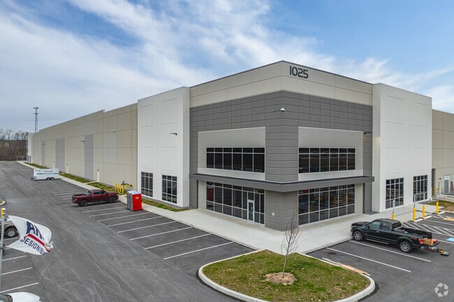
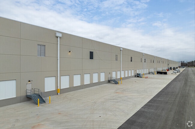
Property Record
1025 Locust Point Rd, Manchester, PA 17345

NEARBY LISTINGS FOR SALE OR LEASE
Property Detail
1025 Locust Point Rd
26-000-05-0001.B0-00000
Locust Point
Warehouse
York
AE
Pennsylvania
42133C0203F
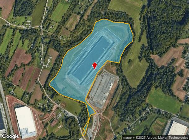
121.20 AC
2025
York County
2025
Philadelphia
021020
York-Hanover, PA
2,285 SF
DEMOGRAPHICS near 1025 Locust Point Rd
1 Mile
3 Mile
5 Mile
2024 Total Population
684
17,206
43,294
2029 Population
715
17,717
44,479
Pop Growth 2024-2029
+ 4.53%
+ 2.97%
+ 2.74%
Average Age
42
39
40
2024 Total Households
272
6,516
16,160
HH Growth 2024-2029
+ 4.41%
+ 2.93%
+ 2.76%
Median Household Inc
$106,753
$80,564
$86,024
Avg Household Size
2.50
2.60
2.60
2024 Avg HH Vehicles
3.00
2.00
2.00
Median Home Value
$247,872
$192,813
$212,612
Median Year Built
1977
1985
1988
Nearby Places
Map Layers
Map Styles
 Street
 Aerial
- Restaurants
- Banks
- Shops
- Fitness
- Groceries
PUBLIC TRANSPORTATION
AIRPORT
Harrisburg International
DRIVE
WALK
Distance
Harrisburg International
38 min
23.6 mi
Freight Ports
Port of Baltimore
DRIVE
WALK
Distance
Port of Baltimore
95 min
65.4 mi
SALE & LEASE HISTORY
LISTING DATE
SALE/LEASE

Jun 03, 2021
For Lease
Nearby Properties
Address
Land Use
TOTAL SIZE
Lot Size
Zoning
Address
Land Use
TOTAL SIZE
Lot Size
Zoning
93.42 AC
Address
Land Use
TOTAL SIZE
Lot Size
Zoning
1,456 SF
97.78 AC
AG
Address
Land Use
TOTAL SIZE
Lot Size
Zoning
1,344 SF
274.50 AC
ID
Address
Land Use
TOTAL SIZE
Lot Size
Zoning
299,254 SF
Address
Land Use
TOTAL SIZE
Lot Size
Zoning
89.58 AC
ID
Address
Land Use
TOTAL SIZE
Lot Size
Zoning
3,766 SF
86.60 AC
AG
Address
Land Use
TOTAL SIZE
Lot Size
Zoning
603,000 SF
56.64 AC
AG
Address
Land Use
TOTAL SIZE
Lot Size
Zoning
1,120 SF
67.19 AC
ID
Address
Land Use
TOTAL SIZE
Lot Size
Zoning
680,192 SF
51.41 AC
AG
Address
Land Use
TOTAL SIZE
Lot Size
Zoning
216,544 SF
Address
Land Use
TOTAL SIZE
Lot Size
Zoning
708,000 SF
55.49 AC
I
Address
Land Use
TOTAL SIZE
Lot Size
Zoning
624,000 SF
50.30 AC
AG
Address
Land Use
TOTAL SIZE
Lot Size
Zoning
378,090 SF
38.70 AC
I
Address
Land Use
TOTAL SIZE
Lot Size
Zoning
496,062 SF
45.60 AC
I
Address
Land Use
TOTAL SIZE
Lot Size
Zoning
390,000 SF
32.13 AC
RS
Address
Land Use
TOTAL SIZE
Lot Size
Zoning
1,716 SF
11.30 AC
RS
Address
Land Use
TOTAL SIZE
Lot Size
Zoning
390,619 SF
46.36 AC
I
Address
Land Use
TOTAL SIZE
Lot Size
Zoning
342,160 SF
33.54 AC
I
Address
Land Use
TOTAL SIZE
Lot Size
Zoning
193,025 SF
32.22 AC
I
Address
Land Use
TOTAL SIZE
Lot Size
Zoning
265,645 SF
18.19 AC
I
Address
Land Use
TOTAL SIZE
Lot Size
Zoning
14.22 AC
Address
Land Use
TOTAL SIZE
Lot Size
Zoning
15.55 AC
I
Address
Land Use
TOTAL SIZE
Lot Size
Zoning
148,263 SF
36.42 AC
I
Address
Land Use
TOTAL SIZE
Lot Size
Zoning
174,733 SF
Address
Land Use
TOTAL SIZE
Lot Size
Zoning
219,126 SF
Address
Land Use
TOTAL SIZE
Lot Size
Zoning
12.76 AC
Address
Land Use
TOTAL SIZE
Lot Size
Zoning
406,400 SF
11.97 AC
I
Address
Land Use
TOTAL SIZE
Lot Size
Zoning
1,152 SF
19.27 AC
ID
Address
Land Use
TOTAL SIZE
Lot Size
Zoning
11.40 AC
ID
The World's #1 Commercial Real Estate Marketplace
Connect with us
© 2025 CoStar Group
The information above has been obtained from sources believed reliable. While we do not doubt its accuracy we have not verified it and make no guarantee, warranty or representation about it. It is your responsibility to independently confirm its accuracy and completeness. Any projections, opinions, assumptions, or estimates used are for example only and do not represent the current or future performance of the property. The value of this transaction to you depends on tax and other factors which should be evaluated by your tax, financial, and legal advisors. You and your advisors should conduct a careful, independent investigation of the property to determine to your satisfaction the suitability of the property for your needs.