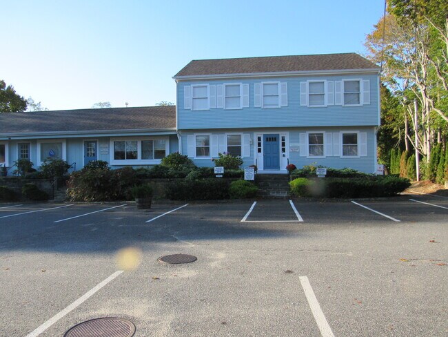
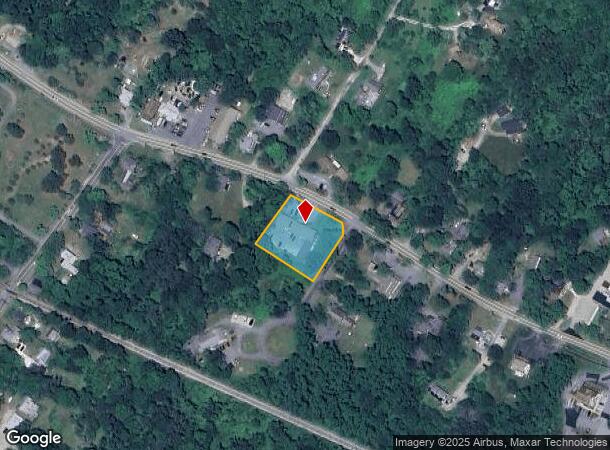
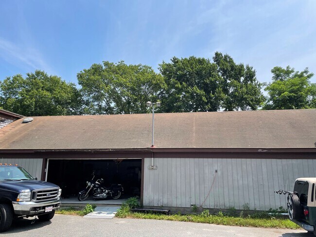
Property Record
1025 Main St, West Barnstable, MA 02668
NEARBY LISTINGS FOR SALE OR LEASE
-
-
View all West Barnstable listings for lease on LoopNet.com
Property Detail
1025 Main St
BARN-000178-000000-000024
Barnstable
Officebuilding
Massachusetts
X
24
25001C0553J
0.80 AC
2025
Cape Cod
2025
Other Market Areas
012200
Barnstable Town, MA
6,568 SF
DEMOGRAPHICS near 1025 Main St
1 Mile
3 Mile
5 Mile
2024 Total Population
472
9,046
34,283
2029 Population
465
8,972
34,394
Pop Growth 2024-2029
(1.48%)
(0.82%)
+ 0.32%
Average Age
48
47
47
2024 Total Households
186
3,631
13,880
HH Growth 2024-2029
(2.15%)
(1.16%)
+ 0.09%
Median Household Inc
$110,810
$117,543
$100,881
Avg Household Size
2.30
2.40
2.40
2024 Avg HH Vehicles
2.00
2.00
2.00
Median Home Value
$623,853
$489,037
$479,748
Median Year Built
1985
1981
1980
Nearby Places
Map Layers
Map Styles
 Street
 Aerial
- Restaurants
- Banks
- Shops
- Fitness
- Groceries
PUBLIC TRANSPORTATION
COMMUTER RAIL
DRIVE
WALK
Distance
12 min
6.1 mi
AIRPORT
Martha's Vineyard
DRIVE
WALK
Distance
Martha's Vineyard
101 min
36.4 mi
Nantucket Memorial
DRIVE
WALK
Distance
Nantucket Memorial
162 min
39.7 mi
Freight Ports
Port of New Bedford Harbor
DRIVE
WALK
Distance
Port of New Bedford Harbor
58 min
41.4 mi
SALE & LEASE HISTORY
LISTING DATE
SALE/LEASE

Sep 03, 2020
For Lease
Oct 27, 2016
For Lease
Oct 12, 2016
For Lease
Jul 29, 2024
For Lease
Aug 05, 2021
For Sale
Nearby Properties
Address
Land Use
TOTAL SIZE
Lot Size
Zoning
Address
Land Use
TOTAL SIZE
Lot Size
Zoning
44 AC
RG;RF
Address
Land Use
TOTAL SIZE
Lot Size
Zoning
1,114.30 AC
Address
Land Use
TOTAL SIZE
Lot Size
Zoning
36,536 SF
36.91 AC
RG;RF-
Address
Land Use
TOTAL SIZE
Lot Size
Zoning
39,689 SF
9.12 AC
Address
Land Use
TOTAL SIZE
Lot Size
Zoning
126.31 AC
RG;RF-
Address
Land Use
TOTAL SIZE
Lot Size
Zoning
1,188.31 AC
RF;RF-
Address
Land Use
TOTAL SIZE
Lot Size
Zoning
143.68 AC
R
Address
Land Use
TOTAL SIZE
Lot Size
Zoning
1.91 AC
RF
Address
Land Use
TOTAL SIZE
Lot Size
Zoning
5.32 AC
RF
Address
Land Use
TOTAL SIZE
Lot Size
Zoning
7.13 AC
1
Address
Land Use
TOTAL SIZE
Lot Size
Zoning
61 AC
1
Address
Land Use
TOTAL SIZE
Lot Size
Zoning
6,209 SF
7.18 AC
R-2
Address
Land Use
TOTAL SIZE
Lot Size
Zoning
172.75 AC
RG;RF-
Address
Land Use
TOTAL SIZE
Lot Size
Zoning
4,217 SF
1.86 AC
R-2
Address
Land Use
TOTAL SIZE
Lot Size
Zoning
14,273 SF
5.60 AC
Address
Land Use
TOTAL SIZE
Lot Size
Zoning
2.73 AC
R
Address
Land Use
TOTAL SIZE
Lot Size
Zoning
7,452 SF
1.72 AC
RF;RF-
Address
Land Use
TOTAL SIZE
Lot Size
Zoning
27 AC
R-2
Address
Land Use
TOTAL SIZE
Lot Size
Zoning
8,858 SF
1.47 AC
Address
Land Use
TOTAL SIZE
Lot Size
Zoning
133 AC
Address
Land Use
TOTAL SIZE
Lot Size
Zoning
2,826 SF
4.13 AC
RF
Address
Land Use
TOTAL SIZE
Lot Size
Zoning
1.35 AC
RD
Address
Land Use
TOTAL SIZE
Lot Size
Zoning
6.58 AC
Address
Land Use
TOTAL SIZE
Lot Size
Zoning
7,572 SF
14.18 AC
Address
Land Use
TOTAL SIZE
Lot Size
Zoning
10,047 SF
2 AC
RIDGE
Address
Land Use
TOTAL SIZE
Lot Size
Zoning
1,200 SF
14.75 AC
1
Address
Land Use
TOTAL SIZE
Lot Size
Zoning
Address
Land Use
TOTAL SIZE
Lot Size
Zoning
1 AC
RF-1;R
Address
Land Use
TOTAL SIZE
Lot Size
Zoning
2.13 AC
Address
Land Use
TOTAL SIZE
Lot Size
Zoning
The World's #1 Commercial Real Estate Marketplace
Connect with us
© 2026 CoStar Group
The information above has been obtained from sources believed reliable. While we do not doubt its accuracy we have not verified it and make no guarantee, warranty or representation about it. It is your responsibility to independently confirm its accuracy and completeness. Any projections, opinions, assumptions, or estimates used are for example only and do not represent the current or future performance of the property. The value of this transaction to you depends on tax and other factors which should be evaluated by your tax, financial, and legal advisors. You and your advisors should conduct a careful, independent investigation of the property to determine to your satisfaction the suitability of the property for your needs.