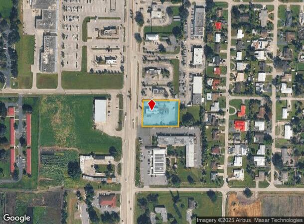
Property Record
1025 S Main St, Belle Glade, FL 33430


NEARBY LISTINGS FOR SALE OR LEASE
Property Detail
1025 S Main St
West Palm Beach-Boca Raton-Delray Beach, FL
Acreage & Unrec
04-37-44-05-01-009-0100
S/D OF 5-44-37 BY STATE SURVEY E 254 FT OF W 314 FT (LESS N 692 FT & S 432 FT) OF STATE LT 9
Restaurantdrivein
Palm Beach
X
Florida
12099C0466F
9
2024
1.05 AC
2025
Palm Bch Cty Outlying
008203
South Florida
2,990 SF
DEMOGRAPHICS near 1025 S Main St
1 Mile
3 Mile
5 Mile
2024 Total Population
7,794
20,037
24,784
2029 Population
8,097
20,640
25,547
Pop Growth 2024-2029
+ 3.89%
+ 3.01%
+ 3.08%
Average Age
37
36
37
2024 Total Households
2,698
6,395
7,250
HH Growth 2024-2029
+ 3.19%
+ 2.39%
+ 2.29%
Median Household Inc
$30,225
$34,352
$34,993
Avg Household Size
2.60
2.80
2.90
2024 Avg HH Vehicles
1.00
2.00
2.00
Median Home Value
$117,735
$150,704
$146,576
Median Year Built
1979
1979
1979
Nearby Places
Map Layers
Map Styles
 Street
 Aerial
- Restaurants
- Banks
- Shops
- Fitness
- Groceries
SALE & LEASE HISTORY
LISTING DATE
SALE/LEASE

Jun 22, 2023
For Sale
Nearby Properties
Address
Land Use
TOTAL SIZE
Lot Size
Zoning
Address
Land Use
TOTAL SIZE
Lot Size
Zoning
347,809 SF
87.36 AC
R-1
Address
Land Use
TOTAL SIZE
Lot Size
Zoning
727,313 SF
120.89 AC
AP
Address
Land Use
TOTAL SIZE
Lot Size
Zoning
337,585 SF
21.10 AC
R-3
Address
Land Use
TOTAL SIZE
Lot Size
Zoning
181,653 SF
21.86 AC
R-1
Address
Land Use
TOTAL SIZE
Lot Size
Zoning
123,563 SF
18.74 AC
R-1
Address
Land Use
TOTAL SIZE
Lot Size
Zoning
98,544 SF
377.44 AC
AR
Address
Land Use
TOTAL SIZE
Lot Size
Zoning
108,444 SF
51.84 AC
IL
Address
Land Use
TOTAL SIZE
Lot Size
Zoning
123,613 SF
19.10 AC
R-1
Address
Land Use
TOTAL SIZE
Lot Size
Zoning
367,476 SF
148 AC
AP
Address
Land Use
TOTAL SIZE
Lot Size
Zoning
278,248 SF
70.66 AC
R-2
Address
Land Use
TOTAL SIZE
Lot Size
Zoning
93,624 SF
40 AC
R-1
Address
Land Use
TOTAL SIZE
Lot Size
Zoning
179,250 SF
89.52 AC
AR
Address
Land Use
TOTAL SIZE
Lot Size
Zoning
70,936 SF
29.86 AC
PIP
Address
Land Use
TOTAL SIZE
Lot Size
Zoning
80,466 SF
10.49 AC
PIP
Address
Land Use
TOTAL SIZE
Lot Size
Zoning
99,314 SF
13.73 AC
B-2
Address
Land Use
TOTAL SIZE
Lot Size
Zoning
81,291 SF
146.64 AC
A-1
Address
Land Use
TOTAL SIZE
Lot Size
Zoning
124,666 SF
8.20 AC
R-3
Address
Land Use
TOTAL SIZE
Lot Size
Zoning
800 SF
636.58 AC
AP
Address
Land Use
TOTAL SIZE
Lot Size
Zoning
128,987 SF
15.09 AC
I-G
Address
Land Use
TOTAL SIZE
Lot Size
Zoning
130,992 SF
9.70 AC
B-2
Address
Land Use
TOTAL SIZE
Lot Size
Zoning
42,830 SF
8.53 AC
R-2
Address
Land Use
TOTAL SIZE
Lot Size
Zoning
69,790 SF
10.24 AC
R-1
Address
Land Use
TOTAL SIZE
Lot Size
Zoning
84,954 SF
6.48 AC
B-2
Address
Land Use
TOTAL SIZE
Lot Size
Zoning
74,511 SF
10 AC
R-1
Address
Land Use
TOTAL SIZE
Lot Size
Zoning
168 SF
279.75 AC
AR
Address
Land Use
TOTAL SIZE
Lot Size
Zoning
50,578 SF
2.58 AC
R-2
Address
Land Use
TOTAL SIZE
Lot Size
Zoning
62,822 SF
6.57 AC
R-2
Address
Land Use
TOTAL SIZE
Lot Size
Zoning
45,013 SF
7 AC
R-3
Address
Land Use
TOTAL SIZE
Lot Size
Zoning
36,732 SF
10 AC
R-2
Address
Land Use
TOTAL SIZE
Lot Size
Zoning
26,522 SF
4.11 AC
B-2
The World's #1 Commercial Real Estate Marketplace
Connect with us
© 2026 CoStar Group
The information above has been obtained from sources believed reliable. While we do not doubt its accuracy we have not verified it and make no guarantee, warranty or representation about it. It is your responsibility to independently confirm its accuracy and completeness. Any projections, opinions, assumptions, or estimates used are for example only and do not represent the current or future performance of the property. The value of this transaction to you depends on tax and other factors which should be evaluated by your tax, financial, and legal advisors. You and your advisors should conduct a careful, independent investigation of the property to determine to your satisfaction the suitability of the property for your needs.