Property Record
1025 W 1700 N, Logan, UT 84321

Property Detail
1025 W 1700 N
Logan, UT-ID
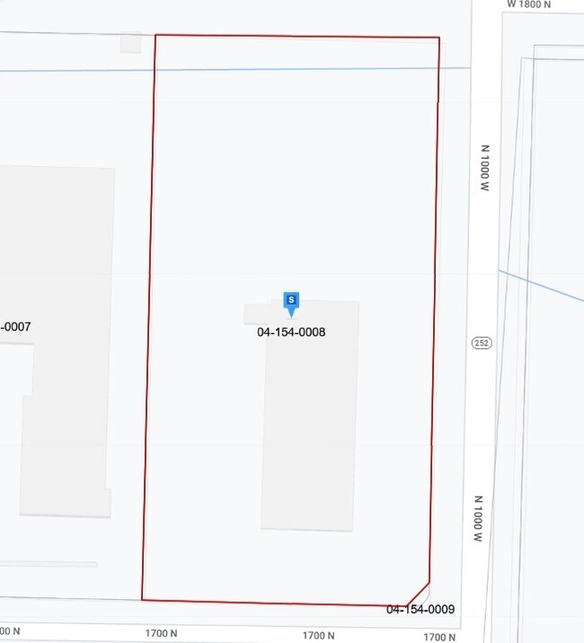
LOT 8 NORTHWEST RDA SUBDIVISION CONT 4.62 ACLESS: PARCEL TO UDOT FOR 1000 WEST (ENT 1060756) CONT 162 SQ FTSUBJ TO ESMNT SEE
04-154-0008
Cache
Realpropertynec
Utah
B and X Area of moderate flood hazard, usually the area between the limits of the 100-year and 500-year floods.
8
2025
4.61 AC
2025
Cache County
000302
Salt Lake City
35,390 SF
NEARBY LISTINGS FOR SALE OR LEASE
DEMOGRAPHICS near 1025 W 1700 N
1 mile
3 mile
5 mile
2025 Total Population
4,125
47,191
92,675
2030 Population
4,386
49,727
98,205
Pop Growth 2025-2030
+ 6.33%
+ 5.37%
+ 5.97%
Average Age
27
30
32
2025 Total Households
1,503
16,262
30,188
HH Growth 2025-2030
+ 6.85%
+ 5.90%
+ 6.42%
Median Household Inc
$60,754
$57,660
$73,420
Avg Household Size
2.70
2.70
2.90
2025 Avg HH Vehicles
2.00
2.00
2.00
Median Home Value
$348,734
$389,377
$453,916
Median Year Built
2004
1986
1991
Nearby Places
Map Layers
Map Styles
 Street
 Aerial
Transit
 Traffic
 Biking
Places
Listings with unknown addresses are not visible on the map
- Restaurants
- Banks
- Shops
- Fitness
- Groceries
Nearby Properties
Address
Land Use
TOTAL SIZE
Lot Size
Zoning
Address
Land Use
TOTAL SIZE
Lot Size
Zoning
174,627 SF
24.84 AC
Address
Land Use
TOTAL SIZE
Lot Size
Zoning
193,043 SF
28.79 AC
Address
Land Use
TOTAL SIZE
Lot Size
Zoning
342,162 SF
2.83 AC
Address
Land Use
TOTAL SIZE
Lot Size
Zoning
23,756 SF
16.99 AC
Address
Land Use
TOTAL SIZE
Lot Size
Zoning
124,161 SF
2.21 AC
Address
Land Use
TOTAL SIZE
Lot Size
Zoning
18.85 AC
Address
Land Use
TOTAL SIZE
Lot Size
Zoning
17.61 AC
Address
Land Use
TOTAL SIZE
Lot Size
Zoning
86,000 SF
9 AC
Address
Land Use
TOTAL SIZE
Lot Size
Zoning
10,000 SF
1.53 AC
Address
Land Use
TOTAL SIZE
Lot Size
Zoning
206,100 SF
19.96 AC
Address
Land Use
TOTAL SIZE
Lot Size
Zoning
238,540 SF
18.02 AC
Address
Land Use
TOTAL SIZE
Lot Size
Zoning
86,240 SF
9.85 AC
Address
Land Use
TOTAL SIZE
Lot Size
Zoning
26,440 SF
7.78 AC
Address
Land Use
TOTAL SIZE
Lot Size
Zoning
11.01 AC
Address
Land Use
TOTAL SIZE
Lot Size
Zoning
29,529 SF
6.90 AC
Address
Land Use
TOTAL SIZE
Lot Size
Zoning
212,851 SF
19.88 AC
Address
Land Use
TOTAL SIZE
Lot Size
Zoning
85,350 SF
5.51 AC
Address
Land Use
TOTAL SIZE
Lot Size
Zoning
31,347 SF
8.64 AC
Address
Land Use
TOTAL SIZE
Lot Size
Zoning
6,372 SF
9.22 AC
Address
Land Use
TOTAL SIZE
Lot Size
Zoning
114,290 SF
7 AC
Address
Land Use
TOTAL SIZE
Lot Size
Zoning
214,625 SF
17.90 AC
Address
Land Use
TOTAL SIZE
Lot Size
Zoning
131,871 SF
13.47 AC
Address
Land Use
TOTAL SIZE
Lot Size
Zoning
33,600 SF
14.65 AC
Address
Land Use
TOTAL SIZE
Lot Size
Zoning
81,897 SF
0.92 AC
Address
Land Use
TOTAL SIZE
Lot Size
Zoning
4.63 AC
Address
Land Use
TOTAL SIZE
Lot Size
Zoning
67,554 SF
10.22 AC
Address
Land Use
TOTAL SIZE
Lot Size
Zoning
88,165 SF
1.84 AC
Address
Land Use
TOTAL SIZE
Lot Size
Zoning
103,658 SF
7.28 AC
The World's #1 Commercial Real Estate Marketplace
Connect with us
© 2026 CoStar Group
The information above has been obtained from sources believed reliable. While we do not doubt its accuracy we have not verified it and make no guarantee, warranty or representation about it. It is your responsibility to independently confirm its accuracy and completeness. Any projections, opinions, assumptions, or estimates used are for example only and do not represent the current or future performance of the property. The value of this transaction to you depends on tax and other factors which should be evaluated by your tax, financial, and legal advisors. You and your advisors should conduct a careful, independent investigation of the property to determine to your satisfaction the suitability of the property for your needs.