Property Record
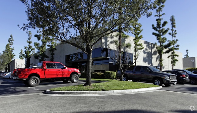
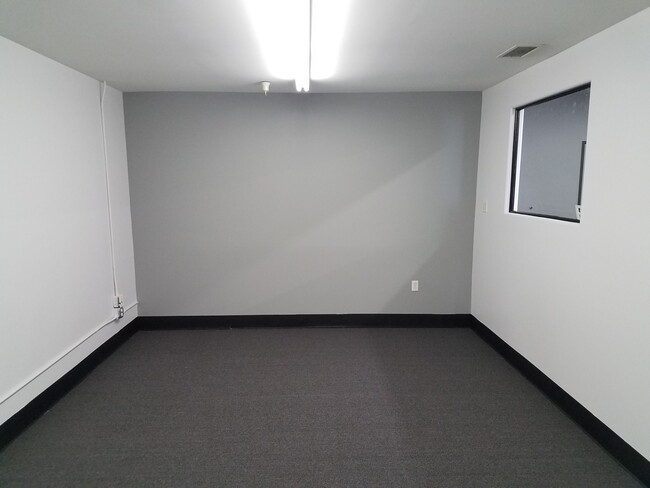
10251 Trademark St, Rancho Cucamonga, CA 91730


Current Lease Availabilities
NEARBY LISTINGS FOR SALE OR LEASE
Property Detail
10251 Trademark St
0210-441-15
PARCEL MAP 13125 UNIT 15 BOOK 155 PAGE 58 PARCEL MAP 13125 UNIT 15 AND INT IN COMMON AREA
Industrialcondominium
San Bernardino
X
California
06071C8629H
0.11 AC
2024
Airport Area
2025
Inland Empire (California)
002111
Riverside-San Bernardino-Ontario, CA
4,868 SF
DEMOGRAPHICS near 10251 Trademark St
1 Mile
3 Mile
5 Mile
2024 Total Population
10,556
106,548
320,507
2029 Population
10,770
108,343
325,459
Pop Growth 2024-2029
+ 2.03%
+ 1.68%
+ 1.55%
Average Age
35
36
37
2024 Total Households
3,845
35,112
102,731
HH Growth 2024-2029
+ 1.90%
+ 1.81%
+ 1.62%
Median Household Inc
$80,143
$78,934
$87,286
Avg Household Size
2.70
2.90
3.00
2024 Avg HH Vehicles
2.00
2.00
2.00
Median Home Value
$502,742
$488,278
$584,500
Median Year Built
1997
1985
1983
Nearby Places
Map Layers
Map Styles
 Street
 Aerial
- Restaurants
- Banks
- Shops
- Fitness
- Groceries
PUBLIC TRANSPORTATION
COMMUTER RAIL
Rancho Cucamonga (San Bernardino Line - Southern California Regional Rail Authority (Metrolink))
DRIVE
WALK
Distance
Rancho Cucamonga (San Bernardino Line - Southern California Regional Rail Authority (Metrolink))
6 min
2.3 mi
East Ontario (Riverside Line - Southern California Regional Rail Authority (Metrolink))
DRIVE
WALK
Distance
East Ontario (Riverside Line - Southern California Regional Rail Authority (Metrolink))
8 min
3.5 mi
AIRPORT
Ontario International
DRIVE
WALK
Distance
Ontario International
7 min
3.0 mi
Freight Ports
Port of Long Beach
DRIVE
WALK
Distance
Port of Long Beach
69 min
54.5 mi
Nearby Properties
Address
Land Use
TOTAL SIZE
Lot Size
Zoning
Address
Land Use
TOTAL SIZE
Lot Size
Zoning
1,459,702 SF
96.41 AC
Address
Land Use
TOTAL SIZE
Lot Size
Zoning
1,422,524 SF
44.96 AC
Address
Land Use
TOTAL SIZE
Lot Size
Zoning
244,370 SF
59.72 AC
Address
Land Use
TOTAL SIZE
Lot Size
Zoning
707,551 SF
20.36 AC
Address
Land Use
TOTAL SIZE
Lot Size
Zoning
752,497 SF
24.89 AC
Address
Land Use
TOTAL SIZE
Lot Size
Zoning
539,128 SF
10.24 AC
Address
Land Use
TOTAL SIZE
Lot Size
Zoning
293,860 SF
16.10 AC
Address
Land Use
TOTAL SIZE
Lot Size
Zoning
34.80 AC
Address
Land Use
TOTAL SIZE
Lot Size
Zoning
545,161 SF
11.10 AC
Address
Land Use
TOTAL SIZE
Lot Size
Zoning
453,960 SF
18.54 AC
Address
Land Use
TOTAL SIZE
Lot Size
Zoning
591,495 SF
18.29 AC
Address
Land Use
TOTAL SIZE
Lot Size
Zoning
1,052,840 SF
41.85 AC
Address
Land Use
TOTAL SIZE
Lot Size
Zoning
531,988 SF
9.83 AC
Address
Land Use
TOTAL SIZE
Lot Size
Zoning
87,909 SF
30.12 AC
Address
Land Use
TOTAL SIZE
Lot Size
Zoning
286,732 SF
9.58 AC
Address
Land Use
TOTAL SIZE
Lot Size
Zoning
261,357 SF
10.03 AC
Address
Land Use
TOTAL SIZE
Lot Size
Zoning
440,209 SF
10.34 AC
Address
Land Use
TOTAL SIZE
Lot Size
Zoning
830,300 SF
39.99 AC
Address
Land Use
TOTAL SIZE
Lot Size
Zoning
317,070 SF
14.26 AC
Address
Land Use
TOTAL SIZE
Lot Size
Zoning
190,724 SF
10.69 AC
Address
Land Use
TOTAL SIZE
Lot Size
Zoning
387,965 SF
10.92 AC
Address
Land Use
TOTAL SIZE
Lot Size
Zoning
817,493 SF
93.45 AC
Address
Land Use
TOTAL SIZE
Lot Size
Zoning
797,408 SF
66.66 AC
Address
Land Use
TOTAL SIZE
Lot Size
Zoning
252,800 SF
12.90 AC
Address
Land Use
TOTAL SIZE
Lot Size
Zoning
468,682 SF
19.40 AC
Address
Land Use
TOTAL SIZE
Lot Size
Zoning
174,092 SF
4.42 AC
Address
Land Use
TOTAL SIZE
Lot Size
Zoning
656,040 SF
28.47 AC
Address
Land Use
TOTAL SIZE
Lot Size
Zoning
358,375 SF
9.30 AC
Address
Land Use
TOTAL SIZE
Lot Size
Zoning
183,039 SF
8.30 AC
Address
Land Use
TOTAL SIZE
Lot Size
Zoning
151,805 SF
10.59 AC
CM
The World's #1 Commercial Real Estate Marketplace
Connect with us
© 2025 CoStar Group
The information above has been obtained from sources believed reliable. While we do not doubt its accuracy we have not verified it and make no guarantee, warranty or representation about it. It is your responsibility to independently confirm its accuracy and completeness. Any projections, opinions, assumptions, or estimates used are for example only and do not represent the current or future performance of the property. The value of this transaction to you depends on tax and other factors which should be evaluated by your tax, financial, and legal advisors. You and your advisors should conduct a careful, independent investigation of the property to determine to your satisfaction the suitability of the property for your needs.