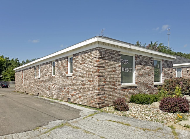
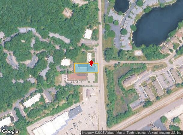
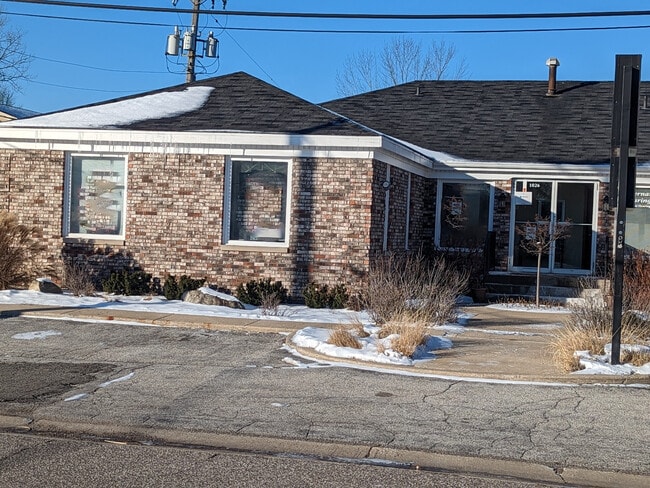
Property Record
1026 N Karwick Rd, Michigan City, IN 46360
Current Lease Availabilities
NEARBY LISTINGS FOR SALE OR LEASE
Property Detail
1026 N Karwick Rd
46-01-22-226-030.000-022
42-01-22-226-030 92.8 X 228 FT MID PT E SD NE1/4 S22 T38 R4 .486 A
Officebuilding
La Porte
X
Indiana
18091C0126E
0.49 AC
2023
South Bend/Elkhart
2024
Other Market Areas
041100
Michigan City-La Porte, IN
5,858 SF
DEMOGRAPHICS near 1026 N Karwick Rd
1 Mile
3 Mile
5 Mile
2024 Total Population
2,903
23,653
43,784
2029 Population
2,999
24,037
44,080
Pop Growth 2024-2029
+ 3.31%
+ 1.62%
+ 0.68%
Average Age
49
43
42
2024 Total Households
1,435
10,404
18,005
HH Growth 2024-2029
+ 3.34%
+ 1.77%
+ 0.79%
Median Household Inc
$74,485
$59,405
$57,465
Avg Household Size
2.00
2.20
2.20
2024 Avg HH Vehicles
2.00
2.00
2.00
Median Home Value
$358,088
$159,395
$156,318
Median Year Built
1970
1959
1963
Nearby Places
- Restaurants
- Banks
- Shops
- Fitness
- Groceries
PUBLIC TRANSPORTATION
COMMUTER RAIL
Carroll Avenue (Michigan City) Station (South Shore Line - Northern Indiana Commuter Transportation District (South Shore Line))
DRIVE
WALK
Distance
Carroll Avenue (Michigan City) Station (South Shore Line - Northern Indiana Commuter Transportation District (South Shore Line))
6 min
2.6 mi
DRIVE
WALK
Distance
8 min
3.5 mi
AIRPORT
South Bend International
DRIVE
WALK
Distance
South Bend International
57 min
33.6 mi
Nearby Properties
Address
Land Use
TOTAL SIZE
Lot Size
Zoning
Address
Land Use
TOTAL SIZE
Lot Size
Zoning
920,913 SF
34.37 AC
Address
Land Use
TOTAL SIZE
Lot Size
Zoning
472,695 SF
46.06 AC
Address
Land Use
TOTAL SIZE
Lot Size
Zoning
167,108 SF
16.38 AC
Address
Land Use
TOTAL SIZE
Lot Size
Zoning
286,688 SF
24.13 AC
Address
Land Use
TOTAL SIZE
Lot Size
Zoning
201,125 SF
7.95 AC
Address
Land Use
TOTAL SIZE
Lot Size
Zoning
203,370 SF
5.83 AC
Address
Land Use
TOTAL SIZE
Lot Size
Zoning
139,650 SF
9.45 AC
Address
Land Use
TOTAL SIZE
Lot Size
Zoning
540,651 SF
17.27 AC
Address
Land Use
TOTAL SIZE
Lot Size
Zoning
125,634 SF
8.97 AC
Address
Land Use
TOTAL SIZE
Lot Size
Zoning
120,170 SF
46.25 AC
Address
Land Use
TOTAL SIZE
Lot Size
Zoning
105,603 SF
8.02 AC
Address
Land Use
TOTAL SIZE
Lot Size
Zoning
255,150 SF
20 AC
Address
Land Use
TOTAL SIZE
Lot Size
Zoning
42,120 SF
2.19 AC
Address
Land Use
TOTAL SIZE
Lot Size
Zoning
139,674 SF
10.63 AC
Address
Land Use
TOTAL SIZE
Lot Size
Zoning
17,282 SF
19.20 AC
Address
Land Use
TOTAL SIZE
Lot Size
Zoning
103,465 SF
7 AC
Address
Land Use
TOTAL SIZE
Lot Size
Zoning
100,931 SF
9.07 AC
Address
Land Use
TOTAL SIZE
Lot Size
Zoning
22,523 SF
0.31 AC
Address
Land Use
TOTAL SIZE
Lot Size
Zoning
199,835 SF
23.86 AC
Address
Land Use
TOTAL SIZE
Lot Size
Zoning
494,068 SF
33.55 AC
Address
Land Use
TOTAL SIZE
Lot Size
Zoning
26,371 SF
128.69 AC
Address
Land Use
TOTAL SIZE
Lot Size
Zoning
221,778 SF
18.61 AC
Address
Land Use
TOTAL SIZE
Lot Size
Zoning
51,979 SF
32.03 AC
Address
Land Use
TOTAL SIZE
Lot Size
Zoning
87,667 SF
1.27 AC
Address
Land Use
TOTAL SIZE
Lot Size
Zoning
78,714 SF
14 AC
Address
Land Use
TOTAL SIZE
Lot Size
Zoning
35,178 SF
0.31 AC
Address
Land Use
TOTAL SIZE
Lot Size
Zoning
84,775 SF
0.31 AC
Address
Land Use
TOTAL SIZE
Lot Size
Zoning
51,658 SF
9.70 AC
Address
Land Use
TOTAL SIZE
Lot Size
Zoning
15,908 SF
3.25 AC
Address
Land Use
TOTAL SIZE
Lot Size
Zoning
28,464 SF
1.81 AC
The World's #1 Commercial Real Estate Marketplace
Connect with us
© 2025 CoStar Group
The information above has been obtained from sources believed reliable. While we do not doubt its accuracy we have not verified it and make no guarantee, warranty or representation about it. It is your responsibility to independently confirm its accuracy and completeness. Any projections, opinions, assumptions, or estimates used are for example only and do not represent the current or future performance of the property. The value of this transaction to you depends on tax and other factors which should be evaluated by your tax, financial, and legal advisors. You and your advisors should conduct a careful, independent investigation of the property to determine to your satisfaction the suitability of the property for your needs.