Property Record
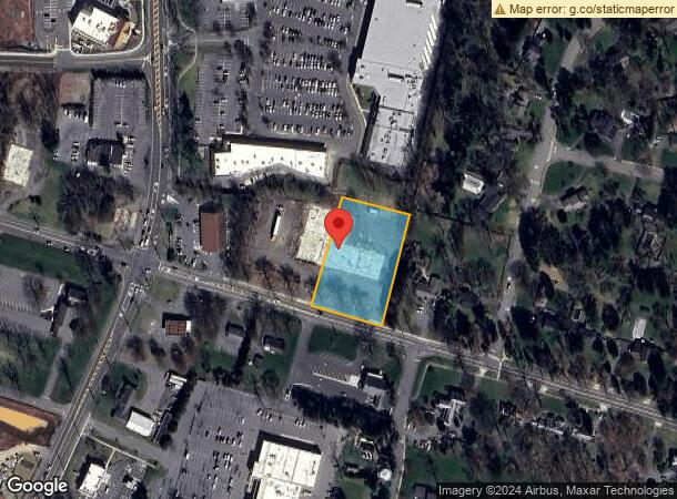
1026 Rt 518, Montgomery, NJ 08558


NEARBY LISTINGS FOR SALE OR LEASE
Property Detail
1026 Rt 518
Newark, NJ-PA
ADDITIONAL LOTS: 49
13-29002-0000-00050
Somerset
Storemultistory
New Jersey
X
50
34035C0244F
3 AC
2024
Princeton North
2025
Northern New Jersey
054202
DEMOGRAPHICS near 1026 Rt 518
1 Mile
3 Mile
5 Mile
2024 Total Population
5,741
22,380
81,474
2029 Population
5,740
22,366
81,490
Pop Growth 2024-2029
(0.02%)
(0.06%)
+ 0.02%
Average Age
42
42
41
2024 Total Households
2,124
7,909
28,935
HH Growth 2024-2029
(0.38%)
(0.29%)
(0.02%)
Median Household Inc
$150,997
$188,163
$166,967
Avg Household Size
2.60
2.70
2.70
2024 Avg HH Vehicles
2.00
2.00
2.00
Median Home Value
$490,296
$704,340
$699,412
Median Year Built
1999
1987
1986
Nearby Places
Map Layers
Map Styles
 Street
 Aerial
- Restaurants
- Banks
- Shops
- Fitness
- Groceries
PUBLIC TRANSPORTATION
COMMUTER RAIL
Princeton (Princeton Branch - NJ Transit Commuter Rail (NJ Transit))
DRIVE
WALK
Distance
Princeton (Princeton Branch - NJ Transit Commuter Rail (NJ Transit))
13 min
4.9 mi
Princeton Junction (Northeast Corridor Line - NJ Transit Commuter Rail (NJ Transit), Princeton Branch - NJ Transit Commuter Rail (NJ Transit))
DRIVE
WALK
Distance
Princeton Junction (Northeast Corridor Line - NJ Transit Commuter Rail (NJ Transit), Princeton Branch - NJ Transit Commuter Rail (NJ Transit))
20 min
8.4 mi
AIRPORT
Newark Liberty International
DRIVE
WALK
Distance
Newark Liberty International
56 min
47.3 mi
SALE & LEASE HISTORY
LISTING DATE
SALE/LEASE

Oct 29, 2018
For Sale
Nov 09, 2018
For Sale
Nearby Properties
Address
Land Use
TOTAL SIZE
Lot Size
Zoning
Address
Land Use
TOTAL SIZE
Lot Size
Zoning
115,000 SF
7.98 AC
OR2
Address
Land Use
TOTAL SIZE
Lot Size
Zoning
216,000 SF
22.79 AC
SC
Address
Land Use
TOTAL SIZE
Lot Size
Zoning
Address
Land Use
TOTAL SIZE
Lot Size
Zoning
0.26 AC
OR2
Address
Land Use
TOTAL SIZE
Lot Size
Zoning
345.28 AC
M3
Address
Land Use
TOTAL SIZE
Lot Size
Zoning
35.71 AC
OR1
Address
Land Use
TOTAL SIZE
Lot Size
Zoning
10 AC
OR1
Address
Land Use
TOTAL SIZE
Lot Size
Zoning
17.45 AC
HC
Address
Land Use
TOTAL SIZE
Lot Size
Zoning
5 AC
REO2
Address
Land Use
TOTAL SIZE
Lot Size
Zoning
4.09 AC
Address
Land Use
TOTAL SIZE
Lot Size
Zoning
9.92 AC
S2
Address
Land Use
TOTAL SIZE
Lot Size
Zoning
1,268 SF
66.60 AC
ROL
Address
Land Use
TOTAL SIZE
Lot Size
Zoning
11.86 AC
R8
Address
Land Use
TOTAL SIZE
Lot Size
Zoning
17.04 AC
HC
Address
Land Use
TOTAL SIZE
Lot Size
Zoning
125,750 SF
2.27 AC
OR2
Address
Land Use
TOTAL SIZE
Lot Size
Zoning
247.02 AC
Address
Land Use
TOTAL SIZE
Lot Size
Zoning
9.78 AC
R2
Address
Land Use
TOTAL SIZE
Lot Size
Zoning
28.31 AC
R2
Address
Land Use
TOTAL SIZE
Lot Size
Zoning
33,400 SF
9.25 AC
3
Address
Land Use
TOTAL SIZE
Lot Size
Zoning
64,420 SF
10.70 AC
OR2
Address
Land Use
TOTAL SIZE
Lot Size
Zoning
8.59 AC
OR2
Address
Land Use
TOTAL SIZE
Lot Size
Zoning
40.80 AC
MCRZ
Address
Land Use
TOTAL SIZE
Lot Size
Zoning
18.65 AC
REO2
Address
Land Use
TOTAL SIZE
Lot Size
Zoning
64,844 SF
6.27 AC
OR1
Address
Land Use
TOTAL SIZE
Lot Size
Zoning
71.60 AC
R1
Address
Land Use
TOTAL SIZE
Lot Size
Zoning
11.04 AC
Address
Land Use
TOTAL SIZE
Lot Size
Zoning
2,784 SF
8.65 AC
NBH
Address
Land Use
TOTAL SIZE
Lot Size
Zoning
42,379 SF
18.43 AC
OR1
Address
Land Use
TOTAL SIZE
Lot Size
Zoning
54,338 SF
13.18 AC
OR1
Address
Land Use
TOTAL SIZE
Lot Size
Zoning
14.53 AC
The World's #1 Commercial Real Estate Marketplace
Connect with us
© 2025 CoStar Group
The information above has been obtained from sources believed reliable. While we do not doubt its accuracy we have not verified it and make no guarantee, warranty or representation about it. It is your responsibility to independently confirm its accuracy and completeness. Any projections, opinions, assumptions, or estimates used are for example only and do not represent the current or future performance of the property. The value of this transaction to you depends on tax and other factors which should be evaluated by your tax, financial, and legal advisors. You and your advisors should conduct a careful, independent investigation of the property to determine to your satisfaction the suitability of the property for your needs.