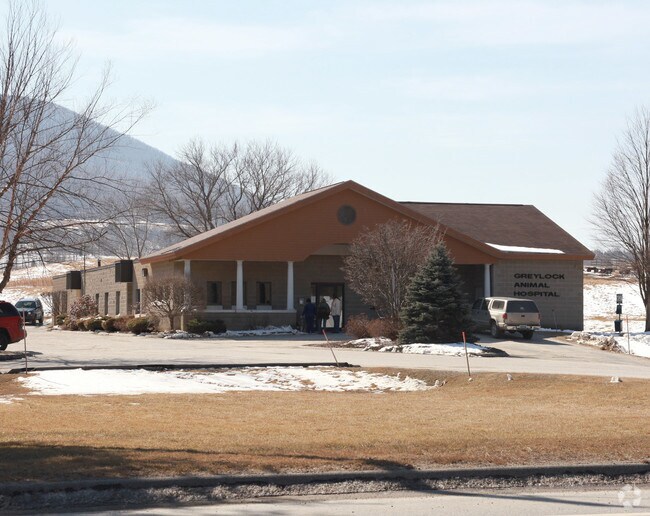
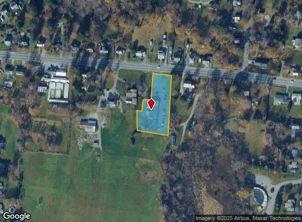
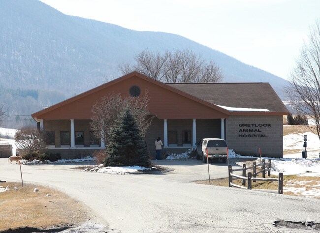
Property Record
1028 State Rd, North Adams, MA 01247
NEARBY LISTINGS FOR SALE OR LEASE
Property Detail
1028 State Rd
Pittsfield, MA
Berkshire
NADA-000094-000000-000012B
Massachusetts
Commercialbuilding
12b
2025
1.17 AC
2025
Massachusetts North/West Area
921500
Other Market Areas
6,763 SF
DEMOGRAPHICS near 1028 State Rd
1 mile
3 mile
5 mile
2024 Total Population
1,960
11,836
22,661
2029 Population
1,944
11,777
22,542
Pop Growth 2024-2029
(0.82%)
(0.50%)
(0.53%)
Average Age
43
42
43
2024 Total Households
789
4,551
9,391
HH Growth 2024-2029
(0.89%)
(0.44%)
(0.50%)
Median Household Inc
$59,906
$65,703
$56,880
Avg Household Size
2.20
2.10
2.10
2024 Avg HH Vehicles
2.00
2.00
2.00
Median Home Value
$235,169
$269,785
$237,811
Median Year Built
1952
1950
1949
Nearby Places
Map Layers
Map Styles
 Street
 Aerial
Transit
 Traffic
 Biking
Places
Listings with unknown addresses are not visible on the map
- Restaurants
- Banks
- Shops
- Fitness
- Groceries
Nearby Properties
Address
Land Use
TOTAL SIZE
Lot Size
Zoning
Address
Land Use
TOTAL SIZE
Lot Size
Zoning
17.72 AC
VB
Address
Land Use
TOTAL SIZE
Lot Size
Zoning
3,770 SF
134 AC
GR
Address
Land Use
TOTAL SIZE
Lot Size
Zoning
283,398 SF
14.50 AC
GR
Address
Land Use
TOTAL SIZE
Lot Size
Zoning
4.98 AC
GR
Address
Land Use
TOTAL SIZE
Lot Size
Zoning
61,182 SF
3.86 AC
GR
Address
Land Use
TOTAL SIZE
Lot Size
Zoning
91,474 SF
8.75 AC
PB
Address
Land Use
TOTAL SIZE
Lot Size
Zoning
603,161 SF
11.31 AC
Address
Land Use
TOTAL SIZE
Lot Size
Zoning
5.24 AC
GR
Address
Land Use
TOTAL SIZE
Lot Size
Zoning
3,205 SF
132 AC
Address
Land Use
TOTAL SIZE
Lot Size
Zoning
37,254 SF
14.16 AC
GR
Address
Land Use
TOTAL SIZE
Lot Size
Zoning
4.30 AC
GR
Address
Land Use
TOTAL SIZE
Lot Size
Zoning
114,992 SF
5.95 AC
Address
Land Use
TOTAL SIZE
Lot Size
Zoning
64,956 SF
6.79 AC
Address
Land Use
TOTAL SIZE
Lot Size
Zoning
62,745 SF
3.40 AC
PB
Address
Land Use
TOTAL SIZE
Lot Size
Zoning
2,295.68 AC
RR1
Address
Land Use
TOTAL SIZE
Lot Size
Zoning
36,843 SF
114 AC
GR
Address
Land Use
TOTAL SIZE
Lot Size
Zoning
32,036 SF
2.62 AC
Address
Land Use
TOTAL SIZE
Lot Size
Zoning
142,868 SF
11 AC
Address
Land Use
TOTAL SIZE
Lot Size
Zoning
7,241 SF
5.08 AC
GR
Address
Land Use
TOTAL SIZE
Lot Size
Zoning
10,224 SF
510 AC
Address
Land Use
TOTAL SIZE
Lot Size
Zoning
17 AC
GR
Address
Land Use
TOTAL SIZE
Lot Size
Zoning
117,566 SF
10 AC
Address
Land Use
TOTAL SIZE
Lot Size
Zoning
18.40 AC
GR
Address
Land Use
TOTAL SIZE
Lot Size
Zoning
2,492 SF
6.80 AC
GR
Address
Land Use
TOTAL SIZE
Lot Size
Zoning
75,398 SF
1.71 AC
Address
Land Use
TOTAL SIZE
Lot Size
Zoning
1.01 AC
Address
Land Use
TOTAL SIZE
Lot Size
Zoning
5,779 SF
22.86 AC
GR
Address
Land Use
TOTAL SIZE
Lot Size
Zoning
365 AC
RR2
Address
Land Use
TOTAL SIZE
Lot Size
Zoning
14,183 SF
10.06 AC
GR
Address
Land Use
TOTAL SIZE
Lot Size
Zoning
7,016 SF
7.28 AC
GR
The World's #1 Commercial Real Estate Marketplace
Connect with us
© 2026 CoStar Group
The information above has been obtained from sources believed reliable. While we do not doubt its accuracy we have not verified it and make no guarantee, warranty or representation about it. It is your responsibility to independently confirm its accuracy and completeness. Any projections, opinions, assumptions, or estimates used are for example only and do not represent the current or future performance of the property. The value of this transaction to you depends on tax and other factors which should be evaluated by your tax, financial, and legal advisors. You and your advisors should conduct a careful, independent investigation of the property to determine to your satisfaction the suitability of the property for your needs.