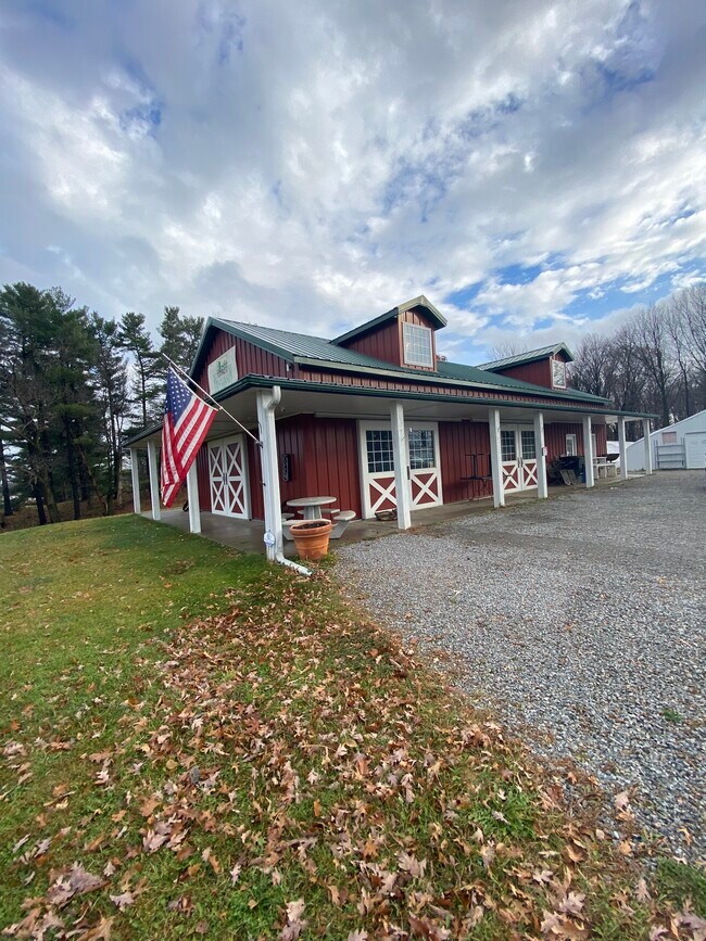
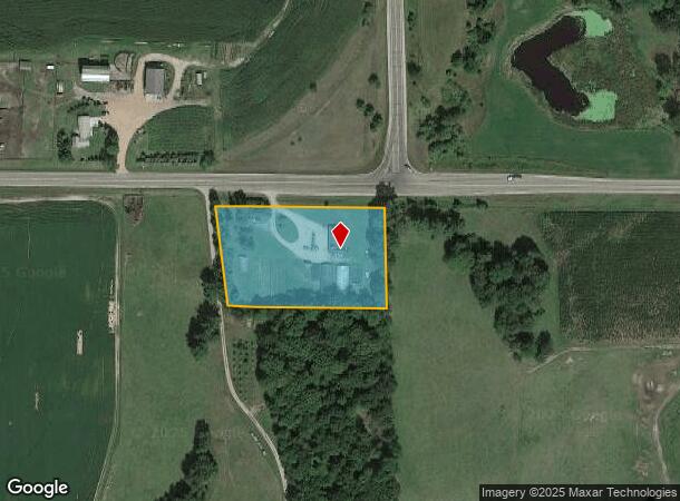
Property Record
10281 State Highway 66, Rosholt, WI 54473
NEARBY LISTINGS FOR SALE OR LEASE
-
-
View all Rosholt listings for sale on LoopNet.com
Property Detail
10281 State Highway 66
Stevens Point-Plover, WI
E20RDS OF N24RDS OF NWSE EX N60'CONVEYED TO PORT CO FOR HY DES 179/112 EX PRT DESC 885397 BUT INC PART DESC 885398S22 T25 R10
002-25-1022-14.03
Portage
Commercialnec
Wisconsin
2024
2.35 AC
2024
Wausau/Stevens Point
960100
Other Market Areas
DEMOGRAPHICS near 10281 State Highway 66
1 Mile
3 Mile
5 Mile
2024 Total Population
97
1,132
1,950
2029 Population
99
1,151
1,963
Pop Growth 2024-2029
+ 2.06%
+ 1.68%
+ 0.67%
Average Age
45
43
44
2024 Total Households
41
470
810
HH Growth 2024-2029
0.00%
+ 1.91%
+ 0.62%
Median Household Inc
$77,500
$71,412
$73,480
Avg Household Size
2.30
2.40
2.40
2024 Avg HH Vehicles
2.00
2.00
2.00
Median Home Value
$279,999
$256,504
$258,454
Median Year Built
1967
1961
1968
Nearby Places
Map Layers
Map Styles
 Street
 Aerial
- Restaurants
- Banks
- Shops
- Fitness
- Groceries
PUBLIC TRANSPORTATION
AIRPORT
Central Wisconsin
DRIVE
WALK
Distance
Central Wisconsin
53 min
37.1 mi
SALE & LEASE HISTORY
LISTING DATE
SALE/LEASE

Jul 23, 2025
For Sale
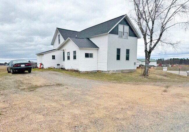
Nearby Properties
Address
Land Use
TOTAL SIZE
Lot Size
Zoning
Address
Land Use
TOTAL SIZE
Lot Size
Zoning
2,352 SF
40 AC
A-G
Address
Land Use
TOTAL SIZE
Lot Size
Zoning
36.65 AC
A4
Address
Land Use
TOTAL SIZE
Lot Size
Zoning
Address
Land Use
TOTAL SIZE
Lot Size
Zoning
1.48 AC
Address
Land Use
TOTAL SIZE
Lot Size
Zoning
1.27 AC
Address
Land Use
TOTAL SIZE
Lot Size
Zoning
29.01 AC
A4
Address
Land Use
TOTAL SIZE
Lot Size
Zoning
1.17 AC
Address
Land Use
TOTAL SIZE
Lot Size
Zoning
40 AC
A4
Address
Land Use
TOTAL SIZE
Lot Size
Zoning
10 AC
A4
Address
Land Use
TOTAL SIZE
Lot Size
Zoning
1.58 AC
C1
Address
Land Use
TOTAL SIZE
Lot Size
Zoning
10 AC
A4
Address
Land Use
TOTAL SIZE
Lot Size
Zoning
5.45 AC
A4
Address
Land Use
TOTAL SIZE
Lot Size
Zoning
0.77 AC
Address
Land Use
TOTAL SIZE
Lot Size
Zoning
40 AC
A4
Address
Land Use
TOTAL SIZE
Lot Size
Zoning
30.13 AC
A4
Address
Land Use
TOTAL SIZE
Lot Size
Zoning
39 AC
A4
Address
Land Use
TOTAL SIZE
Lot Size
Zoning
40 AC
A4
Address
Land Use
TOTAL SIZE
Lot Size
Zoning
0.95 AC
Address
Land Use
TOTAL SIZE
Lot Size
Zoning
9.50 AC
A4
Address
Land Use
TOTAL SIZE
Lot Size
Zoning
37.77 AC
A4
Address
Land Use
TOTAL SIZE
Lot Size
Zoning
40 AC
A4
Address
Land Use
TOTAL SIZE
Lot Size
Zoning
40 AC
A4
Address
Land Use
TOTAL SIZE
Lot Size
Zoning
20 AC
A4
Address
Land Use
TOTAL SIZE
Lot Size
Zoning
0.20 AC
Address
Land Use
TOTAL SIZE
Lot Size
Zoning
38.97 AC
A4
Address
Land Use
TOTAL SIZE
Lot Size
Zoning
2,288 SF
36.25 AC
A-G
Address
Land Use
TOTAL SIZE
Lot Size
Zoning
40 AC
A4
Address
Land Use
TOTAL SIZE
Lot Size
Zoning
38.30 AC
A4
Address
Land Use
TOTAL SIZE
Lot Size
Zoning
15.92 AC
A4
The World's #1 Commercial Real Estate Marketplace
Connect with us
© 2026 CoStar Group
The information above has been obtained from sources believed reliable. While we do not doubt its accuracy we have not verified it and make no guarantee, warranty or representation about it. It is your responsibility to independently confirm its accuracy and completeness. Any projections, opinions, assumptions, or estimates used are for example only and do not represent the current or future performance of the property. The value of this transaction to you depends on tax and other factors which should be evaluated by your tax, financial, and legal advisors. You and your advisors should conduct a careful, independent investigation of the property to determine to your satisfaction the suitability of the property for your needs.