Property Record
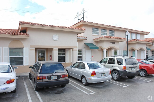
10281 Sw 72Nd St, Miami, FL 33173


NEARBY LISTINGS FOR SALE OR LEASE
Property Detail
10281 Sw 72Nd St
30-4029-056-0210
Office Park Condo
Commercialcondominium
SUNSET 102 OFFICE PARK CONDO UNIT 103 BLDG B UNDIV 1837/32016 INT IN COMMON ELEMENTS OFF REC 20464-4635 OR 24936-483 25229-2289 09 2006 1
X
Miami/Dade
12086C0453L
Florida
2024
Kendall
2025
South Florida
008604
Miami-Miami Beach-Kendall, FL
1,837 SF
DEMOGRAPHICS near 10281 Sw 72Nd St
1 Mile
3 Mile
5 Mile
2024 Total Population
17,005
139,488
432,409
2029 Population
16,503
135,430
420,259
Pop Growth 2024-2029
(2.95%)
(2.91%)
(2.81%)
Average Age
43
44
43
2024 Total Households
6,326
50,774
150,429
HH Growth 2024-2029
(3.29%)
(3.22%)
(3.14%)
Median Household Inc
$72,155
$71,831
$70,019
Avg Household Size
2.60
2.60
2.70
2024 Avg HH Vehicles
2.00
2.00
2.00
Median Home Value
$366,444
$407,478
$403,985
Median Year Built
1978
1975
1977
Nearby Places
Map Layers
Map Styles
 Street
 Aerial
- Restaurants
- Banks
- Shops
- Fitness
- Groceries
PUBLIC TRANSPORTATION
COMMUTER RAIL
Dadeland South (Metrorail Green Line - Miami-Dade Transit (Metrorail/Metromover))
DRIVE
WALK
Distance
Dadeland South (Metrorail Green Line - Miami-Dade Transit (Metrorail/Metromover))
9 min
4.2 mi
Dadeland North (Metrorail Green Line - Miami-Dade Transit (Metrorail/Metromover))
DRIVE
WALK
Distance
Dadeland North (Metrorail Green Line - Miami-Dade Transit (Metrorail/Metromover))
8 min
4.3 mi
AIRPORT
Miami International
DRIVE
WALK
Distance
Miami International
22 min
11.6 mi
Fort Lauderdale/Hollywood International
DRIVE
WALK
Distance
Fort Lauderdale/Hollywood International
51 min
38.6 mi
Freight Ports
Port of Miami
DRIVE
WALK
Distance
Port of Miami
30 min
15.3 mi
SALE & LEASE HISTORY
LISTING DATE
SALE/LEASE

Mar 16, 2023
For Lease
Nearby Properties
Address
Land Use
TOTAL SIZE
Lot Size
Zoning
Address
Land Use
TOTAL SIZE
Lot Size
Zoning
2,238,641 SF
39 AC
6114
Address
Land Use
TOTAL SIZE
Lot Size
Zoning
1,018,683 SF
11.46 AC
5000
Address
Land Use
TOTAL SIZE
Lot Size
Zoning
1,527,515 SF
55.17 AC
5000
Address
Land Use
TOTAL SIZE
Lot Size
Zoning
1,335,151 SF
180 AC
0100
Address
Land Use
TOTAL SIZE
Lot Size
Zoning
1,275,460 SF
15.30 AC
6400
Address
Land Use
TOTAL SIZE
Lot Size
Zoning
766,093 SF
8.91 AC
5000
Address
Land Use
TOTAL SIZE
Lot Size
Zoning
634,144 SF
3.12 AC
6114
Address
Land Use
TOTAL SIZE
Lot Size
Zoning
332,017 SF
6400
Address
Land Use
TOTAL SIZE
Lot Size
Zoning
333,947 SF
21.32 AC
6400
Address
Land Use
TOTAL SIZE
Lot Size
Zoning
452,547 SF
0.90 AC
6114
Address
Land Use
TOTAL SIZE
Lot Size
Zoning
553,491 SF
10.64 AC
3900
Address
Land Use
TOTAL SIZE
Lot Size
Zoning
349,295 SF
25.16 AC
6061
Address
Land Use
TOTAL SIZE
Lot Size
Zoning
350,948 SF
22.42 AC
3800
Address
Land Use
TOTAL SIZE
Lot Size
Zoning
245,376 SF
27 AC
6400
Address
Land Use
TOTAL SIZE
Lot Size
Zoning
196,806 SF
158.17 AC
8900
Address
Land Use
TOTAL SIZE
Lot Size
Zoning
367,374 SF
9.89 AC
8900
Address
Land Use
TOTAL SIZE
Lot Size
Zoning
313,755 SF
5 AC
2300
Address
Land Use
TOTAL SIZE
Lot Size
Zoning
183,845 SF
18.77 AC
5000
Address
Land Use
TOTAL SIZE
Lot Size
Zoning
276,202 SF
13.46 AC
3800
Address
Land Use
TOTAL SIZE
Lot Size
Zoning
240,674 SF
8.71 AC
6400
Address
Land Use
TOTAL SIZE
Lot Size
Zoning
228,254 SF
10.80 AC
3800
Address
Land Use
TOTAL SIZE
Lot Size
Zoning
116,627 SF
74.78 AC
8900
Address
Land Use
TOTAL SIZE
Lot Size
Zoning
291,110 SF
13.38 AC
3800
Address
Land Use
TOTAL SIZE
Lot Size
Zoning
237,857 SF
9.09 AC
2300
Address
Land Use
TOTAL SIZE
Lot Size
Zoning
249,202 SF
29.49 AC
8900
Address
Land Use
TOTAL SIZE
Lot Size
Zoning
283,695 SF
9.22 AC
3900
Address
Land Use
TOTAL SIZE
Lot Size
Zoning
19,382 SF
130 AC
8900
Address
Land Use
TOTAL SIZE
Lot Size
Zoning
474,455 SF
3.58 AC
6111
Address
Land Use
TOTAL SIZE
Lot Size
Zoning
175,184 SF
12.41 AC
6200
Address
Land Use
TOTAL SIZE
Lot Size
Zoning
227,540 SF
10.64 AC
3800
The World's #1 Commercial Real Estate Marketplace
Connect with us
© 2025 CoStar Group
The information above has been obtained from sources believed reliable. While we do not doubt its accuracy we have not verified it and make no guarantee, warranty or representation about it. It is your responsibility to independently confirm its accuracy and completeness. Any projections, opinions, assumptions, or estimates used are for example only and do not represent the current or future performance of the property. The value of this transaction to you depends on tax and other factors which should be evaluated by your tax, financial, and legal advisors. You and your advisors should conduct a careful, independent investigation of the property to determine to your satisfaction the suitability of the property for your needs.