Property Record
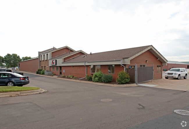
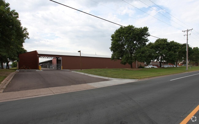
10285 89Th Ave N, Maple Grove, MN 55369

Property Detail
10285 89Th Ave N
13-119-22-42-0002
UNPLATTED 13 119 22 THE NORTH 555.00 FEET, AS MEASURED AT RIGHT ANGLES TO THE NORTH LINE, OF THE WEST 1/4 OF THE WEST 1/2 OF THE SOUTHEAST 1/4 OF SECTION 13, TOWNSHIP T IRREGULAR
Industrialgeneral
Hennepin
B and X Area of moderate flood hazard, usually the area between the limits of the 100-year and 500-year floods.
Minnesota
2024
6.04 AC
2024
Northwest
026726
Minneapolis/St Paul
46,112 SF
Minneapolis-St. Paul-Bloomington, MN-WI
NEARBY LISTINGS FOR SALE OR LEASE
DEMOGRAPHICS near 10285 89Th Ave N
1 mile
3 mile
5 mile
2025 Total Population
5,269
57,101
191,170
2030 Population
5,294
57,108
191,357
Pop Growth 2025-2030
+ 0.47%
+ 0.01%
+ 0.10%
Average Age
42
40
40
2025 Total Households
2,203
21,767
69,543
HH Growth 2025-2030
+ 0.27%
(0.02%)
+ 0.04%
Median Household Inc
$89,311
$105,797
$102,698
Avg Household Size
2.30
2.60
2.70
2025 Avg HH Vehicles
2.00
2.00
2.00
Median Home Value
$331,722
$352,355
$361,649
Median Year Built
1978
1984
1985
Nearby Places
Map Layers
Map Styles
 Street
 Aerial
Layers
 Traffic
 Biking
Places
Listings with unknown addresses are not visible on the map
- Restaurants
- Banks
- Shops
- Fitness
- Groceries
PUBLIC TRANSPORTATION
COMMUTER RAIL
Anoka Station (Northstar Corridor - Northstar Commuter Rail)
Drive
Walk
Distance
Anoka Station (Northstar Corridor - Northstar Commuter Rail)
15 min
8.7 mi
AIRPORT
Minneapolis-St Paul International/Wold-Chamberlain
Drive
Walk
Distance
Minneapolis-St Paul International/Wold-Chamberlain
39 min
27.2 mi
Freight Ports
Port Milwaukee
Drive
Walk
Distance
Port Milwaukee
391 min
352.8 mi
Nearby Properties
Address
Land Use
TOTAL SIZE
Lot Size
Zoning
Address
Land Use
TOTAL SIZE
Lot Size
Zoning
69.46 AC
Address
Land Use
TOTAL SIZE
Lot Size
Zoning
Address
Land Use
TOTAL SIZE
Lot Size
Zoning
52,110 SF
35.71 AC
Address
Land Use
TOTAL SIZE
Lot Size
Zoning
68.12 AC
Address
Land Use
TOTAL SIZE
Lot Size
Zoning
10.90 AC
Address
Land Use
TOTAL SIZE
Lot Size
Zoning
297,060 SF
19.17 AC
Address
Land Use
TOTAL SIZE
Lot Size
Zoning
7.53 AC
Address
Land Use
TOTAL SIZE
Lot Size
Zoning
Address
Land Use
TOTAL SIZE
Lot Size
Zoning
Address
Land Use
TOTAL SIZE
Lot Size
Zoning
8.11 AC
Address
Land Use
TOTAL SIZE
Lot Size
Zoning
42.65 AC
Address
Land Use
TOTAL SIZE
Lot Size
Zoning
7.50 AC
Address
Land Use
TOTAL SIZE
Lot Size
Zoning
Address
Land Use
TOTAL SIZE
Lot Size
Zoning
Address
Land Use
TOTAL SIZE
Lot Size
Zoning
409,456 SF
12.40 AC
Address
Land Use
TOTAL SIZE
Lot Size
Zoning
Address
Land Use
TOTAL SIZE
Lot Size
Zoning
196,970 SF
15.63 AC
Address
Land Use
TOTAL SIZE
Lot Size
Zoning
24.75 AC
Address
Land Use
TOTAL SIZE
Lot Size
Zoning
16.54 AC
Address
Land Use
TOTAL SIZE
Lot Size
Zoning
58,119 SF
18.55 AC
Address
Land Use
TOTAL SIZE
Lot Size
Zoning
14.72 AC
Address
Land Use
TOTAL SIZE
Lot Size
Zoning
21.53 AC
Address
Land Use
TOTAL SIZE
Lot Size
Zoning
228,208 SF
24.92 AC
Address
Land Use
TOTAL SIZE
Lot Size
Zoning
Address
Land Use
TOTAL SIZE
Lot Size
Zoning
1.99 AC
Address
Land Use
TOTAL SIZE
Lot Size
Zoning
Address
Land Use
TOTAL SIZE
Lot Size
Zoning
35.38 AC
Address
Land Use
TOTAL SIZE
Lot Size
Zoning
13.63 AC
Address
Land Use
TOTAL SIZE
Lot Size
Zoning
90,700 SF
17.07 AC
Address
Land Use
TOTAL SIZE
Lot Size
Zoning
18.59 AC
The World's #1 Commercial Real Estate Marketplace
Connect with us
© 2026 CoStar Group
The information above has been obtained from sources believed reliable. While we do not doubt its accuracy we have not verified it and make no guarantee, warranty or representation about it. It is your responsibility to independently confirm its accuracy and completeness. Any projections, opinions, assumptions, or estimates used are for example only and do not represent the current or future performance of the property. The value of this transaction to you depends on tax and other factors which should be evaluated by your tax, financial, and legal advisors. You and your advisors should conduct a careful, independent investigation of the property to determine to your satisfaction the suitability of the property for your needs.