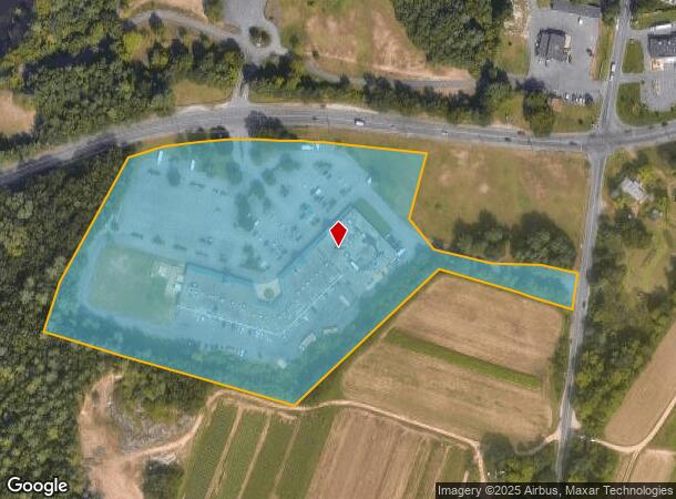
Property Record
1029 North Rd, Westfield, MA 01085


NEARBY LISTINGS FOR SALE OR LEASE
Property Detail
1029 North Rd
WFLD-000073-R000000-000008
Hampden
Regionalshoppingcenterormallwithanchorstore
Massachusetts
X
8
25013C0190F
12.46 AC
2025
Hampden County
2025
Hartford
812500
Springfield, MA
57,197 SF
DEMOGRAPHICS near 1029 North Rd
1 Mile
3 Mile
5 Mile
2024 Total Population
1,880
14,610
96,991
2029 Population
1,768
14,100
94,015
Pop Growth 2024-2029
(5.96%)
(3.49%)
(3.07%)
Average Age
43
45
41
2024 Total Households
727
5,861
39,980
HH Growth 2024-2029
(6.19%)
(3.57%)
(3.09%)
Median Household Inc
$66,676
$69,103
$59,424
Avg Household Size
2.50
2.30
2.30
2024 Avg HH Vehicles
2.00
2.00
2.00
Median Home Value
$289,019
$275,822
$269,272
Median Year Built
1975
1971
1959
Nearby Places
Map Layers
Map Styles
 Street
 Aerial
- Restaurants
- Banks
- Shops
- Fitness
- Groceries
PUBLIC TRANSPORTATION
COMMUTER RAIL
Holyoke Amtrak (Valley Flyer - Amtrak, Vermonter - Amtrak)
DRIVE
WALK
Distance
Holyoke Amtrak (Valley Flyer - Amtrak, Vermonter - Amtrak)
11 min
5.7 mi
AIRPORT
Bradley International
DRIVE
WALK
Distance
Bradley International
45 min
21.9 mi
Freight Ports
Port of New Haven
DRIVE
WALK
Distance
Port of New Haven
97 min
74.5 mi
SALE & LEASE HISTORY
LISTING DATE
SALE/LEASE

Feb 09, 2017
For Lease
Nearby Properties
Address
Land Use
TOTAL SIZE
Lot Size
Zoning
Address
Land Use
TOTAL SIZE
Lot Size
Zoning
50.97 AC
BH
Address
Land Use
TOTAL SIZE
Lot Size
Zoning
71.67 AC
Address
Land Use
TOTAL SIZE
Lot Size
Zoning
133.29 AC
Address
Land Use
TOTAL SIZE
Lot Size
Zoning
Address
Land Use
TOTAL SIZE
Lot Size
Zoning
3.80 AC
Address
Land Use
TOTAL SIZE
Lot Size
Zoning
138,504 SF
13.18 AC
RO
Address
Land Use
TOTAL SIZE
Lot Size
Zoning
Address
Land Use
TOTAL SIZE
Lot Size
Zoning
74.25 AC
Address
Land Use
TOTAL SIZE
Lot Size
Zoning
12.90 AC
IP
Address
Land Use
TOTAL SIZE
Lot Size
Zoning
136,654 SF
11.71 AC
BG
Address
Land Use
TOTAL SIZE
Lot Size
Zoning
8.16 AC
RM40
Address
Land Use
TOTAL SIZE
Lot Size
Zoning
16.38 AC
RA
Address
Land Use
TOTAL SIZE
Lot Size
Zoning
143,568 SF
14.69 AC
Address
Land Use
TOTAL SIZE
Lot Size
Zoning
72,239 SF
13.87 AC
R-1A
Address
Land Use
TOTAL SIZE
Lot Size
Zoning
908.80 AC
RA
Address
Land Use
TOTAL SIZE
Lot Size
Zoning
161,029 SF
9.97 AC
RA
Address
Land Use
TOTAL SIZE
Lot Size
Zoning
99,230 SF
10.94 AC
Address
Land Use
TOTAL SIZE
Lot Size
Zoning
138,289 SF
22.79 AC
IG
Address
Land Use
TOTAL SIZE
Lot Size
Zoning
207,672 SF
18.62 AC
IP
Address
Land Use
TOTAL SIZE
Lot Size
Zoning
196,705 SF
21.45 AC
RM20
Address
Land Use
TOTAL SIZE
Lot Size
Zoning
191,133 SF
12.28 AC
RM-2
Address
Land Use
TOTAL SIZE
Lot Size
Zoning
201,953 SF
5.64 AC
BH
Address
Land Use
TOTAL SIZE
Lot Size
Zoning
26.98 AC
BG
Address
Land Use
TOTAL SIZE
Lot Size
Zoning
64,216 SF
27.50 AC
Address
Land Use
TOTAL SIZE
Lot Size
Zoning
139,546 SF
8.84 AC
IG
Address
Land Use
TOTAL SIZE
Lot Size
Zoning
88,104 SF
2.90 AC
IP
Address
Land Use
TOTAL SIZE
Lot Size
Zoning
129,821 SF
9.02 AC
RM20
Address
Land Use
TOTAL SIZE
Lot Size
Zoning
33,221 SF
15.05 AC
SC
Address
Land Use
TOTAL SIZE
Lot Size
Zoning
30,710 SF
15.05 AC
SC
Address
Land Use
TOTAL SIZE
Lot Size
Zoning
224,738 SF
16.59 AC
RM-2
The World's #1 Commercial Real Estate Marketplace
Connect with us
© 2026 CoStar Group
The information above has been obtained from sources believed reliable. While we do not doubt its accuracy we have not verified it and make no guarantee, warranty or representation about it. It is your responsibility to independently confirm its accuracy and completeness. Any projections, opinions, assumptions, or estimates used are for example only and do not represent the current or future performance of the property. The value of this transaction to you depends on tax and other factors which should be evaluated by your tax, financial, and legal advisors. You and your advisors should conduct a careful, independent investigation of the property to determine to your satisfaction the suitability of the property for your needs.