Property Record
103 12Th St, Pflugerville, TX 78660
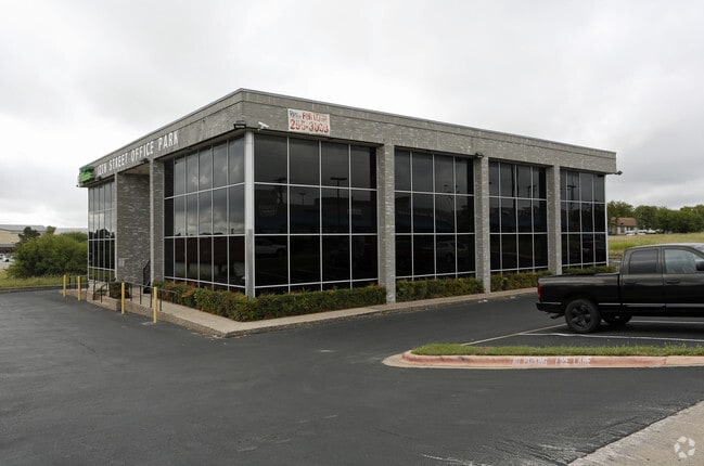


Property Detail
103 12Th St
Austin-Round Rock-San Marcos, TX
LOT 3B SETTLERS RIDGE COMMERCIAL NO 3
275990
Travis
Officebuilding
Texas
B and X Area of moderate flood hazard, usually the area between the limits of the 100-year and 500-year floods.
3b
2025
0.62 AC
2025
Far Northeast
044500
Austin
11,600 SF
NEARBY LISTINGS FOR SALE OR LEASE
DEMOGRAPHICS near 103 12Th St
1 mile
3 mile
5 mile
2025 Total Population
13,200
97,168
256,189
2030 Population
13,611
101,715
272,801
Pop Growth 2025-2030
+ 3.11%
+ 4.68%
+ 6.48%
Average Age
41
37
37
2025 Total Households
4,581
36,072
97,821
HH Growth 2025-2030
+ 3.65%
+ 5.18%
+ 7.06%
Median Household Inc
$108,854
$97,151
$96,848
Avg Household Size
2.80
2.60
2.60
2025 Avg HH Vehicles
2.00
2.00
2.00
Median Home Value
$385,959
$373,678
$409,661
Median Year Built
1999
2006
2005
Nearby Places
Map Layers
Map Styles
 Street
 Aerial
Transit
 Traffic
 Biking
Places
Listings with unknown addresses are not visible on the map
- Restaurants
- Banks
- Shops
- Fitness
- Groceries
PUBLIC TRANSPORTATION
COMMUTER RAIL
Howard Station (Capital MetroRail - Capital Metropolitan Transportation Authority Rail (MetroRail))
Drive
Walk
Distance
Howard Station (Capital MetroRail - Capital Metropolitan Transportation Authority Rail (MetroRail))
11 min
5.3 mi
Kramer Station (Capital MetroRail - Capital Metropolitan Transportation Authority Rail (MetroRail))
Drive
Walk
Distance
Kramer Station (Capital MetroRail - Capital Metropolitan Transportation Authority Rail (MetroRail))
16 min
8.9 mi
AIRPORT
Austin-Bergstrom International
Drive
Walk
Distance
Austin-Bergstrom International
26 min
26.4 mi
Freight Ports
Calhoun Port
Drive
Walk
Distance
Calhoun Port
1 min
138.4 mi
SALE & LEASE HISTORY
LISTING DATE
SALE/LEASE

Sep 24, 2016
For Lease
Jan 30, 2018
For Lease
Dec 22, 2018
For Sale
Dec 16, 2022
For Lease
Nearby Properties
Address
Land Use
TOTAL SIZE
Lot Size
Zoning
Address
Land Use
TOTAL SIZE
Lot Size
Zoning
3,842,019 SF
92.55 AC
Address
Land Use
TOTAL SIZE
Lot Size
Zoning
4,355 SF
263.17 AC
Address
Land Use
TOTAL SIZE
Lot Size
Zoning
368,100 SF
38.07 AC
Address
Land Use
TOTAL SIZE
Lot Size
Zoning
491,412 SF
25.66 AC
Address
Land Use
TOTAL SIZE
Lot Size
Zoning
475,624 SF
64.73 AC
Address
Land Use
TOTAL SIZE
Lot Size
Zoning
426,415 SF
50 AC
Address
Land Use
TOTAL SIZE
Lot Size
Zoning
400,695 SF
21.02 AC
Address
Land Use
TOTAL SIZE
Lot Size
Zoning
273,462 SF
47.12 AC
Address
Land Use
TOTAL SIZE
Lot Size
Zoning
541,124 SF
60.17 AC
Address
Land Use
TOTAL SIZE
Lot Size
Zoning
349,128 SF
17.89 AC
Address
Land Use
TOTAL SIZE
Lot Size
Zoning
295,750 SF
21.46 AC
Address
Land Use
TOTAL SIZE
Lot Size
Zoning
307,036 SF
21.64 AC
Address
Land Use
TOTAL SIZE
Lot Size
Zoning
371,167 SF
13.18 AC
Address
Land Use
TOTAL SIZE
Lot Size
Zoning
361,440 SF
19.35 AC
Address
Land Use
TOTAL SIZE
Lot Size
Zoning
290,400 SF
42.71 AC
Address
Land Use
TOTAL SIZE
Lot Size
Zoning
377,239 SF
16.95 AC
Address
Land Use
TOTAL SIZE
Lot Size
Zoning
326,015 SF
11.11 AC
Address
Land Use
TOTAL SIZE
Lot Size
Zoning
237,600 SF
14.10 AC
Address
Land Use
TOTAL SIZE
Lot Size
Zoning
275,550 SF
10.50 AC
Address
Land Use
TOTAL SIZE
Lot Size
Zoning
313,414 SF
37.71 AC
Address
Land Use
TOTAL SIZE
Lot Size
Zoning
341,480 SF
16.35 AC
Address
Land Use
TOTAL SIZE
Lot Size
Zoning
272,250 SF
15.31 AC
Address
Land Use
TOTAL SIZE
Lot Size
Zoning
7,260 SF
93.05 AC
Address
Land Use
TOTAL SIZE
Lot Size
Zoning
346,964 SF
23.41 AC
Address
Land Use
TOTAL SIZE
Lot Size
Zoning
361,338 SF
20 AC
Address
Land Use
TOTAL SIZE
Lot Size
Zoning
344,341 SF
19.19 AC
PUD
Address
Land Use
TOTAL SIZE
Lot Size
Zoning
307,910 SF
20 AC
Address
Land Use
TOTAL SIZE
Lot Size
Zoning
278,578 SF
14.50 AC
Address
Land Use
TOTAL SIZE
Lot Size
Zoning
349,860 SF
16.88 AC
Address
Land Use
TOTAL SIZE
Lot Size
Zoning
321,912 SF
15.76 AC
The World's #1 Commercial Real Estate Marketplace
Connect with us
© 2026 CoStar Group
The information above has been obtained from sources believed reliable. While we do not doubt its accuracy we have not verified it and make no guarantee, warranty or representation about it. It is your responsibility to independently confirm its accuracy and completeness. Any projections, opinions, assumptions, or estimates used are for example only and do not represent the current or future performance of the property. The value of this transaction to you depends on tax and other factors which should be evaluated by your tax, financial, and legal advisors. You and your advisors should conduct a careful, independent investigation of the property to determine to your satisfaction the suitability of the property for your needs.