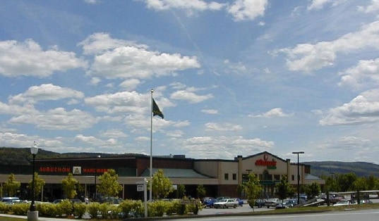
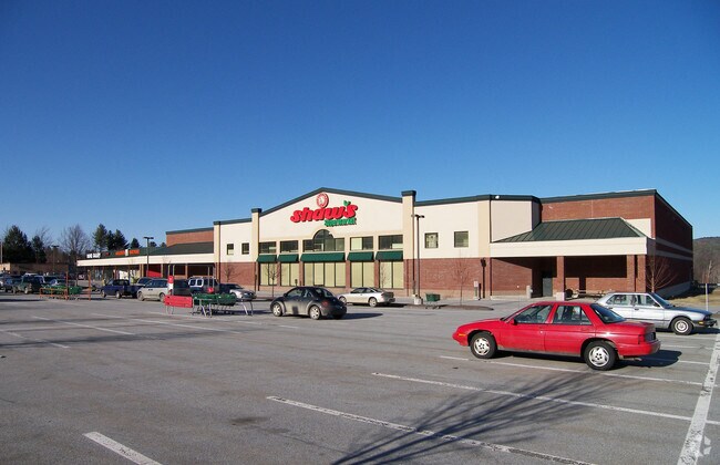
Property Record
189 Vt Route 12 S, Randolph, VT 05060
NEARBY LISTINGS FOR SALE OR LEASE
Property Detail
189 Vt Route 12 S
Claremont-Lebanon, NH-VT
BANK DRIVE - THRU BRANCH
507-159-13227
Orange
Commercialnec
Vermont
2024
Vermont North Area
2024
Other Market Areas
959400
DEMOGRAPHICS near 189 Vt Route 12 S
1 Mile
3 Mile
5 Mile
2024 Total Population
1,462
3,594
5,705
2029 Population
1,537
3,778
5,974
Pop Growth 2024-2029
+ 5.13%
+ 5.12%
+ 4.72%
Average Age
45
45
45
2024 Total Households
657
1,585
2,423
HH Growth 2024-2029
+ 5.18%
+ 5.30%
+ 4.87%
Median Household Inc
$66,770
$68,914
$70,874
Avg Household Size
2.20
2.20
2.30
2024 Avg HH Vehicles
2.00
2.00
2.00
Median Home Value
$212,975
$223,947
$230,323
Median Year Built
1949
1965
1972
Nearby Places
- Restaurants
- Banks
- Shops
- Fitness
- Groceries
PUBLIC TRANSPORTATION
COMMUTER RAIL
Randolph Amtrak (Vermonter - Amtrak)
DRIVE
WALK
Distance
Randolph Amtrak (Vermonter - Amtrak)
2 min
16 min
0.9 mi
Freight Ports
Albany, NY Port
DRIVE
WALK
Distance
Albany, NY Port
206 min
131.0 mi
SALE & LEASE HISTORY
LISTING DATE
SALE/LEASE

Oct 26, 2018
For Lease
Nearby Properties
Address
Land Use
TOTAL SIZE
Lot Size
Zoning
Address
Land Use
TOTAL SIZE
Lot Size
Zoning
130.20 AC
Address
Land Use
TOTAL SIZE
Lot Size
Zoning
31.70 AC
Address
Land Use
TOTAL SIZE
Lot Size
Zoning
6.20 AC
Address
Land Use
TOTAL SIZE
Lot Size
Zoning
25.38 AC
Address
Land Use
TOTAL SIZE
Lot Size
Zoning
11.50 AC
Address
Land Use
TOTAL SIZE
Lot Size
Zoning
62,664 SF
13.72 AC
C
Address
Land Use
TOTAL SIZE
Lot Size
Zoning
42.10 AC
Address
Land Use
TOTAL SIZE
Lot Size
Zoning
550.48 AC
C
Address
Land Use
TOTAL SIZE
Lot Size
Zoning
6.90 AC
C
Address
Land Use
TOTAL SIZE
Lot Size
Zoning
12.18 AC
Address
Land Use
TOTAL SIZE
Lot Size
Zoning
40,988 SF
7.60 AC
I
Address
Land Use
TOTAL SIZE
Lot Size
Zoning
1.14 AC
Address
Land Use
TOTAL SIZE
Lot Size
Zoning
32.23 AC
Address
Land Use
TOTAL SIZE
Lot Size
Zoning
15,875 SF
0.47 AC
Address
Land Use
TOTAL SIZE
Lot Size
Zoning
71.40 AC
Address
Land Use
TOTAL SIZE
Lot Size
Zoning
550.48 AC
Address
Land Use
TOTAL SIZE
Lot Size
Zoning
7.34 AC
Address
Land Use
TOTAL SIZE
Lot Size
Zoning
15.50 AC
Address
Land Use
TOTAL SIZE
Lot Size
Zoning
4,032 SF
1.41 AC
C
Address
Land Use
TOTAL SIZE
Lot Size
Zoning
10,526 SF
5.70 AC
Address
Land Use
TOTAL SIZE
Lot Size
Zoning
114,878 SF
7.80 AC
I
Address
Land Use
TOTAL SIZE
Lot Size
Zoning
16,828 SF
0.50 AC
Address
Land Use
TOTAL SIZE
Lot Size
Zoning
42.10 AC
Address
Land Use
TOTAL SIZE
Lot Size
Zoning
9.01 AC
Address
Land Use
TOTAL SIZE
Lot Size
Zoning
3,594 SF
5.66 AC
C
Address
Land Use
TOTAL SIZE
Lot Size
Zoning
14,319 SF
5.38 AC
C
Address
Land Use
TOTAL SIZE
Lot Size
Zoning
1,920 SF
112.86 AC
Address
Land Use
TOTAL SIZE
Lot Size
Zoning
4,278 SF
1.03 AC
C
Address
Land Use
TOTAL SIZE
Lot Size
Zoning
12,157 SF
2.60 AC
Address
Land Use
TOTAL SIZE
Lot Size
Zoning
15,232 SF
0.14 AC
C
The World's #1 Commercial Real Estate Marketplace
Connect with us
© 2025 CoStar Group
The information above has been obtained from sources believed reliable. While we do not doubt its accuracy we have not verified it and make no guarantee, warranty or representation about it. It is your responsibility to independently confirm its accuracy and completeness. Any projections, opinions, assumptions, or estimates used are for example only and do not represent the current or future performance of the property. The value of this transaction to you depends on tax and other factors which should be evaluated by your tax, financial, and legal advisors. You and your advisors should conduct a careful, independent investigation of the property to determine to your satisfaction the suitability of the property for your needs.