Property Record
103 Ave, New Stanton, PA 15672
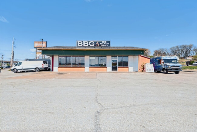


Property Detail
103 Ave
Pittsburgh, PA
PT LOTS 1-2-3-4 BLDG 130X105XIR
64-04-09-0-022
WESTMORELAND
Commercialofficeresidentialmixeduse
Pennsylvania
B and X Area of moderate flood hazard, usually the area between the limits of the 100-year and 500-year floods.
1-4
2025
0.31 AC
2026
Westmoreland County
804901
Pittsburgh
1,470 SF
NEARBY LISTINGS FOR SALE OR LEASE
DEMOGRAPHICS near 103 Ave
1 mile
3 mile
5 mile
2025 Total Population
2,291
9,179
23,753
2030 Population
2,268
8,993
23,274
Pop Growth 2025-2030
(1.00%)
(2.03%)
(2.02%)
Average Age
43
44
46
2025 Total Households
1,009
4,107
10,013
HH Growth 2025-2030
(1.39%)
(2.12%)
(2.21%)
Median Household Inc
$73,520
$69,826
$71,318
Avg Household Size
2.20
2.20
2.20
2025 Avg HH Vehicles
2.00
2.00
2.00
Median Home Value
$264,027
$205,913
$213,498
Median Year Built
1974
1969
1972
Nearby Places
Map Layers
Map Styles
 Street
 Aerial
Layers
 Traffic
 Biking
Places
Listings with unknown addresses are not visible on the map
- Restaurants
- Banks
- Shops
- Fitness
- Groceries
PUBLIC TRANSPORTATION
COMMUTER RAIL
Drive
Walk
Distance
15 min
8.4 mi
AIRPORT
Arnold Palmer Regional
Drive
Walk
Distance
Arnold Palmer Regional
32 min
17.8 mi
SALE & LEASE HISTORY
LISTING DATE
SALE/LEASE

Jun 21, 2024
For Sale
Nearby Properties
Address
Land Use
TOTAL SIZE
Lot Size
Zoning
Address
Land Use
TOTAL SIZE
Lot Size
Zoning
168.67 AC
Address
Land Use
TOTAL SIZE
Lot Size
Zoning
37.67 AC
Address
Land Use
TOTAL SIZE
Lot Size
Zoning
185.70 AC
Address
Land Use
TOTAL SIZE
Lot Size
Zoning
44.36 AC
Address
Land Use
TOTAL SIZE
Lot Size
Zoning
21.91 AC
Address
Land Use
TOTAL SIZE
Lot Size
Zoning
208,800 SF
31.20 AC
Address
Land Use
TOTAL SIZE
Lot Size
Zoning
32.50 AC
Address
Land Use
TOTAL SIZE
Lot Size
Zoning
Address
Land Use
TOTAL SIZE
Lot Size
Zoning
14.79 AC
Address
Land Use
TOTAL SIZE
Lot Size
Zoning
13.39 AC
Address
Land Use
TOTAL SIZE
Lot Size
Zoning
326,000 SF
109.40 AC
Address
Land Use
TOTAL SIZE
Lot Size
Zoning
35.40 AC
Address
Land Use
TOTAL SIZE
Lot Size
Zoning
57.96 AC
Address
Land Use
TOTAL SIZE
Lot Size
Zoning
342.14 AC
Address
Land Use
TOTAL SIZE
Lot Size
Zoning
57.80 AC
Address
Land Use
TOTAL SIZE
Lot Size
Zoning
Address
Land Use
TOTAL SIZE
Lot Size
Zoning
9.23 AC
Address
Land Use
TOTAL SIZE
Lot Size
Zoning
Address
Land Use
TOTAL SIZE
Lot Size
Zoning
Address
Land Use
TOTAL SIZE
Lot Size
Zoning
1,924 SF
6.55 AC
Address
Land Use
TOTAL SIZE
Lot Size
Zoning
11.95 AC
Address
Land Use
TOTAL SIZE
Lot Size
Zoning
90,464 SF
21 AC
Address
Land Use
TOTAL SIZE
Lot Size
Zoning
54,542 SF
38.84 AC
Address
Land Use
TOTAL SIZE
Lot Size
Zoning
141.89 AC
Address
Land Use
TOTAL SIZE
Lot Size
Zoning
11.28 AC
Address
Land Use
TOTAL SIZE
Lot Size
Zoning
43,432 SF
4.18 AC
Address
Land Use
TOTAL SIZE
Lot Size
Zoning
28.93 AC
Address
Land Use
TOTAL SIZE
Lot Size
Zoning
7.40 AC
Address
Land Use
TOTAL SIZE
Lot Size
Zoning
82,116 SF
22.17 AC
Address
Land Use
TOTAL SIZE
Lot Size
Zoning
5,600 SF
4.41 AC
The World's #1 Commercial Real Estate Marketplace
Connect with us
© 2026 CoStar Group
The information above has been obtained from sources believed reliable. While we do not doubt its accuracy we have not verified it and make no guarantee, warranty or representation about it. It is your responsibility to independently confirm its accuracy and completeness. Any projections, opinions, assumptions, or estimates used are for example only and do not represent the current or future performance of the property. The value of this transaction to you depends on tax and other factors which should be evaluated by your tax, financial, and legal advisors. You and your advisors should conduct a careful, independent investigation of the property to determine to your satisfaction the suitability of the property for your needs.