Property Record
103 E Smith St, Bridgeport, CT 06607


Save to a Folder
{{folder.Name}}
{{folder.ListingIds.length}} Properties
{{folder.ListingIds.length}} Property
Create a New Folder
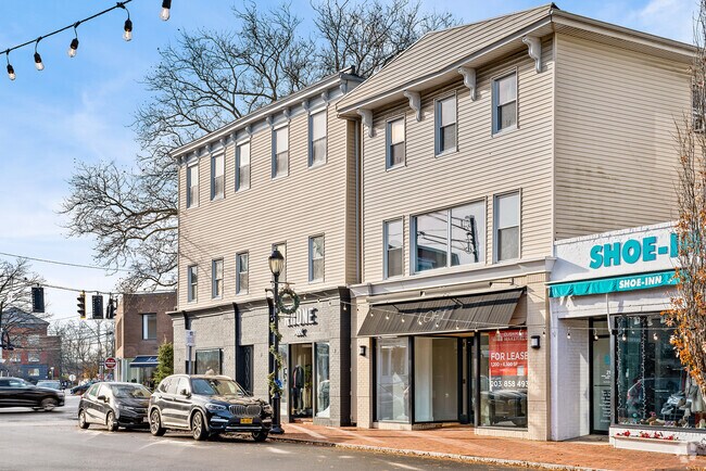
Property Detail
103 E Smith St
WPOR-000009C-000000-000134
Fairfield
Commercialbuilding
Connecticut
BCD
134-0
AE The base floodplain where base flood elevations are provided. AE Zones are now used on new format FIRMs instead of A1-A30 Zones.
0.17 AC
2024
Westport
2025
Westchester/So Connecticut
050200
Bridgeport-Stamford-Danbury, CT
16,550 SF
NEARBY LISTINGS FOR SALE OR LEASE
DEMOGRAPHICS near 103 E Smith St
1 mile
3 mile
5 mile
2025 Total Population
6,102
48,158
131,727
2030 Population
6,298
49,495
134,993
Pop Growth 2025-2030
+ 3.21%
+ 2.78%
+ 2.48%
Average Age
43
43
42
2025 Total Households
2,205
17,780
50,216
HH Growth 2025-2030
+ 3.17%
+ 2.73%
+ 2.52%
Median Household Inc
$225,416
$170,922
$130,482
Avg Household Size
2.70
2.60
2.60
2025 Avg HH Vehicles
2.00
2.00
2.00
Median Home Value
$1,086,158
$932,896
$808,537
Median Year Built
1965
1965
1967
Nearby Places
Map Layers
Map Styles
 Street
 Aerial
Layers
 Traffic
 Biking
Places
Listings with unknown addresses are not visible on the map
- Restaurants
- Banks
- Shops
- Fitness
- Groceries
PUBLIC TRANSPORTATION
COMMUTER RAIL
Bridgeport Station (New Haven Line - Shore Line East, Shore Line East - Shore Line East)
Drive
Walk
Distance
Bridgeport Station (New Haven Line - Shore Line East, Shore Line East - Shore Line East)
4 min
1.3 mi
Stratford Station (New Haven Line - Metro-North Commuter Railroad Company (Metro-North))
Drive
Walk
Distance
Stratford Station (New Haven Line - Metro-North Commuter Railroad Company (Metro-North))
6 min
3.3 mi
AIRPORT
Tweed/New Haven
Drive
Walk
Distance
Tweed/New Haven
35 min
21.8 mi
Westchester County
Drive
Walk
Distance
Westchester County
54 min
35.8 mi
Long Island MacArthur
Drive
Walk
Distance
Long Island MacArthur
111 min
36.0 mi
Freight Ports
Port of New Haven
Drive
Walk
Distance
Port of New Haven
29 min
18.9 mi
SALE & LEASE HISTORY
LISTING DATE
SALE/LEASE

Sep 24, 2016
For Lease
Mar 30, 2022
For Sale
Nearby Properties
Address
Land Use
TOTAL SIZE
Lot Size
Zoning
Address
Land Use
TOTAL SIZE
Lot Size
Zoning
Address
Land Use
TOTAL SIZE
Lot Size
Zoning
22.85 AC
Address
Land Use
TOTAL SIZE
Lot Size
Zoning
23.95 AC
RB
Address
Land Use
TOTAL SIZE
Lot Size
Zoning
145,000 SF
15.70 AC
ILI
Address
Land Use
TOTAL SIZE
Lot Size
Zoning
39,031 SF
451.38 AC
ADD
Address
Land Use
TOTAL SIZE
Lot Size
Zoning
111 AC
RA
Address
Land Use
TOTAL SIZE
Lot Size
Zoning
4.14 AC
MUEM
Address
Land Use
TOTAL SIZE
Lot Size
Zoning
178,265 SF
6.92 AC
Address
Land Use
TOTAL SIZE
Lot Size
Zoning
83,122 SF
4.39 AC
Address
Land Use
TOTAL SIZE
Lot Size
Zoning
288,875 SF
1.57 AC
MUEM
Address
Land Use
TOTAL SIZE
Lot Size
Zoning
146,351 SF
8.86 AC
Address
Land Use
TOTAL SIZE
Lot Size
Zoning
497,430 SF
4.16 AC
DCB
Address
Land Use
TOTAL SIZE
Lot Size
Zoning
23 AC
RC
Address
Land Use
TOTAL SIZE
Lot Size
Zoning
162,376 SF
7.82 AC
Address
Land Use
TOTAL SIZE
Lot Size
Zoning
10.66 AC
ORR
Address
Land Use
TOTAL SIZE
Lot Size
Zoning
585,480 SF
3.66 AC
Address
Land Use
TOTAL SIZE
Lot Size
Zoning
493,114 SF
2.20 AC
DCB
Address
Land Use
TOTAL SIZE
Lot Size
Zoning
23.70 AC
RB
Address
Land Use
TOTAL SIZE
Lot Size
Zoning
92,318 SF
5.33 AC
Address
Land Use
TOTAL SIZE
Lot Size
Zoning
368,000 SF
18.69 AC
D-17
Address
Land Use
TOTAL SIZE
Lot Size
Zoning
216,972 SF
2.53 AC
DCB
Address
Land Use
TOTAL SIZE
Lot Size
Zoning
225,264 SF
28.22 AC
MC
Address
Land Use
TOTAL SIZE
Lot Size
Zoning
14.90 AC
RC
Address
Land Use
TOTAL SIZE
Lot Size
Zoning
5.31 AC
RC
Address
Land Use
TOTAL SIZE
Lot Size
Zoning
204,000 SF
1.84 AC
MUEM
Address
Land Use
TOTAL SIZE
Lot Size
Zoning
7.52 AC
RC
Address
Land Use
TOTAL SIZE
Lot Size
Zoning
110,506 SF
0.06 AC
RBB
Address
Land Use
TOTAL SIZE
Lot Size
Zoning
2.40 AC
DCB
Address
Land Use
TOTAL SIZE
Lot Size
Zoning
2 AC
DCB
Address
Land Use
TOTAL SIZE
Lot Size
Zoning
722 SF
47.10 AC
RM-1
The World's #1 Commercial Real Estate Marketplace
Connect with us
© 2026 CoStar Group
The information above has been obtained from sources believed reliable. While we do not doubt its accuracy we have not verified it and make no guarantee, warranty or representation about it. It is your responsibility to independently confirm its accuracy and completeness. Any projections, opinions, assumptions, or estimates used are for example only and do not represent the current or future performance of the property. The value of this transaction to you depends on tax and other factors which should be evaluated by your tax, financial, and legal advisors. You and your advisors should conduct a careful, independent investigation of the property to determine to your satisfaction the suitability of the property for your needs.