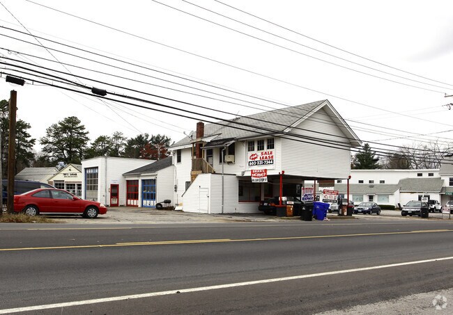
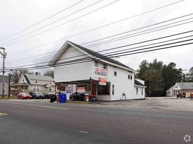
Property Record
103 Lowell Rd, Hudson, NH 03051
NEARBY LISTINGS FOR SALE OR LEASE
Property Detail
103 Lowell Rd
Autorepair
Hillsborough
X
New Hampshire
33011C0518D
0.16 AC
2024
Hillsborough
2024
Boston
012201
Manchester-Nashua, NH
1,323 SF
HDSO-000198-000004
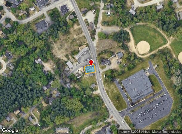
DEMOGRAPHICS near 103 Lowell Rd
1 Mile
3 Mile
5 Mile
2024 Total Population
6,629
63,148
124,254
2029 Population
6,802
64,403
126,823
Pop Growth 2024-2029
+ 2.61%
+ 1.99%
+ 2.07%
Average Age
42
40
42
2024 Total Households
2,591
25,735
50,337
HH Growth 2024-2029
+ 2.55%
+ 2.00%
+ 2.07%
Median Household Inc
$82,474
$82,289
$95,217
Avg Household Size
2.50
2.40
2.40
2024 Avg HH Vehicles
2.00
2.00
2.00
Median Home Value
$361,489
$354,205
$372,520
Median Year Built
1972
1967
1977
Nearby Places
Map Layers
Map Styles
 Street
 Aerial
- Restaurants
- Banks
- Shops
- Fitness
- Groceries
PUBLIC TRANSPORTATION
AIRPORT
Manchester Boston Regional
DRIVE
WALK
Distance
Manchester Boston Regional
31 min
17.3 mi
Freight Ports
Port of Boston
DRIVE
WALK
Distance
Port of Boston
67 min
47.9 mi
Nearby Properties
Address
Land Use
TOTAL SIZE
Lot Size
Zoning
Address
Land Use
TOTAL SIZE
Lot Size
Zoning
19.70 AC
RB
Address
Land Use
TOTAL SIZE
Lot Size
Zoning
27.98 AC
GI
Address
Land Use
TOTAL SIZE
Lot Size
Zoning
20.72 AC
RC
Address
Land Use
TOTAL SIZE
Lot Size
Zoning
15.19 AC
RC
Address
Land Use
TOTAL SIZE
Lot Size
Zoning
522,476 SF
74.89 AC
GD
Address
Land Use
TOTAL SIZE
Lot Size
Zoning
220,295 SF
4.34 AC
D1MU
Address
Land Use
TOTAL SIZE
Lot Size
Zoning
118.50 AC
PI
Address
Land Use
TOTAL SIZE
Lot Size
Zoning
20.80 AC
RC
Address
Land Use
TOTAL SIZE
Lot Size
Zoning
5.30 AC
GIMU
Address
Land Use
TOTAL SIZE
Lot Size
Zoning
133,390 SF
97.42 AC
R2
Address
Land Use
TOTAL SIZE
Lot Size
Zoning
231,216 SF
1.88 AC
GIMU
Address
Land Use
TOTAL SIZE
Lot Size
Zoning
206,913 SF
18.30 AC
GB
Address
Land Use
TOTAL SIZE
Lot Size
Zoning
21.40 AC
RC
Address
Land Use
TOTAL SIZE
Lot Size
Zoning
37.57 AC
R9
Address
Land Use
TOTAL SIZE
Lot Size
Zoning
8.87 AC
RC
Address
Land Use
TOTAL SIZE
Lot Size
Zoning
21.16 AC
D3MU
Address
Land Use
TOTAL SIZE
Lot Size
Zoning
312,738 SF
25.84 AC
ID
Address
Land Use
TOTAL SIZE
Lot Size
Zoning
12.55 AC
RC
Address
Land Use
TOTAL SIZE
Lot Size
Zoning
261,381 SF
3.78 AC
GIMU
Address
Land Use
TOTAL SIZE
Lot Size
Zoning
185,242 SF
35.75 AC
ID
Address
Land Use
TOTAL SIZE
Lot Size
Zoning
116,602 SF
11.74 AC
GB
Address
Land Use
TOTAL SIZE
Lot Size
Zoning
77,276 SF
19.50 AC
PI
Address
Land Use
TOTAL SIZE
Lot Size
Zoning
160,329 SF
16.13 AC
RB
Address
Land Use
TOTAL SIZE
Lot Size
Zoning
129,441 SF
18.90 AC
R9
Address
Land Use
TOTAL SIZE
Lot Size
Zoning
28.33 AC
GI
Address
Land Use
TOTAL SIZE
Lot Size
Zoning
13.02 AC
R9
Address
Land Use
TOTAL SIZE
Lot Size
Zoning
243,335 SF
2.71 AC
GIMU
Address
Land Use
TOTAL SIZE
Lot Size
Zoning
127,825 SF
D1MU
Address
Land Use
TOTAL SIZE
Lot Size
Zoning
148,042 SF
28.53 AC
R2
Address
Land Use
TOTAL SIZE
Lot Size
Zoning
81,200 SF
3.60 AC
GIMU
The World's #1 Commercial Real Estate Marketplace
Connect with us
© 2025 CoStar Group
The information above has been obtained from sources believed reliable. While we do not doubt its accuracy we have not verified it and make no guarantee, warranty or representation about it. It is your responsibility to independently confirm its accuracy and completeness. Any projections, opinions, assumptions, or estimates used are for example only and do not represent the current or future performance of the property. The value of this transaction to you depends on tax and other factors which should be evaluated by your tax, financial, and legal advisors. You and your advisors should conduct a careful, independent investigation of the property to determine to your satisfaction the suitability of the property for your needs.