Property Record
103 S Main St, Brownsville, IN 47325
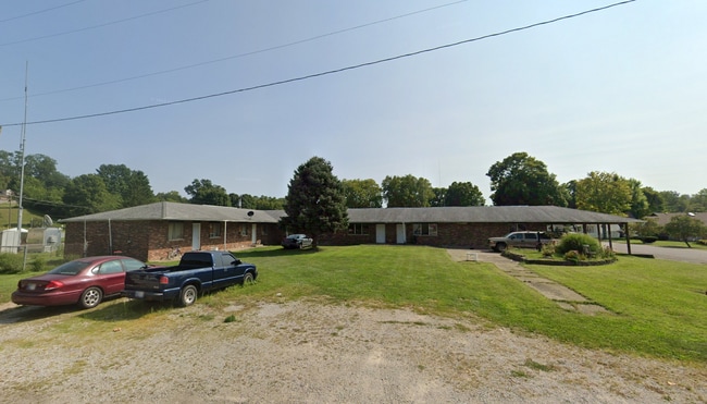
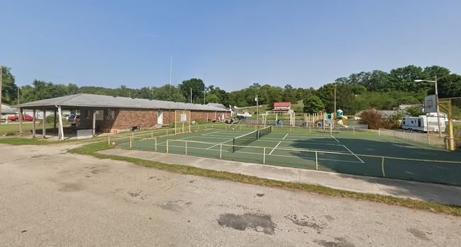
This Property Is For Sale
NEARBY LISTINGS FOR SALE OR LEASE
-
-
View all Brownsville listings for sale on LoopNet.com
Property Detail
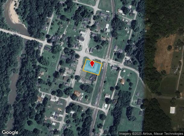
103 S Main St
Cincinnati, OH-KY-IN
Town Brownsville
81-06-18-103-003.073-001
18-14-14 OUTLOTS 73, PT 74
Conveniencestore
Union
X
Indiana
18177C0350E
73
2024
0.47 AC
2024
Indiana South Area
960700
Other Market Areas
5,125 SF
DEMOGRAPHICS near 103 S Main St
1 Mile
3 Mile
5 Mile
2024 Total Population
246
1,076
4,351
2029 Population
242
1,065
4,282
Pop Growth 2024-2029
(1.63%)
(1.02%)
(1.59%)
Average Age
44
44
43
2024 Total Households
99
434
1,815
HH Growth 2024-2029
(1.01%)
(0.92%)
(1.60%)
Median Household Inc
$73,799
$73,643
$66,005
Avg Household Size
2.50
2.50
2.40
2024 Avg HH Vehicles
2.00
2.00
2.00
Median Home Value
$157,407
$162,182
$148,601
Median Year Built
1973
1973
1969
Nearby Places
Map Layers
Map Styles
 Street
 Aerial
- Restaurants
- Banks
- Shops
- Fitness
- Groceries
PUBLIC TRANSPORTATION
COMMUTER RAIL
Connersville Amtrak (Cardinal - Amtrak)
DRIVE
WALK
Distance
Connersville Amtrak (Cardinal - Amtrak)
19 min
8.4 mi
Freight Ports
Port of Toledo
DRIVE
WALK
Distance
Port of Toledo
248 min
202.4 mi
Nearby Properties
Address
Land Use
TOTAL SIZE
Lot Size
Zoning
Address
Land Use
TOTAL SIZE
Lot Size
Zoning
8.16 AC
A-2
Address
Land Use
TOTAL SIZE
Lot Size
Zoning
271.27 AC
Address
Land Use
TOTAL SIZE
Lot Size
Zoning
Address
Land Use
TOTAL SIZE
Lot Size
Zoning
157.21 AC
A-2
Address
Land Use
TOTAL SIZE
Lot Size
Zoning
3,192 SF
125.31 AC
Address
Land Use
TOTAL SIZE
Lot Size
Zoning
113.12 AC
Address
Land Use
TOTAL SIZE
Lot Size
Zoning
131.16 AC
Address
Land Use
TOTAL SIZE
Lot Size
Zoning
110.89 AC
Address
Land Use
TOTAL SIZE
Lot Size
Zoning
138.76 AC
Address
Land Use
TOTAL SIZE
Lot Size
Zoning
121.61 AC
A-2
Address
Land Use
TOTAL SIZE
Lot Size
Zoning
98.50 AC
Address
Land Use
TOTAL SIZE
Lot Size
Zoning
143.40 AC
Address
Land Use
TOTAL SIZE
Lot Size
Zoning
144.24 AC
Address
Land Use
TOTAL SIZE
Lot Size
Zoning
123.09 AC
Address
Land Use
TOTAL SIZE
Lot Size
Zoning
158 AC
Address
Land Use
TOTAL SIZE
Lot Size
Zoning
118.30 AC
A-2
Address
Land Use
TOTAL SIZE
Lot Size
Zoning
113.06 AC
Address
Land Use
TOTAL SIZE
Lot Size
Zoning
101.24 AC
Address
Land Use
TOTAL SIZE
Lot Size
Zoning
1,638 SF
118.05 AC
Address
Land Use
TOTAL SIZE
Lot Size
Zoning
157.30 AC
Address
Land Use
TOTAL SIZE
Lot Size
Zoning
107.50 AC
A-2
Address
Land Use
TOTAL SIZE
Lot Size
Zoning
128.74 AC
A-2
Address
Land Use
TOTAL SIZE
Lot Size
Zoning
91.14 AC
Address
Land Use
TOTAL SIZE
Lot Size
Zoning
139.03 AC
Address
Land Use
TOTAL SIZE
Lot Size
Zoning
106.41 AC
A-2
Address
Land Use
TOTAL SIZE
Lot Size
Zoning
132.41 AC
Address
Land Use
TOTAL SIZE
Lot Size
Zoning
Address
Land Use
TOTAL SIZE
Lot Size
Zoning
77.19 AC
Address
Land Use
TOTAL SIZE
Lot Size
Zoning
104.11 AC
Address
Land Use
TOTAL SIZE
Lot Size
Zoning
115.10 AC
The World's #1 Commercial Real Estate Marketplace
Connect with us
© 2025 CoStar Group
The information above has been obtained from sources believed reliable. While we do not doubt its accuracy we have not verified it and make no guarantee, warranty or representation about it. It is your responsibility to independently confirm its accuracy and completeness. Any projections, opinions, assumptions, or estimates used are for example only and do not represent the current or future performance of the property. The value of this transaction to you depends on tax and other factors which should be evaluated by your tax, financial, and legal advisors. You and your advisors should conduct a careful, independent investigation of the property to determine to your satisfaction the suitability of the property for your needs.