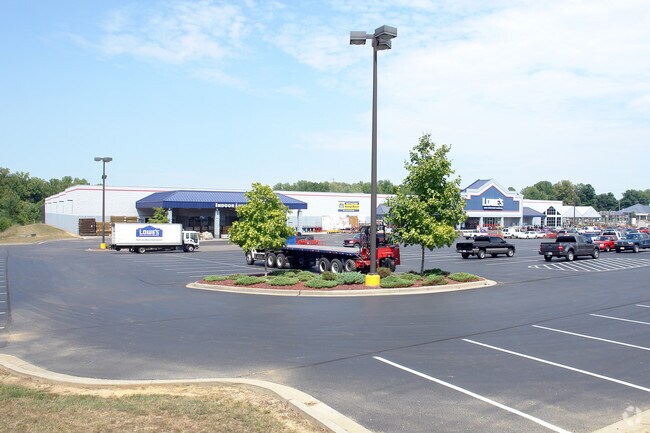
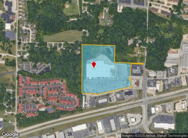
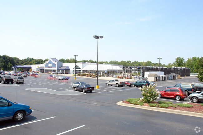
Property Record
103 S Red Bank Rd, Evansville, IN 47712
NEARBY LISTINGS FOR SALE OR LEASE
Property Detail
103 S Red Bank Rd
82-05-28-007-097.074-024
PT NE NE 28-6-11 ALSO EXPRESSWAY COMMERCIAL SUB SEC 1A PT L1 & L 3, 4, 5, 6 ALSO EXPRESSWAY COMMERCIAL SUB SEC 1B LOT 7 & PT
Wholesaleoutletdiscountstore
Vanderburgh
X
Indiana
18129C0275C
7
2024
18.64 AC
2024
Westside
010404
Evansville
136,659 SF
Evansville, IN-KY
DEMOGRAPHICS near 103 S Red Bank Rd
1 Mile
3 Mile
5 Mile
2024 Total Population
4,440
26,135
67,848
2029 Population
4,438
26,035
68,537
Pop Growth 2024-2029
(0.05%)
(0.38%)
+ 1.02%
Average Age
40
40
40
2024 Total Households
2,174
10,715
28,501
HH Growth 2024-2029
0.00%
(0.47%)
+ 1.08%
Median Household Inc
$49,357
$55,788
$47,166
Avg Household Size
2.00
2.20
2.20
2024 Avg HH Vehicles
2.00
2.00
2.00
Median Home Value
$179,206
$161,096
$131,549
Median Year Built
1978
1962
1958
Nearby Places
Map Layers
Map Styles
 Street
 Aerial
- Restaurants
- Banks
- Shops
- Fitness
- Groceries
PUBLIC TRANSPORTATION
AIRPORT
Evansville Regional
DRIVE
WALK
Distance
Evansville Regional
18 min
10.1 mi
Freight Ports
Port of Toledo
DRIVE
WALK
Distance
Port of Toledo
465 min
399.3 mi
Nearby Properties
Address
Land Use
TOTAL SIZE
Lot Size
Zoning
Address
Land Use
TOTAL SIZE
Lot Size
Zoning
298 SF
24.29 AC
Address
Land Use
TOTAL SIZE
Lot Size
Zoning
13,182 SF
25.33 AC
Address
Land Use
TOTAL SIZE
Lot Size
Zoning
19,924 SF
15.63 AC
Address
Land Use
TOTAL SIZE
Lot Size
Zoning
235,153 SF
2.61 AC
Address
Land Use
TOTAL SIZE
Lot Size
Zoning
205,205 SF
16.85 AC
Address
Land Use
TOTAL SIZE
Lot Size
Zoning
25,595 SF
14.99 AC
Address
Land Use
TOTAL SIZE
Lot Size
Zoning
1,936 SF
11.70 AC
Address
Land Use
TOTAL SIZE
Lot Size
Zoning
8,440 SF
5.77 AC
Address
Land Use
TOTAL SIZE
Lot Size
Zoning
16,832 SF
7.90 AC
Address
Land Use
TOTAL SIZE
Lot Size
Zoning
55,263 SF
11.20 AC
Address
Land Use
TOTAL SIZE
Lot Size
Zoning
61,530 SF
12.77 AC
Address
Land Use
TOTAL SIZE
Lot Size
Zoning
118,000 SF
17.17 AC
Address
Land Use
TOTAL SIZE
Lot Size
Zoning
4,441 SF
11.85 AC
3
Address
Land Use
TOTAL SIZE
Lot Size
Zoning
5,808 SF
12.20 AC
Address
Land Use
TOTAL SIZE
Lot Size
Zoning
2,784 SF
14.47 AC
Address
Land Use
TOTAL SIZE
Lot Size
Zoning
3,347 SF
6.14 AC
Address
Land Use
TOTAL SIZE
Lot Size
Zoning
1,800 SF
28.13 AC
Address
Land Use
TOTAL SIZE
Lot Size
Zoning
150,102 SF
20.72 AC
Address
Land Use
TOTAL SIZE
Lot Size
Zoning
1,892 SF
11.95 AC
Address
Land Use
TOTAL SIZE
Lot Size
Zoning
22,756 SF
0.01 AC
Address
Land Use
TOTAL SIZE
Lot Size
Zoning
61,156 SF
3.40 AC
Address
Land Use
TOTAL SIZE
Lot Size
Zoning
87,930 SF
9.79 AC
Address
Land Use
TOTAL SIZE
Lot Size
Zoning
56,144 SF
5 AC
Address
Land Use
TOTAL SIZE
Lot Size
Zoning
26,320 SF
5.95 AC
Address
Land Use
TOTAL SIZE
Lot Size
Zoning
34,390 SF
4.34 AC
Address
Land Use
TOTAL SIZE
Lot Size
Zoning
22,910 SF
21.30 AC
Address
Land Use
TOTAL SIZE
Lot Size
Zoning
39,208 SF
1.43 AC
Address
Land Use
TOTAL SIZE
Lot Size
Zoning
2,980 SF
71.27 AC
Address
Land Use
TOTAL SIZE
Lot Size
Zoning
1,849 SF
62.25 AC
The World's #1 Commercial Real Estate Marketplace
Connect with us
© 2025 CoStar Group
The information above has been obtained from sources believed reliable. While we do not doubt its accuracy we have not verified it and make no guarantee, warranty or representation about it. It is your responsibility to independently confirm its accuracy and completeness. Any projections, opinions, assumptions, or estimates used are for example only and do not represent the current or future performance of the property. The value of this transaction to you depends on tax and other factors which should be evaluated by your tax, financial, and legal advisors. You and your advisors should conduct a careful, independent investigation of the property to determine to your satisfaction the suitability of the property for your needs.