Property Record
103 S Ridgecrest Ave, Nixa, MO 65714

Save to a Folder
{{folder.Name}}
{{folder.ListingIds.length}} Properties
{{folder.ListingIds.length}} Property
Create a New Folder
Property Detail
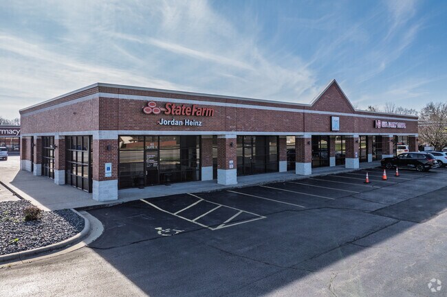
103 S Ridgecrest Ave
Springfield, MO
LOT 1 HIGHWAY 14 OFFICE PARK
10-0.6-13-004-011-001.000
Christian
Storemultistory
Missouri
B and X Area of moderate flood hazard, usually the area between the limits of the 100-year and 500-year floods.
1
2024
4.54 AC
2025
West Christian County
020204
Springfield
7,168 SF
NEARBY LISTINGS FOR SALE OR LEASE
DEMOGRAPHICS near 103 S Ridgecrest Ave
1 mile
3 mile
5 mile
2025 Total Population
9,645
36,454
63,216
2030 Population
10,283
38,741
66,974
Pop Growth 2025-2030
+ 6.61%
+ 6.27%
+ 5.94%
Average Age
39
40
40
2025 Total Households
3,644
13,937
23,969
HH Growth 2025-2030
+ 6.61%
+ 6.27%
+ 5.96%
Median Household Inc
$81,731
$82,527
$82,914
Avg Household Size
2.60
2.60
2.60
2025 Avg HH Vehicles
2.00
2.00
2.00
Median Home Value
$290,012
$308,392
$322,359
Median Year Built
1996
1999
1998
Nearby Places
Map Layers
Map Styles
 Street
 Aerial
Layers
 Traffic
 Biking
Places
Listings with unknown addresses are not visible on the map
- Restaurants
- Banks
- Shops
- Fitness
- Groceries
PUBLIC TRANSPORTATION
AIRPORT
Springfield-Branson Ntl
Drive
Walk
Distance
Springfield-Branson Ntl
39 min
21.8 mi
Freight Ports
Tulsa Port of Inola
Drive
Walk
Distance
Tulsa Port of Inola
202 min
179.4 mi
SALE & LEASE HISTORY
LISTING DATE
SALE/LEASE

Apr 05, 2019
For Lease
Apr 04, 2019
For Sale
Nearby Properties
Address
Land Use
TOTAL SIZE
Lot Size
Zoning
Address
Land Use
TOTAL SIZE
Lot Size
Zoning
6,164 SF
62.43 AC
Address
Land Use
TOTAL SIZE
Lot Size
Zoning
13,048 SF
9.29 AC
Address
Land Use
TOTAL SIZE
Lot Size
Zoning
192,607 SF
26.20 AC
Address
Land Use
TOTAL SIZE
Lot Size
Zoning
5,310 SF
12.27 AC
Address
Land Use
TOTAL SIZE
Lot Size
Zoning
5,360 SF
9.71 AC
Address
Land Use
TOTAL SIZE
Lot Size
Zoning
1,836 SF
35.65 AC
Address
Land Use
TOTAL SIZE
Lot Size
Zoning
68,882 SF
39.87 AC
Address
Land Use
TOTAL SIZE
Lot Size
Zoning
30,049 SF
5.01 AC
Address
Land Use
TOTAL SIZE
Lot Size
Zoning
21,597 SF
18 AC
Address
Land Use
TOTAL SIZE
Lot Size
Zoning
4,894 SF
10.80 AC
Address
Land Use
TOTAL SIZE
Lot Size
Zoning
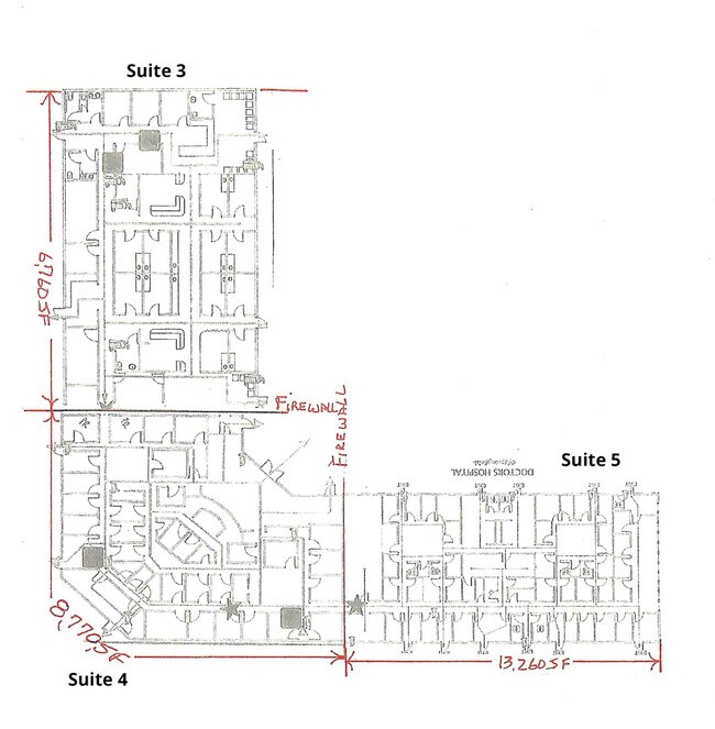
9,841 SF
7.17 AC
Address
Land Use
TOTAL SIZE
Lot Size
Zoning
92,462 SF
19.78 AC
Address
Land Use
TOTAL SIZE
Lot Size
Zoning
1,640 SF
24.20 AC
Address
Land Use
TOTAL SIZE
Lot Size
Zoning
38,524 SF
6.54 AC
Address
Land Use
TOTAL SIZE
Lot Size
Zoning
6,875 SF
6.56 AC
Address
Land Use
TOTAL SIZE
Lot Size
Zoning
54,519 SF
18.56 AC
Address
Land Use
TOTAL SIZE
Lot Size
Zoning
13,634 SF
3.51 AC
Address
Land Use
TOTAL SIZE
Lot Size
Zoning
53,597 SF
39.40 AC
Address
Land Use
TOTAL SIZE
Lot Size
Zoning
11,830 SF
10 AC
Address
Land Use
TOTAL SIZE
Lot Size
Zoning
15,785 SF
3.99 AC
Address
Land Use
TOTAL SIZE
Lot Size
Zoning
11,600 SF
18.75 AC
Address
Land Use
TOTAL SIZE
Lot Size
Zoning
1,768 SF
9.46 AC
Address
Land Use
TOTAL SIZE
Lot Size
Zoning
18,055 SF
7 AC
Address
Land Use
TOTAL SIZE
Lot Size
Zoning
6,006 SF
9.93 AC
Address
Land Use
TOTAL SIZE
Lot Size
Zoning
25,749 SF
39.26 AC
Address
Land Use
TOTAL SIZE
Lot Size
Zoning
2,400 SF
8.51 AC
Address
Land Use
TOTAL SIZE
Lot Size
Zoning
9,483 SF
4.71 AC
Address
Land Use
TOTAL SIZE
Lot Size
Zoning
14,500 SF
19.22 AC
Address
Land Use
TOTAL SIZE
Lot Size
Zoning
13,940 SF
3.43 AC
The World's #1 Commercial Real Estate Marketplace
Connect with us
© 2026 CoStar Group
The information above has been obtained from sources believed reliable. While we do not doubt its accuracy we have not verified it and make no guarantee, warranty or representation about it. It is your responsibility to independently confirm its accuracy and completeness. Any projections, opinions, assumptions, or estimates used are for example only and do not represent the current or future performance of the property. The value of this transaction to you depends on tax and other factors which should be evaluated by your tax, financial, and legal advisors. You and your advisors should conduct a careful, independent investigation of the property to determine to your satisfaction the suitability of the property for your needs.