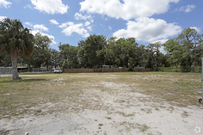
Property Record
103 S Walton Rd, East Palatka, FL 32131


NEARBY LISTINGS FOR SALE OR LEASE
Property Detail
103 S Walton Rd
38-10-27-0000-0720-0000
PT OF WOODRUFF GRT OR77 P489, (SUBJECT TO FPL ESMT OR1426 P678) (MAP SHEET 38A)
Commercialacreage
Putnam
X
Florida
12107C0213C
0.66 AC
2024
Florida Central North Area
2024
Other Market Areas
951000
Palatka, FL
DEMOGRAPHICS near 103 S Walton Rd
1 Mile
3 Mile
5 Mile
2024 Total Population
739
9,906
23,261
2029 Population
763
10,214
24,079
Pop Growth 2024-2029
+ 3.25%
+ 3.11%
+ 3.52%
Average Age
44
41
42
2024 Total Households
311
3,940
9,311
HH Growth 2024-2029
+ 3.22%
+ 3.10%
+ 3.48%
Median Household Inc
$50,869
$31,593
$32,787
Avg Household Size
2.40
2.40
2.40
2024 Avg HH Vehicles
2.00
2.00
2.00
Median Home Value
$854,166
$136,008
$135,838
Median Year Built
1981
1968
1976
Nearby Places
Map Layers
Map Styles
 Street
 Aerial
- Restaurants
- Banks
- Shops
- Fitness
- Groceries
PUBLIC TRANSPORTATION
COMMUTER RAIL
Palatka Amtrak (Silver Meteor - Amtrak, Silver Star - Amtrak)
DRIVE
WALK
Distance
Palatka Amtrak (Silver Meteor - Amtrak, Silver Star - Amtrak)
4 min
2.1 mi
Freight Ports
Jacksonville Port
DRIVE
WALK
Distance
Jacksonville Port
81 min
63.4 mi
SALE & LEASE HISTORY
LISTING DATE
SALE/LEASE

Apr 28, 2017
For Sale
Nearby Properties
Address
Land Use
TOTAL SIZE
Lot Size
Zoning
Address
Land Use
TOTAL SIZE
Lot Size
Zoning
42,106 SF
15.24 AC
Address
Land Use
TOTAL SIZE
Lot Size
Zoning
45,991 SF
1.69 AC
Address
Land Use
TOTAL SIZE
Lot Size
Zoning
19,096 SF
151.97 AC
Address
Land Use
TOTAL SIZE
Lot Size
Zoning
13,825 SF
4.13 AC
Address
Land Use
TOTAL SIZE
Lot Size
Zoning
64,863 SF
18.29 AC
Address
Land Use
TOTAL SIZE
Lot Size
Zoning
6,892 SF
29 AC
Address
Land Use
TOTAL SIZE
Lot Size
Zoning
6,120 SF
6.32 AC
Address
Land Use
TOTAL SIZE
Lot Size
Zoning
67,425 SF
17.47 AC
Address
Land Use
TOTAL SIZE
Lot Size
Zoning
9,250 SF
96.36 AC
Address
Land Use
TOTAL SIZE
Lot Size
Zoning
4,176 SF
6.77 AC
Address
Land Use
TOTAL SIZE
Lot Size
Zoning
57,141 SF
37.09 AC
Address
Land Use
TOTAL SIZE
Lot Size
Zoning
13,054 SF
2.25 AC
Address
Land Use
TOTAL SIZE
Lot Size
Zoning
9,776 SF
3.87 AC
Address
Land Use
TOTAL SIZE
Lot Size
Zoning
46,062 SF
2.28 AC
Address
Land Use
TOTAL SIZE
Lot Size
Zoning
13,335 SF
3.59 AC
Address
Land Use
TOTAL SIZE
Lot Size
Zoning
9,128 SF
4.77 AC
Address
Land Use
TOTAL SIZE
Lot Size
Zoning
18,434 SF
1.98 AC
Address
Land Use
TOTAL SIZE
Lot Size
Zoning
49,514 SF
9 AC
Address
Land Use
TOTAL SIZE
Lot Size
Zoning
1,712 SF
6.98 AC
Address
Land Use
TOTAL SIZE
Lot Size
Zoning
19,146 SF
4.01 AC
Address
Land Use
TOTAL SIZE
Lot Size
Zoning
Address
Land Use
TOTAL SIZE
Lot Size
Zoning
13,060 SF
2.94 AC
Address
Land Use
TOTAL SIZE
Lot Size
Zoning
12,427 SF
16.63 AC
Address
Land Use
TOTAL SIZE
Lot Size
Zoning
24,294 SF
2.06 AC
Address
Land Use
TOTAL SIZE
Lot Size
Zoning
6,150 SF
22.13 AC
Address
Land Use
TOTAL SIZE
Lot Size
Zoning
2,500 SF
4.34 AC
Address
Land Use
TOTAL SIZE
Lot Size
Zoning
2,829 SF
1.31 AC
Address
Land Use
TOTAL SIZE
Lot Size
Zoning
16,240 SF
0.52 AC
Address
Land Use
TOTAL SIZE
Lot Size
Zoning
4,805 SF
2.41 AC
Address
Land Use
TOTAL SIZE
Lot Size
Zoning
12,427 SF
57.71 AC
The World's #1 Commercial Real Estate Marketplace
Connect with us
© 2026 CoStar Group
The information above has been obtained from sources believed reliable. While we do not doubt its accuracy we have not verified it and make no guarantee, warranty or representation about it. It is your responsibility to independently confirm its accuracy and completeness. Any projections, opinions, assumptions, or estimates used are for example only and do not represent the current or future performance of the property. The value of this transaction to you depends on tax and other factors which should be evaluated by your tax, financial, and legal advisors. You and your advisors should conduct a careful, independent investigation of the property to determine to your satisfaction the suitability of the property for your needs.