Property Record
103 T R Harris Dr, Shelby, NC 28150


NEARBY LISTINGS FOR SALE OR LEASE
Property Detail
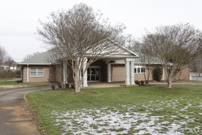
103 T R Harris Dr
26837
2.063 AC HWY 18N
Commercialnec
Cleveland
X
North Carolina
3710254700J
47
2025
2.06 AC
2025
Cleveland County
950800
Charlotte
17,968 SF
Shelby, NC
DEMOGRAPHICS near 103 T R Harris Dr
1 Mile
3 Mile
5 Mile
2024 Total Population
2,612
18,443
35,950
2029 Population
2,728
19,378
37,599
Pop Growth 2024-2029
+ 4.44%
+ 5.07%
+ 4.59%
Average Age
42
42
42
2024 Total Households
1,182
7,753
15,005
HH Growth 2024-2029
+ 4.48%
+ 5.11%
+ 4.60%
Median Household Inc
$33,599
$40,312
$44,071
Avg Household Size
2.10
2.20
2.30
2024 Avg HH Vehicles
2.00
2.00
2.00
Median Home Value
$111,215
$146,834
$148,220
Median Year Built
1973
1972
1975
Nearby Places
Map Layers
Map Styles
 Street
 Aerial
- Restaurants
- Banks
- Shops
- Fitness
- Groceries
PUBLIC TRANSPORTATION
AIRPORT
Charlotte/Douglas International
DRIVE
WALK
Distance
Charlotte/Douglas International
62 min
41.2 mi
SALE & LEASE HISTORY
LISTING DATE
SALE/LEASE

Sep 25, 2016
For Lease
Sep 23, 2016
For Sale
Nearby Properties
Address
Land Use
TOTAL SIZE
Lot Size
Zoning
Address
Land Use
TOTAL SIZE
Lot Size
Zoning
15.70 AC
RO
Address
Land Use
TOTAL SIZE
Lot Size
Zoning
92,278 SF
41.63 AC
R10
Address
Land Use
TOTAL SIZE
Lot Size
Zoning
6,250 SF
18.80 AC
HI
Address
Land Use
TOTAL SIZE
Lot Size
Zoning
29,747 SF
21.06 AC
RO
Address
Land Use
TOTAL SIZE
Lot Size
Zoning
224,162 SF
15 AC
GBCU
Address
Land Use
TOTAL SIZE
Lot Size
Zoning
18,864 SF
10.65 AC
ROCU
Address
Land Use
TOTAL SIZE
Lot Size
Zoning
1,436 SF
8.02 AC
RO
Address
Land Use
TOTAL SIZE
Lot Size
Zoning
24,652 SF
3.72 AC
R10
Address
Land Use
TOTAL SIZE
Lot Size
Zoning
44,684 SF
4.44 AC
RO
Address
Land Use
TOTAL SIZE
Lot Size
Zoning
63,543 SF
24.07 AC
R20
Address
Land Use
TOTAL SIZE
Lot Size
Zoning
134,978 SF
14.50 AC
GB2CU
Address
Land Use
TOTAL SIZE
Lot Size
Zoning
43,540 SF
2.96 AC
GI
Address
Land Use
TOTAL SIZE
Lot Size
Zoning
36,511 SF
11.57 AC
GB2
Address
Land Use
TOTAL SIZE
Lot Size
Zoning
93.55 AC
R10
Address
Land Use
TOTAL SIZE
Lot Size
Zoning
40,074 SF
16 AC
R20
Address
Land Use
TOTAL SIZE
Lot Size
Zoning
24,255 SF
8.28 AC
GB2
Address
Land Use
TOTAL SIZE
Lot Size
Zoning
130 SF
6.14 AC
CB
Address
Land Use
TOTAL SIZE
Lot Size
Zoning
50,776 SF
15.10 AC
R20
Address
Land Use
TOTAL SIZE
Lot Size
Zoning
33,067 SF
3.10 AC
R6CU
Address
Land Use
TOTAL SIZE
Lot Size
Zoning
19,069 SF
12.69 AC
ROCU
Address
Land Use
TOTAL SIZE
Lot Size
Zoning
35,829 SF
4 AC
GB
Address
Land Use
TOTAL SIZE
Lot Size
Zoning
29,969 SF
9.28 AC
CPD
Address
Land Use
TOTAL SIZE
Lot Size
Zoning
49,947 SF
1 AC
GB
Address
Land Use
TOTAL SIZE
Lot Size
Zoning
19,665 SF
68.06 AC
GI
Address
Land Use
TOTAL SIZE
Lot Size
Zoning
2,585 SF
5.62 AC
RO
Address
Land Use
TOTAL SIZE
Lot Size
Zoning
23,500 SF
0.81 AC
RO
Address
Land Use
TOTAL SIZE
Lot Size
Zoning
27,800 SF
2.16 AC
RO
Address
Land Use
TOTAL SIZE
Lot Size
Zoning
43,128 SF
7.61 AC
CPD
Address
Land Use
TOTAL SIZE
Lot Size
Zoning
7,500 SF
108.07 AC
AA1
Address
Land Use
TOTAL SIZE
Lot Size
Zoning
10,302 SF
42.70 AC
LI
The World's #1 Commercial Real Estate Marketplace
Connect with us
© 2026 CoStar Group
The information above has been obtained from sources believed reliable. While we do not doubt its accuracy we have not verified it and make no guarantee, warranty or representation about it. It is your responsibility to independently confirm its accuracy and completeness. Any projections, opinions, assumptions, or estimates used are for example only and do not represent the current or future performance of the property. The value of this transaction to you depends on tax and other factors which should be evaluated by your tax, financial, and legal advisors. You and your advisors should conduct a careful, independent investigation of the property to determine to your satisfaction the suitability of the property for your needs.