Property Record
103 Tom Starling Rd, Fayetteville, NC 28306

Current Lease Availabilities
NEARBY LISTINGS FOR SALE OR LEASE
Property Detail
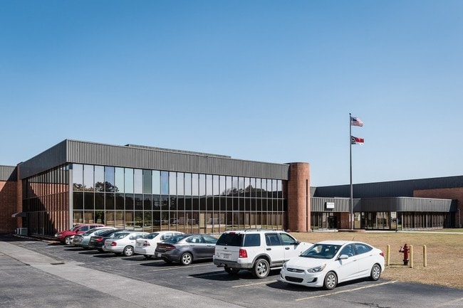
103 Tom Starling Rd
Fayetteville, NC
E. West Mountain/301 South
0424-51-5845
A F CAROLINA DIV LO:MAJ PT 1 SE:01 PL:0116-0132
Distributionwarehouseregional
Cumberland
AE
North Carolina
3720042400J
1
2025
21.10 AC
2025
East Fayetteville
003003
Fayetteville
DEMOGRAPHICS near 103 Tom Starling Rd
1 Mile
3 Mile
5 Mile
2024 Total Population
2,283
28,009
69,920
2029 Population
2,279
27,877
69,695
Pop Growth 2024-2029
(0.18%)
(0.47%)
(0.32%)
Average Age
35
36
36
2024 Total Households
839
10,319
26,461
HH Growth 2024-2029
(0.12%)
(0.47%)
(0.32%)
Median Household Inc
$69,198
$60,229
$55,786
Avg Household Size
2.70
2.70
2.60
2024 Avg HH Vehicles
2.00
2.00
2.00
Median Home Value
$161,181
$165,172
$159,321
Median Year Built
1998
1995
1991
Nearby Places
Map Layers
Map Styles
 Street
 Aerial
- Restaurants
- Banks
- Shops
- Fitness
- Groceries
PUBLIC TRANSPORTATION
COMMUTER RAIL
Fayetteville Amtrak Station (Palmetto - Amtrak, Silver Meteor - Amtrak)
DRIVE
WALK
Distance
Fayetteville Amtrak Station (Palmetto - Amtrak, Silver Meteor - Amtrak)
9 min
7.0 mi
AIRPORT
Fayetteville Regional/Grannis Field
DRIVE
WALK
Distance
Fayetteville Regional/Grannis Field
6 min
3.7 mi
Freight Ports
Port of Wilmington
DRIVE
WALK
Distance
Port of Wilmington
123 min
88.3 mi
Nearby Properties
Address
Land Use
TOTAL SIZE
Lot Size
Zoning
Address
Land Use
TOTAL SIZE
Lot Size
Zoning
1,377 SF
20.14 AC
MR5-MIXED
Address
Land Use
TOTAL SIZE
Lot Size
Zoning
4,947 SF
937.13 AC
MA
Address
Land Use
TOTAL SIZE
Lot Size
Zoning
1,117,824 SF
227 AC
MP
Address
Land Use
TOTAL SIZE
Lot Size
Zoning
56,622 SF
104.70 AC
R10
Address
Land Use
TOTAL SIZE
Lot Size
Zoning
123,423 SF
70.84 AC
A1
Address
Land Use
TOTAL SIZE
Lot Size
Zoning
14,000 SF
97.50 AC
MP
Address
Land Use
TOTAL SIZE
Lot Size
Zoning
191,495 SF
21.41 AC
CC
Address
Land Use
TOTAL SIZE
Lot Size
Zoning
500,548 SF
45.12 AC
MP
Address
Land Use
TOTAL SIZE
Lot Size
Zoning
121,079 SF
15.39 AC
CP
Address
Land Use
TOTAL SIZE
Lot Size
Zoning
7,418 SF
10 AC
OIP
Address
Land Use
TOTAL SIZE
Lot Size
Zoning
13.78 AC
M1P-LIGHT
Address
Land Use
TOTAL SIZE
Lot Size
Zoning
365,607 SF
59.08 AC
HI
Address
Land Use
TOTAL SIZE
Lot Size
Zoning
259,960 SF
31 AC
MP
Address
Land Use
TOTAL SIZE
Lot Size
Zoning
182,589 SF
39.04 AC
MP
Address
Land Use
TOTAL SIZE
Lot Size
Zoning
88,383 SF
13.30 AC
CC
Address
Land Use
TOTAL SIZE
Lot Size
Zoning
16.41 AC
MP
Address
Land Use
TOTAL SIZE
Lot Size
Zoning
9,404 SF
62.05 AC
RR
Address
Land Use
TOTAL SIZE
Lot Size
Zoning
53,351 SF
5.90 AC
CP
Address
Land Use
TOTAL SIZE
Lot Size
Zoning
35,242 SF
56.61 AC
MP
Address
Land Use
TOTAL SIZE
Lot Size
Zoning
51,180 SF
26 AC
R6
Address
Land Use
TOTAL SIZE
Lot Size
Zoning
8,754 SF
4.46 AC
R5A
Address
Land Use
TOTAL SIZE
Lot Size
Zoning
2,347 SF
7.22 AC
R5A
Address
Land Use
TOTAL SIZE
Lot Size
Zoning
1,970 SF
5.04 AC
R5A
Address
Land Use
TOTAL SIZE
Lot Size
Zoning
19,420 SF
14.04 AC
PND
Address
Land Use
TOTAL SIZE
Lot Size
Zoning
58,915 SF
18.75 AC
MP
Address
Land Use
TOTAL SIZE
Lot Size
Zoning
64,445 SF
37.03 AC
MP
Address
Land Use
TOTAL SIZE
Lot Size
Zoning
8,950 SF
1.19 AC
CP
Address
Land Use
TOTAL SIZE
Lot Size
Zoning
45,374 SF
4.71 AC
C3
Address
Land Use
TOTAL SIZE
Lot Size
Zoning
5,666 SF
5.09 AC
R6
The World's #1 Commercial Real Estate Marketplace
Connect with us
© 2026 CoStar Group
The information above has been obtained from sources believed reliable. While we do not doubt its accuracy we have not verified it and make no guarantee, warranty or representation about it. It is your responsibility to independently confirm its accuracy and completeness. Any projections, opinions, assumptions, or estimates used are for example only and do not represent the current or future performance of the property. The value of this transaction to you depends on tax and other factors which should be evaluated by your tax, financial, and legal advisors. You and your advisors should conduct a careful, independent investigation of the property to determine to your satisfaction the suitability of the property for your needs.