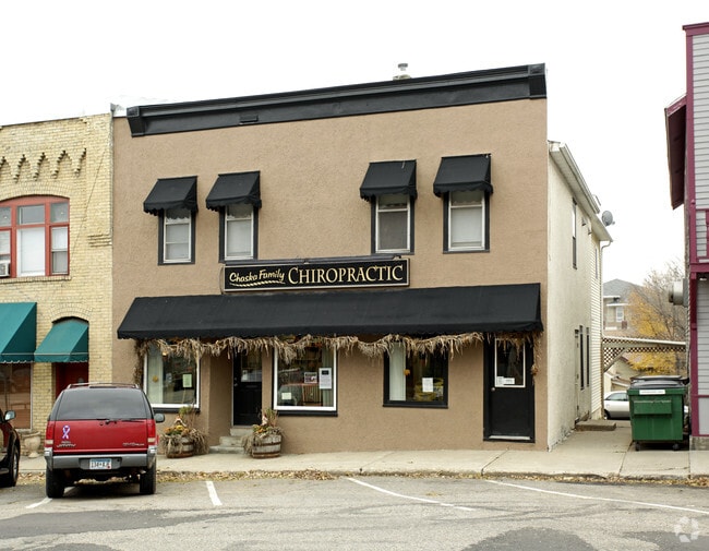
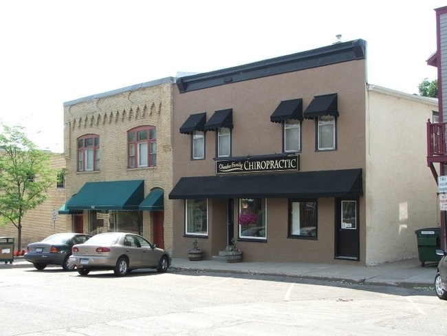
Property Record
103 W 2Nd St, Chaska, MN 55318
NEARBY LISTINGS FOR SALE OR LEASE
Property Detail
103 W 2Nd St
Minneapolis-St. Paul-Bloomington, MN-WI
City Lots Of Chaska
30.0503490
THAT PART OF LOTS 1 & 2 AND 3 & BLOCK 43 & CITY OF CHASKA & ACCORDING TO THE RECORDED PLAT
Multifamilydwelling
Carver
X
Minnesota
27019C0236D
1-2
2025
0.16 AC
2025
Eden Prairie
091002
Minneapolis/St Paul
1,824 SF
DEMOGRAPHICS near 103 W 2Nd St
1 mile
3 mile
5 mile
2024 Total Population
4,667
34,387
72,471
2029 Population
5,021
37,451
78,292
Pop Growth 2024-2029
+ 7.59%
+ 8.91%
+ 8.03%
Average Age
38
38
38
2024 Total Households
1,877
12,411
25,882
HH Growth 2024-2029
+ 7.19%
+ 8.84%
+ 8.13%
Median Household Inc
$66,968
$89,460
$94,951
Avg Household Size
2.40
2.70
2.70
2024 Avg HH Vehicles
2.00
2.00
2.00
Median Home Value
$262,433
$337,287
$357,250
Median Year Built
1985
1994
1996
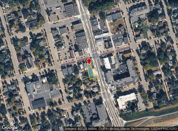
Nearby Places
Map Layers
Map Styles
 Street
 Aerial
Transit
 Traffic
 Biking
Places
Listings with unknown addresses are not visible on the map
- Restaurants
- Banks
- Shops
- Fitness
- Groceries
PUBLIC TRANSPORTATION
AIRPORT
Minneapolis-St Paul International/Wold-Chamberlain
Drive
Walk
Distance
Minneapolis-St Paul International/Wold-Chamberlain
33 min
23.7 mi
SALE & LEASE HISTORY
LISTING DATE
SALE/LEASE

Jul 10, 2018
For Sale
Nearby Properties
Address
Land Use
TOTAL SIZE
Lot Size
Zoning
Address
Land Use
TOTAL SIZE
Lot Size
Zoning
209,623 SF
72.81 AC
Address
Land Use
TOTAL SIZE
Lot Size
Zoning
20,086 SF
12.99 AC
Address
Land Use
TOTAL SIZE
Lot Size
Zoning
Address
Land Use
TOTAL SIZE
Lot Size
Zoning
44,611 SF
9.75 AC
Address
Land Use
TOTAL SIZE
Lot Size
Zoning
20,586 SF
19.34 AC
Address
Land Use
TOTAL SIZE
Lot Size
Zoning
164,809 SF
7.28 AC
Address
Land Use
TOTAL SIZE
Lot Size
Zoning
254,602 SF
18.19 AC
Address
Land Use
TOTAL SIZE
Lot Size
Zoning
57,769 SF
62.10 AC
Address
Land Use
TOTAL SIZE
Lot Size
Zoning
26.05 AC
Address
Land Use
TOTAL SIZE
Lot Size
Zoning
73,937 SF
23.89 AC
Address
Land Use
TOTAL SIZE
Lot Size
Zoning
20.18 AC
Address
Land Use
TOTAL SIZE
Lot Size
Zoning
65,038 SF
6.72 AC
Address
Land Use
TOTAL SIZE
Lot Size
Zoning
10,038 SF
12.21 AC
Address
Land Use
TOTAL SIZE
Lot Size
Zoning
18,980 SF
2.77 AC
Address
Land Use
TOTAL SIZE
Lot Size
Zoning
10.40 AC
Address
Land Use
TOTAL SIZE
Lot Size
Zoning
17.50 AC
Address
Land Use
TOTAL SIZE
Lot Size
Zoning
Address
Land Use
TOTAL SIZE
Lot Size
Zoning
20.79 AC
Address
Land Use
TOTAL SIZE
Lot Size
Zoning
33,982 SF
0.38 AC
Address
Land Use
TOTAL SIZE
Lot Size
Zoning
183,323 SF
16.30 AC
Address
Land Use
TOTAL SIZE
Lot Size
Zoning
128,456 SF
15.85 AC
Address
Land Use
TOTAL SIZE
Lot Size
Zoning
3.75 AC
Address
Land Use
TOTAL SIZE
Lot Size
Zoning
255,630 SF
27.07 AC
Address
Land Use
TOTAL SIZE
Lot Size
Zoning
59,724 SF
10.28 AC
Address
Land Use
TOTAL SIZE
Lot Size
Zoning
61,267 SF
4.59 AC
Address
Land Use
TOTAL SIZE
Lot Size
Zoning
6.32 AC
Address
Land Use
TOTAL SIZE
Lot Size
Zoning
24,768 SF
7.30 AC
Address
Land Use
TOTAL SIZE
Lot Size
Zoning
119.59 AC
I-2
Address
Land Use
TOTAL SIZE
Lot Size
Zoning
29,672 SF
7.79 AC
The World's #1 Commercial Real Estate Marketplace
Connect with us
© 2026 CoStar Group
The information above has been obtained from sources believed reliable. While we do not doubt its accuracy we have not verified it and make no guarantee, warranty or representation about it. It is your responsibility to independently confirm its accuracy and completeness. Any projections, opinions, assumptions, or estimates used are for example only and do not represent the current or future performance of the property. The value of this transaction to you depends on tax and other factors which should be evaluated by your tax, financial, and legal advisors. You and your advisors should conduct a careful, independent investigation of the property to determine to your satisfaction the suitability of the property for your needs.