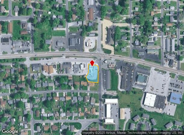
Property Record
103 W Bethalto Blvd, Bethalto, IL 62010

NEARBY LISTINGS FOR SALE OR LEASE
Property Detail
103 W Bethalto Blvd
St. Louis
Bethalto Green Acres
St. Louis, MO-IL
BETHALTO GREEN ACRES LOTS 1 & 2 171.90 X 102.50 IRREGULAR
19-2-08-12-16-403-001
Madison
Restaurantbuilding
Illinois
2024
1-2
2024
0.40 AC
401901
NE Metro Illinois
2,056 SF
DEMOGRAPHICS near 103 W Bethalto Blvd
1 Mile
3 Mile
5 Mile
2024 Total Population
5,932
19,399
42,741
2029 Population
5,859
19,158
42,233
Pop Growth 2024-2029
(1.23%)
(1.24%)
(1.19%)
Average Age
41
42
42
2024 Total Households
2,620
8,239
18,182
HH Growth 2024-2029
(1.22%)
(1.26%)
(1.23%)
Median Household Inc
$66,622
$68,525
$62,769
Avg Household Size
2.20
2.30
2.30
2024 Avg HH Vehicles
2.00
2.00
2.00
Median Home Value
$153,200
$149,866
$129,795
Median Year Built
1973
1967
1961
Nearby Places
Map Layers
Map Styles
 Street
 Aerial
- Restaurants
- Banks
- Shops
- Fitness
- Groceries
PUBLIC TRANSPORTATION
COMMUTER RAIL
Alton Amtrak Station (Lincoln Service - Amtrak, Lincoln Service Missouri River Runner - Amtrak, Texas Eagle - Amtrak)
DRIVE
WALK
Distance
Alton Amtrak Station (Lincoln Service - Amtrak, Lincoln Service Missouri River Runner - Amtrak, Texas Eagle - Amtrak)
14 min
7.5 mi
AIRPORT
St Louis Lambert International
DRIVE
WALK
Distance
St Louis Lambert International
41 min
27.7 mi
Scott AFB/Midamerica St Louis
DRIVE
WALK
Distance
Scott AFB/Midamerica St Louis
58 min
40.6 mi
Freight Ports
Port Milwaukee
DRIVE
WALK
Distance
Port Milwaukee
398 min
350.6 mi
Nearby Properties
Address
Land Use
TOTAL SIZE
Lot Size
Zoning
Address
Land Use
TOTAL SIZE
Lot Size
Zoning
215,635 SF
23.08 AC
Address
Land Use
TOTAL SIZE
Lot Size
Zoning
147,365 SF
1.91 AC
Address
Land Use
TOTAL SIZE
Lot Size
Zoning
66,140 SF
9.79 AC
Address
Land Use
TOTAL SIZE
Lot Size
Zoning
62,859 SF
12 AC
Address
Land Use
TOTAL SIZE
Lot Size
Zoning
58,900 SF
2.05 AC
Address
Land Use
TOTAL SIZE
Lot Size
Zoning
20,000 SF
10.81 AC
Address
Land Use
TOTAL SIZE
Lot Size
Zoning
55,020 SF
2.85 AC
Address
Land Use
TOTAL SIZE
Lot Size
Zoning
21,200 SF
4 AC
Address
Land Use
TOTAL SIZE
Lot Size
Zoning
17,760 SF
2.72 AC
Address
Land Use
TOTAL SIZE
Lot Size
Zoning
26,320 SF
4.82 AC
Address
Land Use
TOTAL SIZE
Lot Size
Zoning
21,614 SF
0.62 AC
Address
Land Use
TOTAL SIZE
Lot Size
Zoning
9,000 SF
13.68 AC
Address
Land Use
TOTAL SIZE
Lot Size
Zoning
111,616 SF
10 AC
Address
Land Use
TOTAL SIZE
Lot Size
Zoning
41,203 SF
Address
Land Use
TOTAL SIZE
Lot Size
Zoning
16,816 SF
2.85 AC
Address
Land Use
TOTAL SIZE
Lot Size
Zoning
19,294 SF
3.27 AC
Address
Land Use
TOTAL SIZE
Lot Size
Zoning
11,275 SF
2.39 AC
Address
Land Use
TOTAL SIZE
Lot Size
Zoning
22,044 SF
5 AC
Address
Land Use
TOTAL SIZE
Lot Size
Zoning
27,000 SF
10 AC
Address
Land Use
TOTAL SIZE
Lot Size
Zoning
8,992 SF
2 AC
Address
Land Use
TOTAL SIZE
Lot Size
Zoning
6,000 SF
5.78 AC
Address
Land Use
TOTAL SIZE
Lot Size
Zoning
24,080 SF
10.70 AC
Address
Land Use
TOTAL SIZE
Lot Size
Zoning
166.90 AC
Address
Land Use
TOTAL SIZE
Lot Size
Zoning
3,780 SF
6.63 AC
Address
Land Use
TOTAL SIZE
Lot Size
Zoning
24,148 SF
2.39 AC
Address
Land Use
TOTAL SIZE
Lot Size
Zoning
4,636 SF
0.79 AC
Address
Land Use
TOTAL SIZE
Lot Size
Zoning
3,002 SF
1.85 AC
Address
Land Use
TOTAL SIZE
Lot Size
Zoning
5,325 SF
0.69 AC
Address
Land Use
TOTAL SIZE
Lot Size
Zoning
1,307 SF
14.66 AC
Address
Land Use
TOTAL SIZE
Lot Size
Zoning
13,809 SF
1.91 AC
The World's #1 Commercial Real Estate Marketplace
Connect with us
© 2025 CoStar Group
The information above has been obtained from sources believed reliable. While we do not doubt its accuracy we have not verified it and make no guarantee, warranty or representation about it. It is your responsibility to independently confirm its accuracy and completeness. Any projections, opinions, assumptions, or estimates used are for example only and do not represent the current or future performance of the property. The value of this transaction to you depends on tax and other factors which should be evaluated by your tax, financial, and legal advisors. You and your advisors should conduct a careful, independent investigation of the property to determine to your satisfaction the suitability of the property for your needs.