Property Record
1030 Farmers Ave, Amarillo, TX 79118

Property Detail
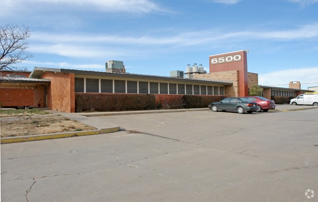
1030 Farmers Ave
R-200-1830-4300-0
SECT 183 A B & M BLK 0002, AN IRREG TR BEG 100FT W & 50FT N OF SE COR OF SECT, 9.0600 ACRES
Warehouse
RANDALL
B and X Area of moderate flood hazard, usually the area between the limits of the 100-year and 500-year floods.
Texas
2024
9.06 AC
2025
Other Market Areas
021702
Amarillo, TX
68,214 SF
NEARBY LISTINGS FOR SALE OR LEASE
DEMOGRAPHICS near 1030 Farmers Ave
1 mile
3 mile
5 mile
2025 Total Population
3,940
48,962
129,756
2030 Population
4,171
51,452
134,063
Pop Growth 2025-2030
+ 5.86%
+ 5.09%
+ 3.32%
Average Age
35
38
39
2025 Total Households
1,536
19,647
52,819
HH Growth 2025-2030
+ 6.32%
+ 5.13%
+ 3.27%
Median Household Inc
$87,007
$73,424
$69,301
Avg Household Size
2.50
2.40
2.40
2025 Avg HH Vehicles
2.00
2.00
2.00
Median Home Value
$211,583
$192,916
$216,454
Median Year Built
2008
1977
1975
Nearby Places
Map Layers
Map Styles
 Street
 Aerial
Layers
 Traffic
 Biking
Places
Listings with unknown addresses are not visible on the map
- Restaurants
- Banks
- Shops
- Fitness
- Groceries
PUBLIC TRANSPORTATION
AIRPORT
Rick Husband Amarillo International
Drive
Walk
Distance
Rick Husband Amarillo International
21 min
14.9 mi
Freight Ports
Tulsa Port Of Catoosa
Drive
Walk
Distance
Tulsa Port Of Catoosa
403 min
382.9 mi
Nearby Properties
Address
Land Use
TOTAL SIZE
Lot Size
Zoning
Address
Land Use
TOTAL SIZE
Lot Size
Zoning
362,796 SF
49.98 AC
A
Address
Land Use
TOTAL SIZE
Lot Size
Zoning
228,223 SF
20.83 AC
Address
Land Use
TOTAL SIZE
Lot Size
Zoning
112,261 SF
21.82 AC
Address
Land Use
TOTAL SIZE
Lot Size
Zoning
182,242 SF
20.70 AC
Address
Land Use
TOTAL SIZE
Lot Size
Zoning
210,217 SF
10.49 AC
M11
Address
Land Use
TOTAL SIZE
Lot Size
Zoning
74,960 SF
7 AC
R2
Address
Land Use
TOTAL SIZE
Lot Size
Zoning
204,468 SF
17.56 AC
Address
Land Use
TOTAL SIZE
Lot Size
Zoning
80,298 SF
7.75 AC
Address
Land Use
TOTAL SIZE
Lot Size
Zoning
167,257 SF
12.66 AC
Address
Land Use
TOTAL SIZE
Lot Size
Zoning
183,758 SF
16.74 AC
R2
Address
Land Use
TOTAL SIZE
Lot Size
Zoning
185,895 SF
9.59 AC
Address
Land Use
TOTAL SIZE
Lot Size
Zoning
172,531 SF
10.37 AC
LC
Address
Land Use
TOTAL SIZE
Lot Size
Zoning
297,246 SF
13.91 AC
MF1
Address
Land Use
TOTAL SIZE
Lot Size
Zoning
217,018 SF
20.82 AC
LC
Address
Land Use
TOTAL SIZE
Lot Size
Zoning
92,058 SF
6.89 AC
PD
Address
Land Use
TOTAL SIZE
Lot Size
Zoning
135,251 SF
6.99 AC
MF1
Address
Land Use
TOTAL SIZE
Lot Size
Zoning
694,915 SF
27.22 AC
Address
Land Use
TOTAL SIZE
Lot Size
Zoning
52,207 SF
7.41 AC
R2
Address
Land Use
TOTAL SIZE
Lot Size
Zoning
128,588 SF
23.53 AC
R3
Address
Land Use
TOTAL SIZE
Lot Size
Zoning
266,594 SF
15.39 AC
Address
Land Use
TOTAL SIZE
Lot Size
Zoning
68,970 SF
5.77 AC
MF1
Address
Land Use
TOTAL SIZE
Lot Size
Zoning
40,845 SF
4.59 AC
GR
Address
Land Use
TOTAL SIZE
Lot Size
Zoning
663,313 SF
149.32 AC
Address
Land Use
TOTAL SIZE
Lot Size
Zoning
76,182 SF
42.19 AC
Address
Land Use
TOTAL SIZE
Lot Size
Zoning
42,332 SF
7.44 AC
Address
Land Use
TOTAL SIZE
Lot Size
Zoning
164,266 SF
5.58 AC
PD
Address
Land Use
TOTAL SIZE
Lot Size
Zoning
55,028 SF
8.89 AC
Address
Land Use
TOTAL SIZE
Lot Size
Zoning
97,796 SF
4 AC
Address
Land Use
TOTAL SIZE
Lot Size
Zoning
63,893 SF
5.48 AC
GR
The World's #1 Commercial Real Estate Marketplace
Connect with us
© 2026 CoStar Group
The information above has been obtained from sources believed reliable. While we do not doubt its accuracy we have not verified it and make no guarantee, warranty or representation about it. It is your responsibility to independently confirm its accuracy and completeness. Any projections, opinions, assumptions, or estimates used are for example only and do not represent the current or future performance of the property. The value of this transaction to you depends on tax and other factors which should be evaluated by your tax, financial, and legal advisors. You and your advisors should conduct a careful, independent investigation of the property to determine to your satisfaction the suitability of the property for your needs.