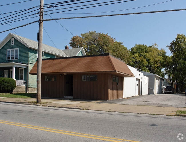
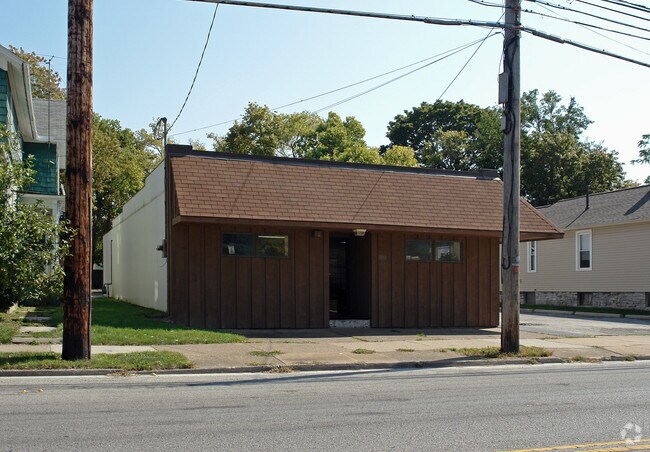
Property Record
1030 Hayes Ave, Sandusky, OH 44870
NEARBY LISTINGS FOR SALE OR LEASE
Property Detail
1030 Hayes Ave
Sandusky, OH
Cooke Flynn And Merrys Subdivision
57-04721-000
LOT 38 WH & PT 36 COOKE FLYNN & MERRY SUB E SIDE OF HAYES .1964A
Parkingstructure
Erie
X
Ohio
39043C0079E
38&36
2024
0.20 AC
2024
Erie County
041100
Cleveland
1,980 SF
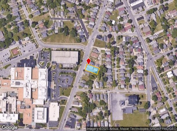
DEMOGRAPHICS near 1030 Hayes Ave
1 Mile
3 Mile
5 Mile
2024 Total Population
15,669
29,826
39,753
2029 Population
15,449
29,322
39,072
Pop Growth 2024-2029
(1.40%)
(1.69%)
(1.71%)
Average Age
39
41
42
2024 Total Households
6,784
12,648
17,056
HH Growth 2024-2029
(1.44%)
(1.76%)
(1.79%)
Median Household Inc
$37,511
$42,057
$47,237
Avg Household Size
2.20
2.20
2.20
2024 Avg HH Vehicles
2.00
2.00
2.00
Median Home Value
$78,324
$113,114
$141,741
Median Year Built
1948
1955
1960
Nearby Places
Map Layers
Map Styles
 Street
 Aerial
- Restaurants
- Banks
- Shops
- Fitness
- Groceries
PUBLIC TRANSPORTATION
COMMUTER RAIL
DRIVE
WALK
Distance
2 min
15 min
0.8 mi
Freight Ports
DRIVE
WALK
Distance
78 min
59.9 mi
SALE & LEASE HISTORY
LISTING DATE
SALE/LEASE

Mar 29, 2023
For Sale
Nearby Properties
Address
Land Use
TOTAL SIZE
Lot Size
Zoning
Address
Land Use
TOTAL SIZE
Lot Size
Zoning
66,569 SF
10.32 AC
Address
Land Use
TOTAL SIZE
Lot Size
Zoning
9,764 SF
14.87 AC
Address
Land Use
TOTAL SIZE
Lot Size
Zoning
1,085 SF
89.97 AC
Address
Land Use
TOTAL SIZE
Lot Size
Zoning
163,634 SF
30.71 AC
Address
Land Use
TOTAL SIZE
Lot Size
Zoning
50,397 SF
15.32 AC
Address
Land Use
TOTAL SIZE
Lot Size
Zoning
4,635 SF
84.11 AC
Address
Land Use
TOTAL SIZE
Lot Size
Zoning
19,208 SF
17.59 AC
Address
Land Use
TOTAL SIZE
Lot Size
Zoning
231,326 SF
128.66 AC
Address
Land Use
TOTAL SIZE
Lot Size
Zoning
131,774 SF
15.18 AC
Address
Land Use
TOTAL SIZE
Lot Size
Zoning
56,460 SF
4.53 AC
Address
Land Use
TOTAL SIZE
Lot Size
Zoning
101,567 SF
10.01 AC
Address
Land Use
TOTAL SIZE
Lot Size
Zoning
208,192 SF
24.39 AC
Address
Land Use
TOTAL SIZE
Lot Size
Zoning
26,358 SF
59.54 AC
Address
Land Use
TOTAL SIZE
Lot Size
Zoning
456,985 SF
65.44 AC
Address
Land Use
TOTAL SIZE
Lot Size
Zoning
40 SF
139.37 AC
Address
Land Use
TOTAL SIZE
Lot Size
Zoning
17.56 AC
Address
Land Use
TOTAL SIZE
Lot Size
Zoning
109,181 SF
8.89 AC
Address
Land Use
TOTAL SIZE
Lot Size
Zoning
29,143 SF
13.73 AC
Address
Land Use
TOTAL SIZE
Lot Size
Zoning
3,623 SF
104.58 AC
Address
Land Use
TOTAL SIZE
Lot Size
Zoning
14,600 SF
1.98 AC
Address
Land Use
TOTAL SIZE
Lot Size
Zoning
46,295 SF
4.31 AC
Address
Land Use
TOTAL SIZE
Lot Size
Zoning
160,380 SF
15.76 AC
Address
Land Use
TOTAL SIZE
Lot Size
Zoning
3,936 SF
26.04 AC
Address
Land Use
TOTAL SIZE
Lot Size
Zoning
66,923 SF
43.99 AC
Address
Land Use
TOTAL SIZE
Lot Size
Zoning
68,204 SF
5.36 AC
Address
Land Use
TOTAL SIZE
Lot Size
Zoning
26,644 SF
0.16 AC
Address
Land Use
TOTAL SIZE
Lot Size
Zoning
36,400 SF
3.87 AC
Address
Land Use
TOTAL SIZE
Lot Size
Zoning
3,379 SF
0.15 AC
Address
Land Use
TOTAL SIZE
Lot Size
Zoning
41,105 SF
2.65 AC
Address
Land Use
TOTAL SIZE
Lot Size
Zoning
61,254 SF
9.88 AC
The World's #1 Commercial Real Estate Marketplace
Connect with us
© 2025 CoStar Group
The information above has been obtained from sources believed reliable. While we do not doubt its accuracy we have not verified it and make no guarantee, warranty or representation about it. It is your responsibility to independently confirm its accuracy and completeness. Any projections, opinions, assumptions, or estimates used are for example only and do not represent the current or future performance of the property. The value of this transaction to you depends on tax and other factors which should be evaluated by your tax, financial, and legal advisors. You and your advisors should conduct a careful, independent investigation of the property to determine to your satisfaction the suitability of the property for your needs.