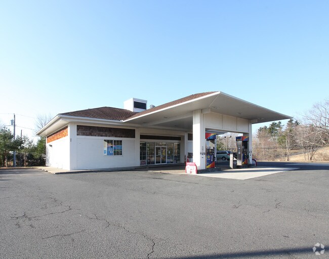
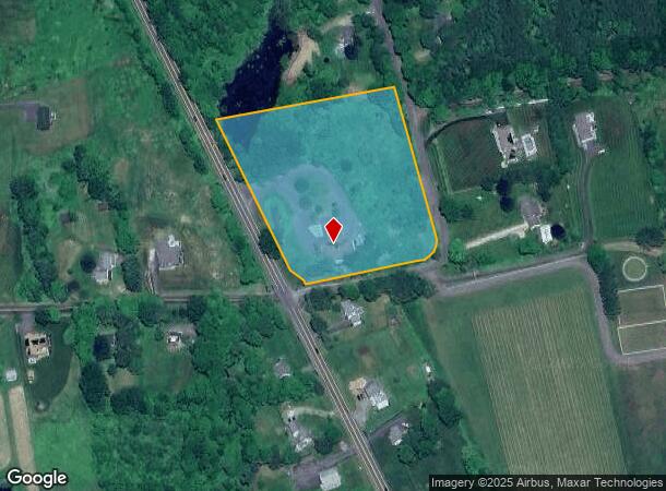
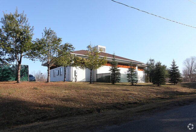
Property Record
1030 Litchfield Rd, Watertown, CT 06795
NEARBY LISTINGS FOR SALE OR LEASE
Property Detail
1030 Litchfield Rd
Torrington, CT
Litchfield
WATE-000045-000029-000006
Connecticut
Servicestation
6
2025
4.40 AC
2025
SE Litchfield County
360200
Hartford
2,992 SF
DEMOGRAPHICS near 1030 Litchfield Rd
1 Mile
3 Mile
5 Mile
2024 Total Population
1,405
12,120
39,443
2029 Population
1,399
12,046
39,250
Pop Growth 2024-2029
(0.43%)
(0.61%)
(0.49%)
Average Age
44
44
43
2024 Total Households
512
4,736
15,809
HH Growth 2024-2029
(0.59%)
(0.61%)
(0.49%)
Median Household Inc
$111,301
$88,564
$83,928
Avg Household Size
2.70
2.50
2.40
2024 Avg HH Vehicles
2.00
2.00
2.00
Median Home Value
$344,244
$297,728
$276,739
Median Year Built
1978
1971
1968
Nearby Places
- Restaurants
- Banks
- Shops
- Fitness
- Groceries
PUBLIC TRANSPORTATION
COMMUTER RAIL
Waterbury Station (New Haven Line - Metro-North Commuter Railroad Company (Metro-North))
DRIVE
WALK
Distance
Waterbury Station (New Haven Line - Metro-North Commuter Railroad Company (Metro-North))
15 min
8.5 mi
AIRPORT
Tweed/New Haven
DRIVE
WALK
Distance
Tweed/New Haven
56 min
35.6 mi
Freight Ports
Port of New Haven
DRIVE
WALK
Distance
Port of New Haven
51 min
32.8 mi
Nearby Properties
Address
Land Use
TOTAL SIZE
Lot Size
Zoning
Address
Land Use
TOTAL SIZE
Lot Size
Zoning
75 AC
R20
Address
Land Use
TOTAL SIZE
Lot Size
Zoning
65,974 SF
20.70 AC
RA15
Address
Land Use
TOTAL SIZE
Lot Size
Zoning
72,336 SF
15.39 AC
R30
Address
Land Use
TOTAL SIZE
Lot Size
Zoning
70.40 AC
R70
Address
Land Use
TOTAL SIZE
Lot Size
Zoning
326,357 SF
53.34 AC
IR200
Address
Land Use
TOTAL SIZE
Lot Size
Zoning
1,154 SF
435 AC
R90
Address
Land Use
TOTAL SIZE
Lot Size
Zoning
182,765 SF
9.08 AC
IG20F
Address
Land Use
TOTAL SIZE
Lot Size
Zoning
128,480 SF
19.91 AC
IR200
Address
Land Use
TOTAL SIZE
Lot Size
Zoning
132,377 SF
11.91 AC
IG20
Address
Land Use
TOTAL SIZE
Lot Size
Zoning
125,770 SF
19 AC
IR200
Address
Land Use
TOTAL SIZE
Lot Size
Zoning
19,508 SF
2.10 AC
BC
Address
Land Use
TOTAL SIZE
Lot Size
Zoning
96,721 SF
7.08 AC
IR200
Address
Land Use
TOTAL SIZE
Lot Size
Zoning
6.94 AC
R30
Address
Land Use
TOTAL SIZE
Lot Size
Zoning
2.22 AC
BC
Address
Land Use
TOTAL SIZE
Lot Size
Zoning
16 AC
R70
Address
Land Use
TOTAL SIZE
Lot Size
Zoning
28,808 SF
8.70 AC
R10
Address
Land Use
TOTAL SIZE
Lot Size
Zoning
25,326 SF
10.02 AC
BMG
Address
Land Use
TOTAL SIZE
Lot Size
Zoning
81,029 SF
20 AC
IR200
Address
Land Use
TOTAL SIZE
Lot Size
Zoning
12,432 SF
20.25 AC
RG
Address
Land Use
TOTAL SIZE
Lot Size
Zoning
52,241 SF
10.31 AC
IR200
Address
Land Use
TOTAL SIZE
Lot Size
Zoning
5.13 AC
IR200
Address
Land Use
TOTAL SIZE
Lot Size
Zoning
3.34 AC
IG20
Address
Land Use
TOTAL SIZE
Lot Size
Zoning
157.47 AC
R90
Address
Land Use
TOTAL SIZE
Lot Size
Zoning
2.70 AC
R10
Address
Land Use
TOTAL SIZE
Lot Size
Zoning
2.98 AC
R10F
Address
Land Use
TOTAL SIZE
Lot Size
Zoning
64.26 AC
RG
Address
Land Use
TOTAL SIZE
Lot Size
Zoning
7.70 AC
R30
Address
Land Use
TOTAL SIZE
Lot Size
Zoning
9.50 AC
IR200
Address
Land Use
TOTAL SIZE
Lot Size
Zoning
4.08 AC
RA15
Address
Land Use
TOTAL SIZE
Lot Size
Zoning
37,416 SF
6.60 AC
IR200
The World's #1 Commercial Real Estate Marketplace
Connect with us
© 2025 CoStar Group
The information above has been obtained from sources believed reliable. While we do not doubt its accuracy we have not verified it and make no guarantee, warranty or representation about it. It is your responsibility to independently confirm its accuracy and completeness. Any projections, opinions, assumptions, or estimates used are for example only and do not represent the current or future performance of the property. The value of this transaction to you depends on tax and other factors which should be evaluated by your tax, financial, and legal advisors. You and your advisors should conduct a careful, independent investigation of the property to determine to your satisfaction the suitability of the property for your needs.