Property Record
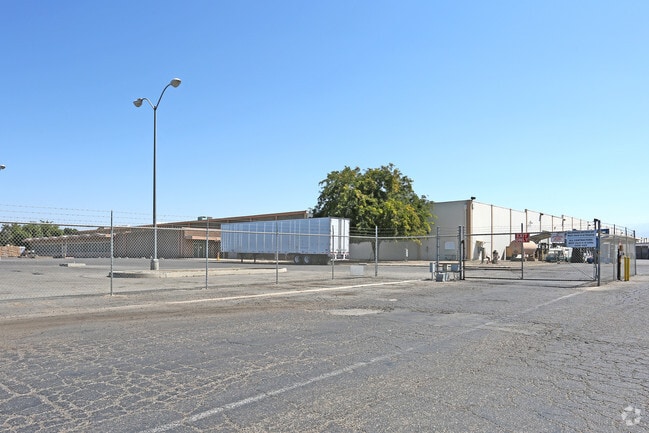
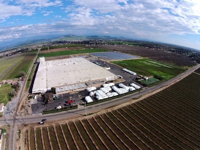
1030 N Anderson Rd, Exeter, CA 93221

Property Detail
1030 N Anderson Rd
133-060-062-000
PARCEL 1 PARCEL MAP NO 4932 PM 50-37
Lightindustrial
Tulare
M1
California
B and X Area of moderate flood hazard, usually the area between the limits of the 100-year and 500-year floods.
1
2025
20.65 AC
2025
Farmersvle/Exeter/Lindsay
001501
Visalia/Porterville
345,600 SF
Visalia, CA
NEARBY LISTINGS FOR SALE OR LEASE
DEMOGRAPHICS near 1030 N Anderson Rd
1 mile
3 mile
5 mile
2025 Total Population
2,264
24,273
36,358
2030 Population
2,286
24,640
37,024
Pop Growth 2025-2030
+ 0.97%
+ 1.51%
+ 1.83%
Average Age
38
36
36
2025 Total Households
762
7,380
11,118
HH Growth 2025-2030
+ 0.92%
+ 1.45%
+ 1.74%
Median Household Inc
$100,202
$67,700
$80,415
Avg Household Size
3.00
3.30
3.20
2025 Avg HH Vehicles
2.00
2.00
2.00
Median Home Value
$335,204
$301,974
$343,989
Median Year Built
1994
1981
1987
Nearby Places
Map Layers
Map Styles
 Street
 Aerial
Layers
 Traffic
 Biking
Places
Listings with unknown addresses are not visible on the map
- Restaurants
- Banks
- Shops
- Fitness
- Groceries
Nearby Properties
Address
Land Use
TOTAL SIZE
Lot Size
Zoning
Address
Land Use
TOTAL SIZE
Lot Size
Zoning
12.40 AC
Address
Land Use
TOTAL SIZE
Lot Size
Zoning
3.45 AC
RM
Address
Land Use
TOTAL SIZE
Lot Size
Zoning
57,025 SF
3.22 AC
GC
Address
Land Use
TOTAL SIZE
Lot Size
Zoning
6,800 SF
2.08 AC
Address
Land Use
TOTAL SIZE
Lot Size
Zoning
31,487 SF
4.87 AC
CG
Address
Land Use
TOTAL SIZE
Lot Size
Zoning
236,140 SF
23.39 AC
Address
Land Use
TOTAL SIZE
Lot Size
Zoning
3,451 SF
1.63 AC
CN
Address
Land Use
TOTAL SIZE
Lot Size
Zoning
57,948 SF
25.17 AC
AE20
Address
Land Use
TOTAL SIZE
Lot Size
Zoning
2.08 AC
Address
Land Use
TOTAL SIZE
Lot Size
Zoning
52,813 SF
3.73 AC
Address
Land Use
TOTAL SIZE
Lot Size
Zoning
24,823 SF
2.64 AC
CN
Address
Land Use
TOTAL SIZE
Lot Size
Zoning
8.38 AC
Address
Land Use
TOTAL SIZE
Lot Size
Zoning
30,592 SF
3.73 AC
ML
Address
Land Use
TOTAL SIZE
Lot Size
Zoning
52,890 SF
1.84 AC
ML
Address
Land Use
TOTAL SIZE
Lot Size
Zoning
29,580 SF
0.64 AC
CN
Address
Land Use
TOTAL SIZE
Lot Size
Zoning
12,770 SF
1.62 AC
CS
Address
Land Use
TOTAL SIZE
Lot Size
Zoning
49,105 SF
2.44 AC
ML
Address
Land Use
TOTAL SIZE
Lot Size
Zoning
44,449 SF
3.19 AC
RM-3
Address
Land Use
TOTAL SIZE
Lot Size
Zoning
6.25 AC
Address
Land Use
TOTAL SIZE
Lot Size
Zoning
3,216 SF
0.44 AC
HC
Address
Land Use
TOTAL SIZE
Lot Size
Zoning
37,760 SF
2.01 AC
Address
Land Use
TOTAL SIZE
Lot Size
Zoning
4.65 AC
Address
Land Use
TOTAL SIZE
Lot Size
Zoning
80.31 AC
A1
Address
Land Use
TOTAL SIZE
Lot Size
Zoning
56,060 SF
3.64 AC
Address
Land Use
TOTAL SIZE
Lot Size
Zoning
17,156 SF
0.72 AC
PF
Address
Land Use
TOTAL SIZE
Lot Size
Zoning
29,392 SF
3 AC
Address
Land Use
TOTAL SIZE
Lot Size
Zoning
Address
Land Use
TOTAL SIZE
Lot Size
Zoning
2,696 SF
0.72 AC
CG
The World's #1 Commercial Real Estate Marketplace
Connect with us
© 2026 CoStar Group
The information above has been obtained from sources believed reliable. While we do not doubt its accuracy we have not verified it and make no guarantee, warranty or representation about it. It is your responsibility to independently confirm its accuracy and completeness. Any projections, opinions, assumptions, or estimates used are for example only and do not represent the current or future performance of the property. The value of this transaction to you depends on tax and other factors which should be evaluated by your tax, financial, and legal advisors. You and your advisors should conduct a careful, independent investigation of the property to determine to your satisfaction the suitability of the property for your needs.