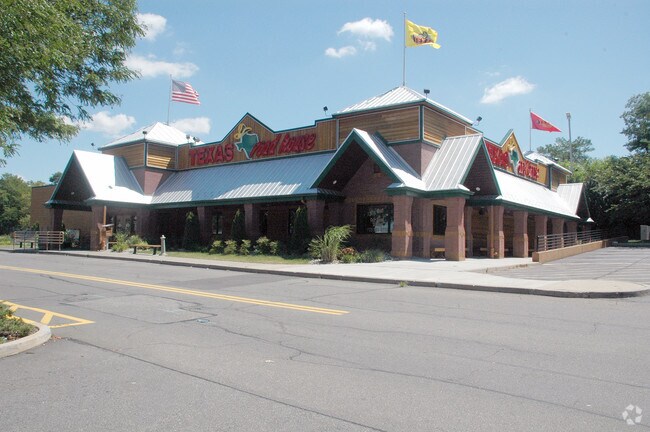
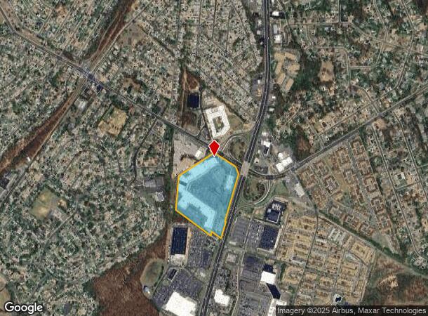
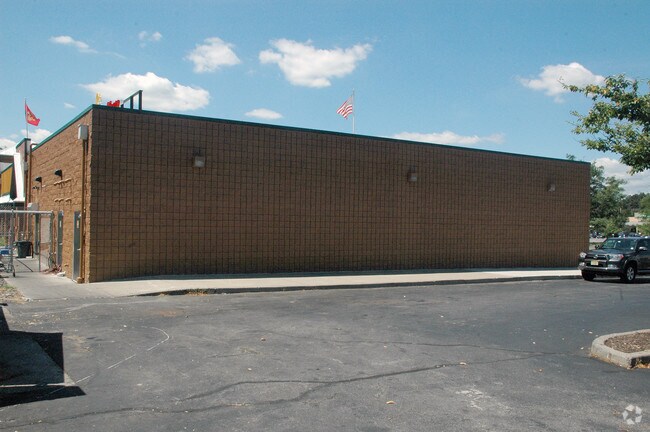
Property Record
1030 Us Highway 9, Parlin, NJ 08859
NEARBY LISTINGS FOR SALE OR LEASE
Property Detail
1030 Us Highway 9
15-05000-0000-00003
22.815AC
Regionalshoppingcenterormallwithanchorstore
Middlesex
X
New Jersey
34023C0158F
3
2024
22.82 AC
2025
South Edison
007905
Northern New Jersey
7,905 SF
Lakewood-New Brunswick, NJ
DEMOGRAPHICS near 1030 Us Highway 9
1 Mile
3 Mile
5 Mile
2024 Total Population
18,967
63,833
203,413
2029 Population
18,825
63,493
200,920
Pop Growth 2024-2029
(0.75%)
(0.53%)
(1.23%)
Average Age
40
42
40
2024 Total Households
7,087
24,679
73,467
HH Growth 2024-2029
(0.82%)
(0.60%)
(1.18%)
Median Household Inc
$84,288
$92,126
$89,185
Avg Household Size
2.70
2.50
2.70
2024 Avg HH Vehicles
2.00
2.00
2.00
Median Home Value
$372,759
$358,725
$383,016
Median Year Built
1967
1968
1967
Nearby Places
Map Layers
Map Styles
 Street
 Aerial
- Restaurants
- Banks
- Shops
- Fitness
- Groceries
PUBLIC TRANSPORTATION
COMMUTER RAIL
South Amboy (North Jersey Coast Line - NJ Transit Commuter Rail (NJ Transit))
DRIVE
WALK
Distance
South Amboy (North Jersey Coast Line - NJ Transit Commuter Rail (NJ Transit))
7 min
3.3 mi
Perth Amboy (North Jersey Coast Line - NJ Transit Commuter Rail (NJ Transit))
DRIVE
WALK
Distance
Perth Amboy (North Jersey Coast Line - NJ Transit Commuter Rail (NJ Transit))
9 min
5.9 mi
AIRPORT
Newark Liberty International
DRIVE
WALK
Distance
Newark Liberty International
33 min
26.7 mi
Trenton Mercer
DRIVE
WALK
Distance
Trenton Mercer
59 min
43.0 mi
Freight Ports
New York Container Terminal
DRIVE
WALK
Distance
New York Container Terminal
26 min
18.9 mi
Nearby Properties
Address
Land Use
TOTAL SIZE
Lot Size
Zoning
Address
Land Use
TOTAL SIZE
Lot Size
Zoning
1,889 SF
235.62 AC
Address
Land Use
TOTAL SIZE
Lot Size
Zoning
0.28 AC
CBD
Address
Land Use
TOTAL SIZE
Lot Size
Zoning
Address
Land Use
TOTAL SIZE
Lot Size
Zoning
2.14 AC
C-4
Address
Land Use
TOTAL SIZE
Lot Size
Zoning
Address
Land Use
TOTAL SIZE
Lot Size
Zoning
Address
Land Use
TOTAL SIZE
Lot Size
Zoning
726 SF
75.46 AC
P
Address
Land Use
TOTAL SIZE
Lot Size
Zoning
7,904 SF
60 AC
AF
Address
Land Use
TOTAL SIZE
Lot Size
Zoning
Address
Land Use
TOTAL SIZE
Lot Size
Zoning
31.22 AC
G1
Address
Land Use
TOTAL SIZE
Lot Size
Zoning
1.58 AC
Address
Land Use
TOTAL SIZE
Lot Size
Zoning
3.29 AC
M1
Address
Land Use
TOTAL SIZE
Lot Size
Zoning
7,904 SF
38.30 AC
AF
Address
Land Use
TOTAL SIZE
Lot Size
Zoning
136,121 SF
12.84 AC
RB
Address
Land Use
TOTAL SIZE
Lot Size
Zoning
329.22 AC
I
Address
Land Use
TOTAL SIZE
Lot Size
Zoning
Address
Land Use
TOTAL SIZE
Lot Size
Zoning
7,905 SF
26.55 AC
CC
Address
Land Use
TOTAL SIZE
Lot Size
Zoning
Address
Land Use
TOTAL SIZE
Lot Size
Zoning
169.71 AC
I
Address
Land Use
TOTAL SIZE
Lot Size
Zoning
7,904 SF
30 AC
AF
Address
Land Use
TOTAL SIZE
Lot Size
Zoning
19.97 AC
P
Address
Land Use
TOTAL SIZE
Lot Size
Zoning
7,904 SF
69.62 AC
AF
Address
Land Use
TOTAL SIZE
Lot Size
Zoning
95.75 AC
I
Address
Land Use
TOTAL SIZE
Lot Size
Zoning
8,000 SF
312.58 AC
ER
Address
Land Use
TOTAL SIZE
Lot Size
Zoning
775 SF
26.95 AC
RAWDI
Address
Land Use
TOTAL SIZE
Lot Size
Zoning
3,850 SF
22.94 AC
G1
Address
Land Use
TOTAL SIZE
Lot Size
Zoning
0.20 AC
Address
Land Use
TOTAL SIZE
Lot Size
Zoning
Address
Land Use
TOTAL SIZE
Lot Size
Zoning
47.57 AC
SED
The World's #1 Commercial Real Estate Marketplace
Connect with us
© 2026 CoStar Group
The information above has been obtained from sources believed reliable. While we do not doubt its accuracy we have not verified it and make no guarantee, warranty or representation about it. It is your responsibility to independently confirm its accuracy and completeness. Any projections, opinions, assumptions, or estimates used are for example only and do not represent the current or future performance of the property. The value of this transaction to you depends on tax and other factors which should be evaluated by your tax, financial, and legal advisors. You and your advisors should conduct a careful, independent investigation of the property to determine to your satisfaction the suitability of the property for your needs.