Property Record
10301 Busch Dr N, Jacksonville, FL 32218

NEARBY LISTINGS FOR SALE OR LEASE
Property Detail
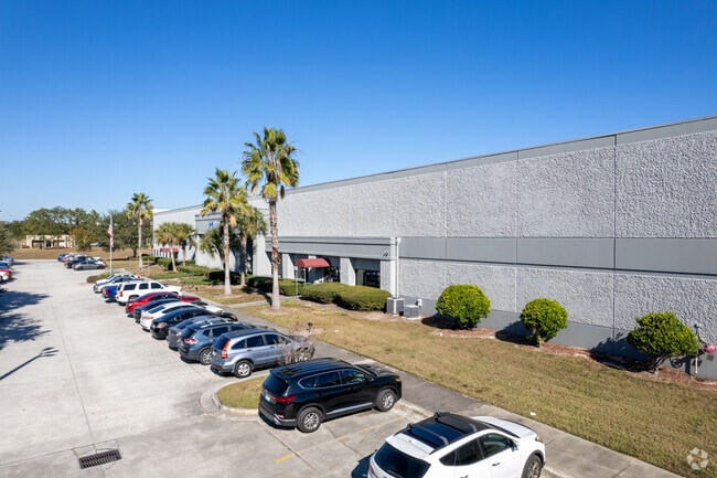
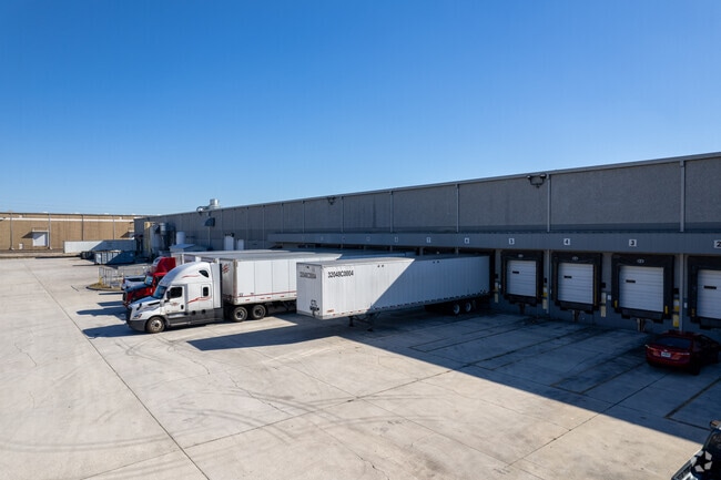
10301 Busch Dr N
108764-0620
Section Land
Lightindustrial
18-1S-27E 13.055 PT RECD O/R 21257-439
X
Duval
12031C0192J
Florida
2025
13.78 AC
2026
Ocean Way
010202
Jacksonville (Florida)
221,498 SF
Jacksonville, FL
DEMOGRAPHICS near 10301 Busch Dr N
1 Mile
3 Mile
5 Mile
2024 Total Population
564
30,285
120,293
2029 Population
586
31,848
127,101
Pop Growth 2024-2029
+ 3.90%
+ 5.16%
+ 5.66%
Average Age
39
38
38
2024 Total Households
202
11,916
46,396
HH Growth 2024-2029
+ 3.96%
+ 5.36%
+ 5.82%
Median Household Inc
$92,692
$51,568
$47,143
Avg Household Size
2.80
2.50
2.50
2024 Avg HH Vehicles
2.00
2.00
2.00
Median Home Value
$262,790
$181,468
$189,579
Median Year Built
2002
1977
1979
Nearby Places
Map Layers
Map Styles
 Street
 Aerial
- Restaurants
- Banks
- Shops
- Fitness
- Groceries
PUBLIC TRANSPORTATION
COMMUTER RAIL
DRIVE
WALK
Distance
17 min
7.9 mi
AIRPORT
Jacksonville International
DRIVE
WALK
Distance
Jacksonville International
17 min
8.4 mi
Nearby Properties
Address
Land Use
TOTAL SIZE
Lot Size
Zoning
Address
Land Use
TOTAL SIZE
Lot Size
Zoning
1,064,086 SF
87.81 AC
IL
Address
Land Use
TOTAL SIZE
Lot Size
Zoning
1,009,974 SF
62.96 AC
PUD
Address
Land Use
TOTAL SIZE
Lot Size
Zoning
336,852 SF
32.69 AC
IL
Address
Land Use
TOTAL SIZE
Lot Size
Zoning
1,170,252 SF
201.15 AC
IH
Address
Land Use
TOTAL SIZE
Lot Size
Zoning
823,286 SF
53.36 AC
IL
Address
Land Use
TOTAL SIZE
Lot Size
Zoning
1,678,675 SF
73.48 AC
IL
Address
Land Use
TOTAL SIZE
Lot Size
Zoning
403,103 SF
31.05 AC
PUD
Address
Land Use
TOTAL SIZE
Lot Size
Zoning
625,900 SF
49.80 AC
IBP
Address
Land Use
TOTAL SIZE
Lot Size
Zoning
588,053 SF
33.10 AC
PUD
Address
Land Use
TOTAL SIZE
Lot Size
Zoning
556,862 SF
27.25 AC
IL
Address
Land Use
TOTAL SIZE
Lot Size
Zoning
556,016 SF
25.95 AC
IH
Address
Land Use
TOTAL SIZE
Lot Size
Zoning
477,945 SF
31.03 AC
CCG-2
Address
Land Use
TOTAL SIZE
Lot Size
Zoning
740,260 SF
59.11 AC
IL
Address
Land Use
TOTAL SIZE
Lot Size
Zoning
428,690 SF
29.57 AC
IL
Address
Land Use
TOTAL SIZE
Lot Size
Zoning
408,384 SF
23.77 AC
IL
Address
Land Use
TOTAL SIZE
Lot Size
Zoning
321,938 SF
29.46 AC
CCG-1
Address
Land Use
TOTAL SIZE
Lot Size
Zoning
841,077 SF
241.17 AC
PUD
Address
Land Use
TOTAL SIZE
Lot Size
Zoning
313,741 SF
37.05 AC
RMD-C
Address
Land Use
TOTAL SIZE
Lot Size
Zoning
478,803 SF
24.43 AC
IL
Address
Land Use
TOTAL SIZE
Lot Size
Zoning
170,638 SF
10.77 AC
PUD
Address
Land Use
TOTAL SIZE
Lot Size
Zoning
210,520 SF
34.87 AC
PUD
Address
Land Use
TOTAL SIZE
Lot Size
Zoning
303,200 SF
17.47 AC
IL
Address
Land Use
TOTAL SIZE
Lot Size
Zoning
274,834 SF
17.84 AC
IW
Address
Land Use
TOTAL SIZE
Lot Size
Zoning
282,099 SF
14.53 AC
IL
Address
Land Use
TOTAL SIZE
Lot Size
Zoning
283,689 SF
21.28 AC
RLD-60
Address
Land Use
TOTAL SIZE
Lot Size
Zoning
269,278 SF
18.95 AC
IL
Address
Land Use
TOTAL SIZE
Lot Size
Zoning
237,480 SF
19.61 AC
PUD
Address
Land Use
TOTAL SIZE
Lot Size
Zoning
119,362 SF
20.32 AC
RMD-C
Address
Land Use
TOTAL SIZE
Lot Size
Zoning
321,852 SF
14.82 AC
IL
The World's #1 Commercial Real Estate Marketplace
Connect with us
© 2025 CoStar Group
The information above has been obtained from sources believed reliable. While we do not doubt its accuracy we have not verified it and make no guarantee, warranty or representation about it. It is your responsibility to independently confirm its accuracy and completeness. Any projections, opinions, assumptions, or estimates used are for example only and do not represent the current or future performance of the property. The value of this transaction to you depends on tax and other factors which should be evaluated by your tax, financial, and legal advisors. You and your advisors should conduct a careful, independent investigation of the property to determine to your satisfaction the suitability of the property for your needs.