Property Record
10305 Chapel Hill Blvd, Pasco, WA 99301


NEARBY LISTINGS FOR SALE OR LEASE
Property Detail
10305 Chapel Hill Blvd
Kennewick-Richland, WA
PTN SE4 7-9-29 LY SLY OF STATE HWY I-182 DAF: COMM AT SE COR SD SEC, SD PT BEARS N02D21E, 2583.78 FROM E4 COR SEC 18; TH N89D47W, 50.04; TH N89D47W ALG SD SEC LN 1262.2 TO FR CO IRRIG CANAL CTRLN TH N56D20W ALG SD CTRLN, 54.41; TH S89D47E AL
115-350-011
Franklin
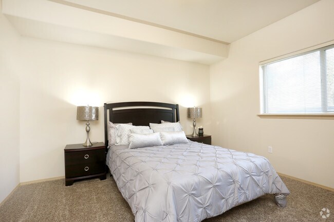
Multifamilydwelling
Washington
2025
20
2025
14.99 AC
020501
Yakima/Kennewick
4,887 SF
Other Market Areas
DEMOGRAPHICS near 10305 Chapel Hill Blvd
1 Mile
3 Mile
5 Mile
2024 Total Population
6,938
46,571
139,710
2029 Population
7,531
50,666
150,652
Pop Growth 2024-2029
+ 8.55%
+ 8.79%
+ 7.83%
Average Age
35
35
37
2024 Total Households
2,363
16,296
51,527
HH Growth 2024-2029
+ 8.46%
+ 8.80%
+ 7.78%
Median Household Inc
$99,667
$89,039
$86,984
Avg Household Size
2.90
2.80
2.70
2024 Avg HH Vehicles
2.00
2.00
2.00
Median Home Value
$325,735
$333,911
$340,715
Median Year Built
2005
2002
1994
Nearby Places
Map Layers
Map Styles
 Street
 Aerial
- Restaurants
- Banks
- Shops
- Fitness
- Groceries
PUBLIC TRANSPORTATION
COMMUTER RAIL
Pasco Amtrak Station (Empire Builder - Amtrak)
DRIVE
WALK
Distance
Pasco Amtrak Station (Empire Builder - Amtrak)
12 min
8.0 mi
AIRPORT
Tri-Cities
DRIVE
WALK
Distance
Tri-Cities
12 min
6.4 mi
Freight Ports
Port of Tacoma
DRIVE
WALK
Distance
Port of Tacoma
265 min
232.0 mi
Nearby Properties
Address
Land Use
TOTAL SIZE
Lot Size
Zoning
Address
Land Use
TOTAL SIZE
Lot Size
Zoning
562,186 SF
7.61 AC
Address
Land Use
TOTAL SIZE
Lot Size
Zoning
254,856 SF
10.47 AC
Address
Land Use
TOTAL SIZE
Lot Size
Zoning
449,397 SF
44.57 AC
Address
Land Use
TOTAL SIZE
Lot Size
Zoning
342,771 SF
11.59 AC
Address
Land Use
TOTAL SIZE
Lot Size
Zoning
428,225 SF
12.60 AC
Address
Land Use
TOTAL SIZE
Lot Size
Zoning
Address
Land Use
TOTAL SIZE
Lot Size
Zoning
183,266 SF
10 AC
Address
Land Use
TOTAL SIZE
Lot Size
Zoning
220,970 SF
1.28 AC
Address
Land Use
TOTAL SIZE
Lot Size
Zoning
76,783 SF
4 AC
Address
Land Use
TOTAL SIZE
Lot Size
Zoning
67,893 SF
3.28 AC
Address
Land Use
TOTAL SIZE
Lot Size
Zoning
144,723 SF
6.88 AC
Address
Land Use
TOTAL SIZE
Lot Size
Zoning
72,220 SF
2.62 AC
Address
Land Use
TOTAL SIZE
Lot Size
Zoning
213,654 SF
21.01 AC
Address
Land Use
TOTAL SIZE
Lot Size
Zoning
81,497 SF
16.69 AC
Address
Land Use
TOTAL SIZE
Lot Size
Zoning
69,488 SF
1.69 AC
Address
Land Use
TOTAL SIZE
Lot Size
Zoning
170,307 SF
14.15 AC
Address
Land Use
TOTAL SIZE
Lot Size
Zoning
116,283 SF
11.18 AC
RICHLAND -
Address
Land Use
TOTAL SIZE
Lot Size
Zoning
116,318 SF
2.74 AC
Address
Land Use
TOTAL SIZE
Lot Size
Zoning
96,486 SF
13.24 AC
Address
Land Use
TOTAL SIZE
Lot Size
Zoning
39,875 SF
1.80 AC
Address
Land Use
TOTAL SIZE
Lot Size
Zoning
86,104 SF
3.26 AC
Address
Land Use
TOTAL SIZE
Lot Size
Zoning
85,104 SF
3 AC
Address
Land Use
TOTAL SIZE
Lot Size
Zoning
89,903 SF
3.89 AC
Address
Land Use
TOTAL SIZE
Lot Size
Zoning
61,068 SF
0.78 AC
Address
Land Use
TOTAL SIZE
Lot Size
Zoning
75,210 SF
4.70 AC
Address
Land Use
TOTAL SIZE
Lot Size
Zoning
32,808 SF
2.45 AC
Address
Land Use
TOTAL SIZE
Lot Size
Zoning
72,085 SF
1.75 AC
Address
Land Use
TOTAL SIZE
Lot Size
Zoning
59,838 SF
5.47 AC
Address
Land Use
TOTAL SIZE
Lot Size
Zoning
91,608 SF
6.60 AC
The World's #1 Commercial Real Estate Marketplace
Connect with us
© 2025 CoStar Group
The information above has been obtained from sources believed reliable. While we do not doubt its accuracy we have not verified it and make no guarantee, warranty or representation about it. It is your responsibility to independently confirm its accuracy and completeness. Any projections, opinions, assumptions, or estimates used are for example only and do not represent the current or future performance of the property. The value of this transaction to you depends on tax and other factors which should be evaluated by your tax, financial, and legal advisors. You and your advisors should conduct a careful, independent investigation of the property to determine to your satisfaction the suitability of the property for your needs.