Property Record
1031 Baker Dr, Monroe, OH 45050


Current Lease Availabilities
Property Detail
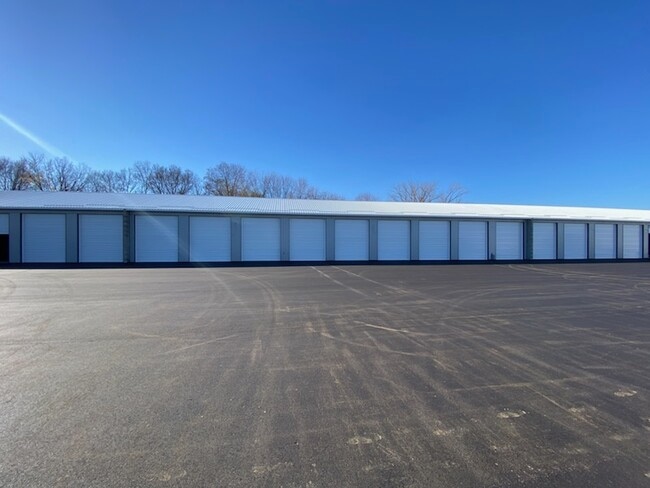
1031 Baker Dr
Cincinnati/Dayton
GARVER RD.BUS.PARK LOT 2 PT
Cincinnati, OH-KY-IN
WARREN
07-01-351-013
Ohio
Industrialacreage
2
2024
9.50 AC
2025
Monroe/Middletown
011200
NEARBY LISTINGS FOR SALE OR LEASE
DEMOGRAPHICS near 1031 Baker Dr
1 mile
3 mile
5 mile
2025 Total Population
173
28,936
89,237
2030 Population
180
29,823
92,350
Pop Growth 2025-2030
+ 4.05%
+ 3.07%
+ 3.49%
Average Age
45
40
40
2025 Total Households
69
10,769
33,411
HH Growth 2025-2030
+ 4.35%
+ 3.36%
+ 3.62%
Median Household Inc
$99,999
$74,830
$77,985
Avg Household Size
2.40
2.40
2.50
2025 Avg HH Vehicles
2.00
2.00
2.00
Median Home Value
$307,143
$279,725
$268,866
Median Year Built
1995
1987
1975
Nearby Places
Map Layers
Map Styles
 Street
 Aerial
Transit
 Traffic
 Biking
Places
Listings with unknown addresses are not visible on the map
- Restaurants
- Banks
- Shops
- Fitness
- Groceries
Nearby Properties
Address
Land Use
TOTAL SIZE
Lot Size
Zoning
Address
Land Use
TOTAL SIZE
Lot Size
Zoning
160,701 SF
10.83 AC
Address
Land Use
TOTAL SIZE
Lot Size
Zoning
198,204 SF
360 AC
Address
Land Use
TOTAL SIZE
Lot Size
Zoning
140,607 SF
314.07 AC
Address
Land Use
TOTAL SIZE
Lot Size
Zoning
258.67 AC
Address
Land Use
TOTAL SIZE
Lot Size
Zoning
40.93 AC
Address
Land Use
TOTAL SIZE
Lot Size
Zoning
130.58 AC
Address
Land Use
TOTAL SIZE
Lot Size
Zoning
157.32 AC
Address
Land Use
TOTAL SIZE
Lot Size
Zoning
369,922 SF
28.10 AC
Address
Land Use
TOTAL SIZE
Lot Size
Zoning
67.56 AC
Address
Land Use
TOTAL SIZE
Lot Size
Zoning
1,380,095 SF
47.11 AC
Address
Land Use
TOTAL SIZE
Lot Size
Zoning
112.09 AC
Address
Land Use
TOTAL SIZE
Lot Size
Zoning
3,956 SF
186.57 AC
Address
Land Use
TOTAL SIZE
Lot Size
Zoning
99.22 AC
Address
Land Use
TOTAL SIZE
Lot Size
Zoning
9,224 SF
16.21 AC
Address
Land Use
TOTAL SIZE
Lot Size
Zoning
542,679 SF
24.92 AC
Address
Land Use
TOTAL SIZE
Lot Size
Zoning
369,922 SF
28.10 AC
Address
Land Use
TOTAL SIZE
Lot Size
Zoning
201,476 SF
22.21 AC
Address
Land Use
TOTAL SIZE
Lot Size
Zoning
120,685 SF
21.52 AC
Address
Land Use
TOTAL SIZE
Lot Size
Zoning
478,217 SF
61.13 AC
Address
Land Use
TOTAL SIZE
Lot Size
Zoning
37,842 SF
13.68 AC
Address
Land Use
TOTAL SIZE
Lot Size
Zoning
612,886 SF
30.51 AC
Address
Land Use
TOTAL SIZE
Lot Size
Zoning
148,762 SF
5.01 AC
Address
Land Use
TOTAL SIZE
Lot Size
Zoning
46.86 AC
Address
Land Use
TOTAL SIZE
Lot Size
Zoning
93,289 SF
11.43 AC
Address
Land Use
TOTAL SIZE
Lot Size
Zoning
93,038 SF
25.80 AC
Address
Land Use
TOTAL SIZE
Lot Size
Zoning
86.47 AC
ADV
Address
Land Use
TOTAL SIZE
Lot Size
Zoning
36.40 AC
Address
Land Use
TOTAL SIZE
Lot Size
Zoning
113,241 SF
7.84 AC
Address
Land Use
TOTAL SIZE
Lot Size
Zoning
485,080 SF
15.10 AC
Address
Land Use
TOTAL SIZE
Lot Size
Zoning
12,500 SF
32.38 AC
MXUC
The World's #1 Commercial Real Estate Marketplace
Connect with us
© 2026 CoStar Group
The information above has been obtained from sources believed reliable. While we do not doubt its accuracy we have not verified it and make no guarantee, warranty or representation about it. It is your responsibility to independently confirm its accuracy and completeness. Any projections, opinions, assumptions, or estimates used are for example only and do not represent the current or future performance of the property. The value of this transaction to you depends on tax and other factors which should be evaluated by your tax, financial, and legal advisors. You and your advisors should conduct a careful, independent investigation of the property to determine to your satisfaction the suitability of the property for your needs.