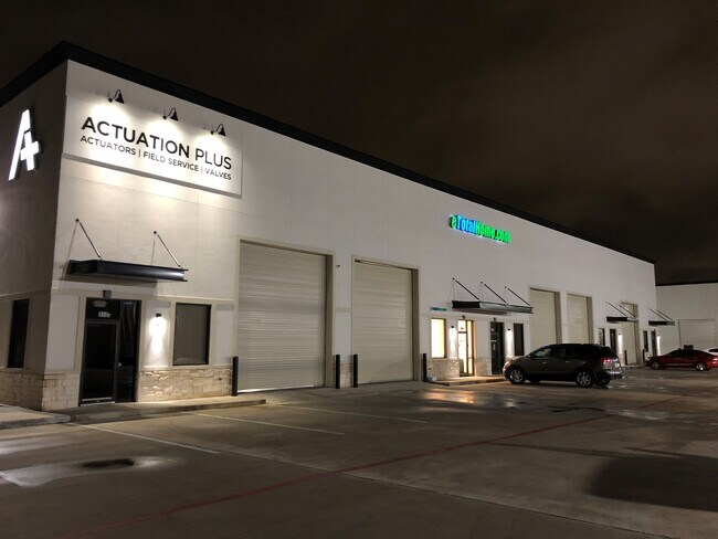
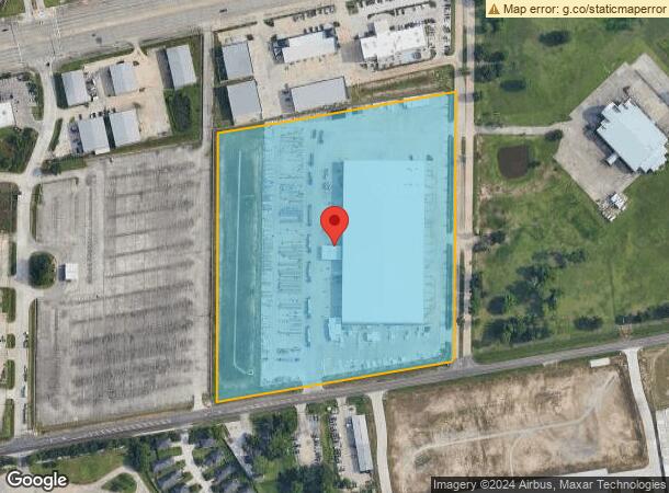
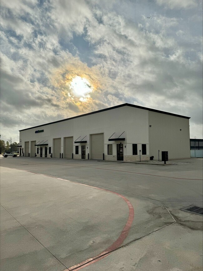
Property Record
1031 Bammel Rd, Houston, TX 77073
NEARBY LISTINGS FOR SALE OR LEASE
Property Detail
1031 Bammel Rd
1307690010001
Bammel Switch Site
Outdoorrecreationbeachmountaindesert
RES A BLK 1 BAMMEL SWITCH SITE
X
Harris
48339C0700F
Texas
2024
14 AC
2025
North Hardy Toll Road
240705
Houston
127,260 SF
Houston-The Woodlands-Sugar Land, TX
DEMOGRAPHICS near 1031 Bammel Rd
1 Mile
3 Mile
5 Mile
2024 Total Population
11,527
99,997
245,129
2029 Population
11,888
102,020
250,043
Pop Growth 2024-2029
+ 3.13%
+ 2.02%
+ 2.00%
Average Age
32
34
35
2024 Total Households
4,014
34,794
84,231
HH Growth 2024-2029
+ 3.24%
+ 2.11%
+ 2.06%
Median Household Inc
$43,885
$53,481
$59,024
Avg Household Size
2.90
2.80
2.80
2024 Avg HH Vehicles
2.00
2.00
2.00
Median Home Value
$155,898
$179,303
$194,519
Median Year Built
1990
1992
1993
Nearby Places
Map Layers
Map Styles
 Street
 Aerial
- Restaurants
- Banks
- Shops
- Fitness
- Groceries
PUBLIC TRANSPORTATION
AIRPORT
George Bush Intcntl/Houston
DRIVE
WALK
Distance
George Bush Intcntl/Houston
16 min
11.2 mi
William P Hobby
DRIVE
WALK
Distance
William P Hobby
49 min
32.5 mi
Freight Ports
Port of Houston
DRIVE
WALK
Distance
Port of Houston
39 min
27.0 mi
SALE & LEASE HISTORY
LISTING DATE
SALE/LEASE

Sep 06, 2017
For Lease
May 30, 2019
For Lease
Jan 20, 2021
For Lease
Nearby Properties
Address
Land Use
TOTAL SIZE
Lot Size
Zoning
Address
Land Use
TOTAL SIZE
Lot Size
Zoning
764,495 SF
54.15 AC
Address
Land Use
TOTAL SIZE
Lot Size
Zoning
734,137 SF
11.37 AC
Address
Land Use
TOTAL SIZE
Lot Size
Zoning
485,125 SF
28.55 AC
Address
Land Use
TOTAL SIZE
Lot Size
Zoning
276,324 SF
33.79 AC
Address
Land Use
TOTAL SIZE
Lot Size
Zoning
409,480 SF
27.32 AC
Address
Land Use
TOTAL SIZE
Lot Size
Zoning
288,721 SF
Address
Land Use
TOTAL SIZE
Lot Size
Zoning
417,597 SF
16.98 AC
Address
Land Use
TOTAL SIZE
Lot Size
Zoning
366,954 SF
18.88 AC
Address
Land Use
TOTAL SIZE
Lot Size
Zoning
350,423 SF
122.83 AC
Address
Land Use
TOTAL SIZE
Lot Size
Zoning
362,720 SF
20.23 AC
Address
Land Use
TOTAL SIZE
Lot Size
Zoning
280,283 SF
16.56 AC
Address
Land Use
TOTAL SIZE
Lot Size
Zoning
378,316 SF
17.34 AC
Address
Land Use
TOTAL SIZE
Lot Size
Zoning
271,432 SF
35.81 AC
Address
Land Use
TOTAL SIZE
Lot Size
Zoning
472,399 SF
20.63 AC
Address
Land Use
TOTAL SIZE
Lot Size
Zoning
329,643 SF
19.99 AC
Address
Land Use
TOTAL SIZE
Lot Size
Zoning
326,920 SF
22.26 AC
Address
Land Use
TOTAL SIZE
Lot Size
Zoning
287,251 SF
18.12 AC
Address
Land Use
TOTAL SIZE
Lot Size
Zoning
291,504 SF
17.17 AC
Address
Land Use
TOTAL SIZE
Lot Size
Zoning
280,318 SF
14.66 AC
Address
Land Use
TOTAL SIZE
Lot Size
Zoning
267,158 SF
12.96 AC
Address
Land Use
TOTAL SIZE
Lot Size
Zoning
174,349 SF
9.95 AC
Address
Land Use
TOTAL SIZE
Lot Size
Zoning
463,081 SF
25.65 AC
Address
Land Use
TOTAL SIZE
Lot Size
Zoning
283,283 SF
15.14 AC
Address
Land Use
TOTAL SIZE
Lot Size
Zoning
259,000 SF
15.73 AC
Address
Land Use
TOTAL SIZE
Lot Size
Zoning
259,000 SF
14.73 AC
Address
Land Use
TOTAL SIZE
Lot Size
Zoning
255,901 SF
11.01 AC
Address
Land Use
TOTAL SIZE
Lot Size
Zoning
158,081 SF
23.46 AC
Address
Land Use
TOTAL SIZE
Lot Size
Zoning
249,134 SF
11.85 AC
Address
Land Use
TOTAL SIZE
Lot Size
Zoning
339,804 SF
14.21 AC
Address
Land Use
TOTAL SIZE
Lot Size
Zoning
244,846 SF
10.03 AC
The World's #1 Commercial Real Estate Marketplace
Connect with us
© 2025 CoStar Group
The information above has been obtained from sources believed reliable. While we do not doubt its accuracy we have not verified it and make no guarantee, warranty or representation about it. It is your responsibility to independently confirm its accuracy and completeness. Any projections, opinions, assumptions, or estimates used are for example only and do not represent the current or future performance of the property. The value of this transaction to you depends on tax and other factors which should be evaluated by your tax, financial, and legal advisors. You and your advisors should conduct a careful, independent investigation of the property to determine to your satisfaction the suitability of the property for your needs.