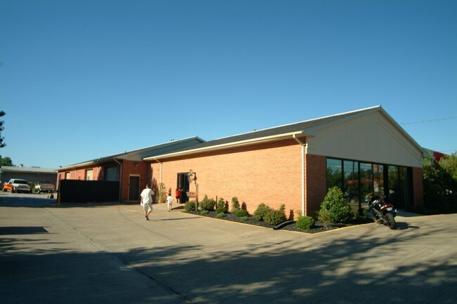
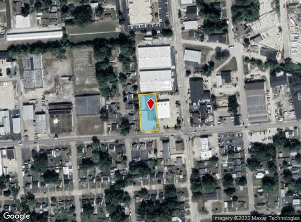
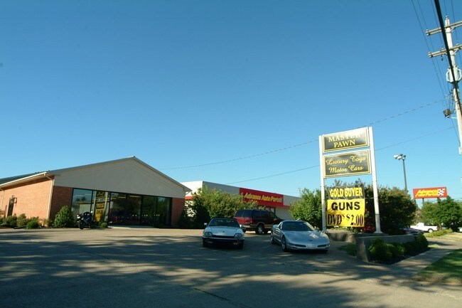
Property Record
1031 E 18Th St, Owensboro, KY 42303
NEARBY LISTINGS FOR SALE OR LEASE
Property Detail
1031 E 18Th St
002-06-13-002-A0-000
2-6-13-2A1031 E 18TH ST.554 ACRE
Commercialnec
Daviess
X
Kentucky
21059C0138E
0.55 AC
2025
Kentucky West Area
2025
Other Market Areas
000401
Owensboro, KY
7,160 SF
DEMOGRAPHICS near 1031 E 18Th St
1 mile
3 mile
5 mile
2024 Total Population
10,848
59,407
76,565
2029 Population
10,949
59,754
76,824
Pop Growth 2024-2029
+ 0.93%
+ 0.58%
+ 0.34%
Average Age
38
40
40
2024 Total Households
4,476
24,504
31,261
HH Growth 2024-2029
+ 0.94%
+ 0.62%
+ 0.36%
Median Household Inc
$37,822
$53,191
$55,784
Avg Household Size
2.30
2.30
2.30
2024 Avg HH Vehicles
2.00
2.00
2.00
Median Home Value
$103,238
$155,584
$162,176
Median Year Built
1959
1970
1973
Nearby Places
Map Layers
Map Styles
 Street
 Aerial
Transit
 Traffic
 Biking
Places
Listings with unknown addresses are not visible on the map
- Restaurants
- Banks
- Shops
- Fitness
- Groceries
PUBLIC TRANSPORTATION
AIRPORT
Evansville Regional
Drive
Walk
Distance
Evansville Regional
58 min
41.0 mi
SALE & LEASE HISTORY
LISTING DATE
SALE/LEASE

Sep 28, 2016
For Sale
May 02, 2017
For Sale
Nearby Properties
Address
Land Use
TOTAL SIZE
Lot Size
Zoning
Address
Land Use
TOTAL SIZE
Lot Size
Zoning
975,956 SF
143.98 AC
Address
Land Use
TOTAL SIZE
Lot Size
Zoning
169,482 SF
10.21 AC
Address
Land Use
TOTAL SIZE
Lot Size
Zoning
3,610 SF
1.23 AC
Address
Land Use
TOTAL SIZE
Lot Size
Zoning
4,361 SF
17.09 AC
Address
Land Use
TOTAL SIZE
Lot Size
Zoning
450,235 SF
24.61 AC
Address
Land Use
TOTAL SIZE
Lot Size
Zoning
184,854 SF
9.46 AC
Address
Land Use
TOTAL SIZE
Lot Size
Zoning
371,705 SF
57.02 AC
Address
Land Use
TOTAL SIZE
Lot Size
Zoning
88,745 SF
2.62 AC
Address
Land Use
TOTAL SIZE
Lot Size
Zoning
28,032 SF
18.13 AC
Address
Land Use
TOTAL SIZE
Lot Size
Zoning
227,450 SF
30.70 AC
Address
Land Use
TOTAL SIZE
Lot Size
Zoning
46,184 SF
1.99 AC
Address
Land Use
TOTAL SIZE
Lot Size
Zoning
215,840 SF
14 AC
Address
Land Use
TOTAL SIZE
Lot Size
Zoning
113,025 SF
2.10 AC
Address
Land Use
TOTAL SIZE
Lot Size
Zoning
187,364 SF
18.64 AC
Address
Land Use
TOTAL SIZE
Lot Size
Zoning
4.73 AC
Address
Land Use
TOTAL SIZE
Lot Size
Zoning
62,312 SF
0.88 AC
Address
Land Use
TOTAL SIZE
Lot Size
Zoning
29,600 SF
3.38 AC
Address
Land Use
TOTAL SIZE
Lot Size
Zoning
478,052 SF
26.50 AC
Address
Land Use
TOTAL SIZE
Lot Size
Zoning
165,207 SF
15.76 AC
Address
Land Use
TOTAL SIZE
Lot Size
Zoning
214,489 SF
22.72 AC
Address
Land Use
TOTAL SIZE
Lot Size
Zoning
7.63 AC
Address
Land Use
TOTAL SIZE
Lot Size
Zoning
Address
Land Use
TOTAL SIZE
Lot Size
Zoning
9,725 SF
22.36 AC
Address
Land Use
TOTAL SIZE
Lot Size
Zoning
215,439 SF
15.02 AC
Address
Land Use
TOTAL SIZE
Lot Size
Zoning
82,027 SF
2.40 AC
Address
Land Use
TOTAL SIZE
Lot Size
Zoning
38,052 SF
11.46 AC
Address
Land Use
TOTAL SIZE
Lot Size
Zoning
655,471 SF
31.03 AC
Address
Land Use
TOTAL SIZE
Lot Size
Zoning
53,280 SF
Address
Land Use
TOTAL SIZE
Lot Size
Zoning
280 SF
2.60 AC
Address
Land Use
TOTAL SIZE
Lot Size
Zoning
67,431 SF
3.53 AC
The World's #1 Commercial Real Estate Marketplace
Connect with us
© 2026 CoStar Group
The information above has been obtained from sources believed reliable. While we do not doubt its accuracy we have not verified it and make no guarantee, warranty or representation about it. It is your responsibility to independently confirm its accuracy and completeness. Any projections, opinions, assumptions, or estimates used are for example only and do not represent the current or future performance of the property. The value of this transaction to you depends on tax and other factors which should be evaluated by your tax, financial, and legal advisors. You and your advisors should conduct a careful, independent investigation of the property to determine to your satisfaction the suitability of the property for your needs.