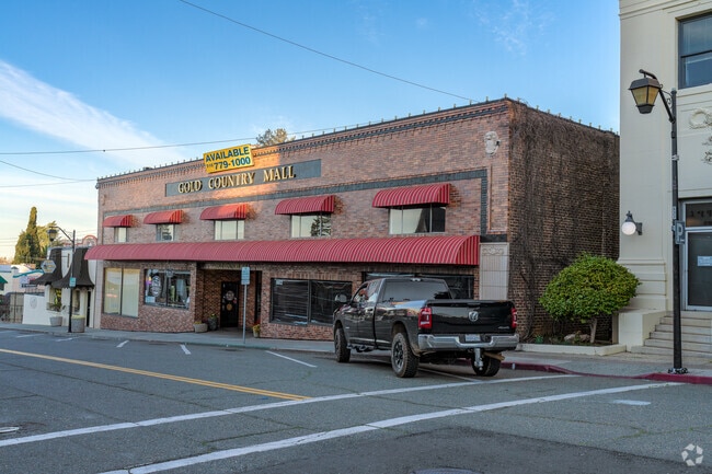
Property Record
1031 High St, Auburn, CA 95603


Current Lease Availabilities
Property Detail
1031 High St
Sacramento-Roseville-Folsom, CA
POR LOT 1 LINDEN HEIGHTS MOR A-6
002-151-002
Placer
Storemultistory
California
B and X Area of moderate flood hazard, usually the area between the limits of the 100-year and 500-year floods.
1
2024
0.20 AC
2025
Auburn/Loomis
020401
Sacramento
24,003 SF
NEARBY LISTINGS FOR SALE OR LEASE
DEMOGRAPHICS near 1031 High St
1 mile
3 mile
5 mile
2025 Total Population
6,925
25,113
41,377
2030 Population
7,255
26,270
43,078
Pop Growth 2025-2030
+ 4.77%
+ 4.61%
+ 4.11%
Average Age
45
46
46
2025 Total Households
3,201
10,735
17,079
HH Growth 2025-2030
+ 4.87%
+ 4.64%
+ 4.15%
Median Household Inc
$59,350
$79,559
$86,745
Avg Household Size
2.10
2.30
2.30
2025 Avg HH Vehicles
2.00
2.00
2.00
Median Home Value
$672,356
$665,356
$663,468
Median Year Built
1976
1979
1980
Nearby Places
Map Layers
Map Styles
 Street
 Aerial
Layers
 Traffic
 Biking
Places
Listings with unknown addresses are not visible on the map
- Restaurants
- Banks
- Shops
- Fitness
- Groceries
PUBLIC TRANSPORTATION
COMMUTER RAIL
Auburn-Conheim (Capitol Corridor - Capitol Corridor Joint Powers Authority)
Drive
Walk
Distance
Auburn-Conheim (Capitol Corridor - Capitol Corridor Joint Powers Authority)
2 min
17 min
0.9 mi
Auburn Amtrak (Capitol Corridor - Amtrak)
Drive
Walk
Distance
Auburn Amtrak (Capitol Corridor - Amtrak)
2 min
18 min
1.0 mi
Freight Ports
Port of Stockton
Drive
Walk
Distance
Port of Stockton
93 min
80.6 mi
Nearby Properties
Address
Land Use
TOTAL SIZE
Lot Size
Zoning
Address
Land Use
TOTAL SIZE
Lot Size
Zoning
84,588 SF
7.30 AC
CPDDC
Address
Land Use
TOTAL SIZE
Lot Size
Zoning
43,785 SF
3.80 AC
Address
Land Use
TOTAL SIZE
Lot Size
Zoning
81,175 SF
2.70 AC
Address
Land Use
TOTAL SIZE
Lot Size
Zoning
72,664 SF
9.80 AC
CPDDC
Address
Land Use
TOTAL SIZE
Lot Size
Zoning
124,714 SF
7.90 AC
Address
Land Use
TOTAL SIZE
Lot Size
Zoning
97,458 SF
7.90 AC
HSDC
Address
Land Use
TOTAL SIZE
Lot Size
Zoning
55,721 SF
3.10 AC
Address
Land Use
TOTAL SIZE
Lot Size
Zoning
52,100 SF
2.30 AC
Address
Land Use
TOTAL SIZE
Lot Size
Zoning
101,170 SF
4.95 AC
Address
Land Use
TOTAL SIZE
Lot Size
Zoning
53,860 SF
3.70 AC
RMDL15DC
Address
Land Use
TOTAL SIZE
Lot Size
Zoning
25,316 SF
2 AC
HSDC
Address
Land Use
TOTAL SIZE
Lot Size
Zoning
18.50 AC
CPDDC
Address
Land Use
TOTAL SIZE
Lot Size
Zoning
49,023 SF
0.89 AC
Address
Land Use
TOTAL SIZE
Lot Size
Zoning
37,259 SF
5.80 AC
Address
Land Use
TOTAL SIZE
Lot Size
Zoning
49,000 SF
2 AC
Address
Land Use
TOTAL SIZE
Lot Size
Zoning
38,276 SF
5.60 AC
Address
Land Use
TOTAL SIZE
Lot Size
Zoning
50,450 SF
2.60 AC
Address
Land Use
TOTAL SIZE
Lot Size
Zoning
13,659 SF
2.10 AC
RMDL6
Address
Land Use
TOTAL SIZE
Lot Size
Zoning
32,210 SF
5.50 AC
C2DC
Address
Land Use
TOTAL SIZE
Lot Size
Zoning
65,550 SF
5.70 AC
Address
Land Use
TOTAL SIZE
Lot Size
Zoning
35,418 SF
2.70 AC
Address
Land Use
TOTAL SIZE
Lot Size
Zoning
44,800 SF
4.10 AC
Address
Land Use
TOTAL SIZE
Lot Size
Zoning
38,448 SF
2.40 AC
Address
Land Use
TOTAL SIZE
Lot Size
Zoning
45,540 SF
1.90 AC
CPDDC
Address
Land Use
TOTAL SIZE
Lot Size
Zoning
26,064 SF
1.60 AC
Address
Land Use
TOTAL SIZE
Lot Size
Zoning
1 SF
2.10 AC
HSDC
Address
Land Use
TOTAL SIZE
Lot Size
Zoning
23,426 SF
2.40 AC
Address
Land Use
TOTAL SIZE
Lot Size
Zoning
54,476 SF
7.82 AC
Address
Land Use
TOTAL SIZE
Lot Size
Zoning
30,419 SF
3 AC
The World's #1 Commercial Real Estate Marketplace
Connect with us
© 2026 CoStar Group
The information above has been obtained from sources believed reliable. While we do not doubt its accuracy we have not verified it and make no guarantee, warranty or representation about it. It is your responsibility to independently confirm its accuracy and completeness. Any projections, opinions, assumptions, or estimates used are for example only and do not represent the current or future performance of the property. The value of this transaction to you depends on tax and other factors which should be evaluated by your tax, financial, and legal advisors. You and your advisors should conduct a careful, independent investigation of the property to determine to your satisfaction the suitability of the property for your needs.