Property Record
1031 Main St, Sewell, NJ 08080


NEARBY LISTINGS FOR SALE OR LEASE
-
-
View all Sewell listings for sale on LoopNet.com
Property Detail
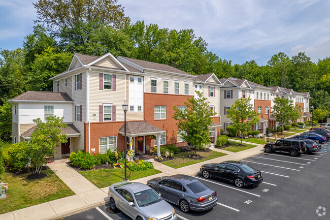
1031 Main St
Philadelphia-Camden-Wilmington, PA-NJ-DE-MD
Alta/Acsm Land Title Survey Tax Map 253
10-00253-01-00038-01
ADDITIONAL LOTS: 39/FACILITY NAME: IN-LIEU TAX PAYMENT
Taxexempt
Gloucester
X
New Jersey
34015C0182E
38.1
0
8.66 AC
2025
Lower Gloucester County
501208
Philadelphia
DEMOGRAPHICS near 1031 Main St
1 Mile
3 Mile
5 Mile
2024 Total Population
3,833
41,319
125,283
2029 Population
3,958
42,588
129,506
Pop Growth 2024-2029
+ 3.26%
+ 3.07%
+ 3.37%
Average Age
42
39
40
2024 Total Households
1,348
14,107
44,338
HH Growth 2024-2029
+ 3.26%
+ 3.36%
+ 3.55%
Median Household Inc
$95,102
$104,869
$103,815
Avg Household Size
2.70
2.60
2.60
2024 Avg HH Vehicles
2.00
2.00
2.00
Median Home Value
$299,073
$275,839
$284,637
Median Year Built
1954
1978
1981
Nearby Places
Map Layers
Map Styles
 Street
 Aerial
- Restaurants
- Banks
- Shops
- Fitness
- Groceries
PUBLIC TRANSPORTATION
AIRPORT
Philadelphia International
DRIVE
WALK
Distance
Philadelphia International
37 min
22.4 mi
Freight Ports
Broadway Terminal - Pier 5
DRIVE
WALK
Distance
Broadway Terminal - Pier 5
21 min
13.9 mi
Nearby Properties
Address
Land Use
TOTAL SIZE
Lot Size
Zoning
Address
Land Use
TOTAL SIZE
Lot Size
Zoning
2,302 SF
61.32 AC
C55
Address
Land Use
TOTAL SIZE
Lot Size
Zoning
96.68 AC
P
Address
Land Use
TOTAL SIZE
Lot Size
Zoning
228.36 AC
INS
Address
Land Use
TOTAL SIZE
Lot Size
Zoning
4.52 AC
P
Address
Land Use
TOTAL SIZE
Lot Size
Zoning
46.38 AC
P
Address
Land Use
TOTAL SIZE
Lot Size
Zoning
23.27 AC
C5
Address
Land Use
TOTAL SIZE
Lot Size
Zoning
4.89 AC
RA
Address
Land Use
TOTAL SIZE
Lot Size
Zoning
1.29 AC
Address
Land Use
TOTAL SIZE
Lot Size
Zoning
Address
Land Use
TOTAL SIZE
Lot Size
Zoning
15.98 AC
PC
Address
Land Use
TOTAL SIZE
Lot Size
Zoning
22.31 AC
C5
Address
Land Use
TOTAL SIZE
Lot Size
Zoning
2.68 AC
P
Address
Land Use
TOTAL SIZE
Lot Size
Zoning
1.52 AC
Address
Land Use
TOTAL SIZE
Lot Size
Zoning
1,316 SF
16.04 AC
PC
Address
Land Use
TOTAL SIZE
Lot Size
Zoning
7.57 AC
P
Address
Land Use
TOTAL SIZE
Lot Size
Zoning
26.26 AC
P
Address
Land Use
TOTAL SIZE
Lot Size
Zoning
8.89 AC
Address
Land Use
TOTAL SIZE
Lot Size
Zoning
12.01 AC
RA
Address
Land Use
TOTAL SIZE
Lot Size
Zoning
14.14 AC
R11
Address
Land Use
TOTAL SIZE
Lot Size
Zoning
Address
Land Use
TOTAL SIZE
Lot Size
Zoning
0.91 AC
P
Address
Land Use
TOTAL SIZE
Lot Size
Zoning
19.43 AC
PR1
Address
Land Use
TOTAL SIZE
Lot Size
Zoning
27.40 AC
LI
Address
Land Use
TOTAL SIZE
Lot Size
Zoning
Address
Land Use
TOTAL SIZE
Lot Size
Zoning
76.61 AC
PI
Address
Land Use
TOTAL SIZE
Lot Size
Zoning
5.30 AC
P
Address
Land Use
TOTAL SIZE
Lot Size
Zoning
3.23 AC
P
Address
Land Use
TOTAL SIZE
Lot Size
Zoning
14.43 AC
CC
Address
Land Use
TOTAL SIZE
Lot Size
Zoning
7.53 AC
RA
Address
Land Use
TOTAL SIZE
Lot Size
Zoning
The World's #1 Commercial Real Estate Marketplace
Connect with us
© 2026 CoStar Group
The information above has been obtained from sources believed reliable. While we do not doubt its accuracy we have not verified it and make no guarantee, warranty or representation about it. It is your responsibility to independently confirm its accuracy and completeness. Any projections, opinions, assumptions, or estimates used are for example only and do not represent the current or future performance of the property. The value of this transaction to you depends on tax and other factors which should be evaluated by your tax, financial, and legal advisors. You and your advisors should conduct a careful, independent investigation of the property to determine to your satisfaction the suitability of the property for your needs.