Property Record
1031 N Powell Rd, Independence, MO 64056

NEARBY LISTINGS FOR SALE OR LEASE
-
-
View all Independence listings for sale on LoopNet.com
Property Detail
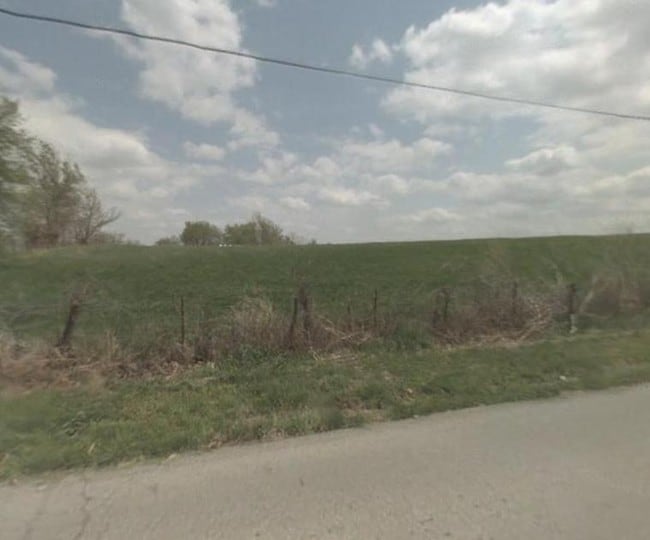
1031 N Powell Rd
Kansas City, MO-KS
Agwanda Estates
16-600-01-06-00-0-00-000
AGWANDA ESTATES --- LOT 1
Agriculturalland
Jackson
X
Missouri
29095C0302G
1
2024
East Jackson County
2025
Kansas City
017700
DEMOGRAPHICS near 1031 N Powell Rd
1 Mile
3 Mile
5 Mile
2024 Total Population
2,756
23,279
54,919
2029 Population
2,720
22,939
54,250
Pop Growth 2024-2029
(1.31%)
(1.46%)
(1.22%)
Average Age
38
37
40
2024 Total Households
939
8,346
21,329
HH Growth 2024-2029
(1.38%)
(1.58%)
(1.39%)
Median Household Inc
$94,148
$67,426
$65,414
Avg Household Size
2.90
2.70
2.50
2024 Avg HH Vehicles
2.00
2.00
2.00
Median Home Value
$185,656
$180,492
$183,908
Median Year Built
1981
1974
1973
Nearby Places
Map Layers
Map Styles
 Street
 Aerial
- Restaurants
- Banks
- Shops
- Fitness
- Groceries
PUBLIC TRANSPORTATION
COMMUTER RAIL
Independence Amtrak Station (Lincoln Service Missouri River Runner - Amtrak, Missouri River Runner - Amtrak)
DRIVE
WALK
Distance
Independence Amtrak Station (Lincoln Service Missouri River Runner - Amtrak, Missouri River Runner - Amtrak)
16 min
7.0 mi
AIRPORT
Kansas City International
DRIVE
WALK
Distance
Kansas City International
46 min
31.0 mi
Freight Ports
Tulsa Port Of Catoosa
DRIVE
WALK
Distance
Tulsa Port Of Catoosa
287 min
255.6 mi
SALE & LEASE HISTORY
LISTING DATE
SALE/LEASE

Sep 24, 2016
For Sale
Aug 20, 2020
For Sale
Nearby Properties
Address
Land Use
TOTAL SIZE
Lot Size
Zoning
Address
Land Use
TOTAL SIZE
Lot Size
Zoning
Address
Land Use
TOTAL SIZE
Lot Size
Zoning
193,191 SF
4.14 AC
Address
Land Use
TOTAL SIZE
Lot Size
Zoning
60,949 SF
16.90 AC
Address
Land Use
TOTAL SIZE
Lot Size
Zoning
56,664 SF
Address
Land Use
TOTAL SIZE
Lot Size
Zoning
111,445 SF
8 AC
Address
Land Use
TOTAL SIZE
Lot Size
Zoning
87,793 SF
24.40 AC
Address
Land Use
TOTAL SIZE
Lot Size
Zoning
24,225 SF
Address
Land Use
TOTAL SIZE
Lot Size
Zoning
104,740 SF
7.25 AC
Address
Land Use
TOTAL SIZE
Lot Size
Zoning
238,345 SF
24.70 AC
Address
Land Use
TOTAL SIZE
Lot Size
Zoning
136,195 SF
33.50 AC
Address
Land Use
TOTAL SIZE
Lot Size
Zoning
158,109 SF
2.77 AC
Address
Land Use
TOTAL SIZE
Lot Size
Zoning
46,489 SF
2.07 AC
Address
Land Use
TOTAL SIZE
Lot Size
Zoning
152,806 SF
94.25 AC
Address
Land Use
TOTAL SIZE
Lot Size
Zoning
47,978 SF
10.20 AC
Address
Land Use
TOTAL SIZE
Lot Size
Zoning
60,046 SF
31.82 AC
Address
Land Use
TOTAL SIZE
Lot Size
Zoning
15,015 SF
1.96 AC
Address
Land Use
TOTAL SIZE
Lot Size
Zoning
138,554 SF
15.62 AC
Address
Land Use
TOTAL SIZE
Lot Size
Zoning
Address
Land Use
TOTAL SIZE
Lot Size
Zoning
111,555 SF
5.54 AC
Address
Land Use
TOTAL SIZE
Lot Size
Zoning
59,939 SF
9.10 AC
Address
Land Use
TOTAL SIZE
Lot Size
Zoning
45,727 SF
9.50 AC
Address
Land Use
TOTAL SIZE
Lot Size
Zoning
38,765 SF
7 AC
Address
Land Use
TOTAL SIZE
Lot Size
Zoning
118.35 AC
Address
Land Use
TOTAL SIZE
Lot Size
Zoning
60,505 SF
128.04 AC
Address
Land Use
TOTAL SIZE
Lot Size
Zoning
5,832 SF
2.37 AC
Address
Land Use
TOTAL SIZE
Lot Size
Zoning
61,770 SF
19.98 AC
Address
Land Use
TOTAL SIZE
Lot Size
Zoning
38,783 SF
9.20 AC
Address
Land Use
TOTAL SIZE
Lot Size
Zoning
27,183 SF
6.25 AC
Address
Land Use
TOTAL SIZE
Lot Size
Zoning
17,040 SF
1.87 AC
Address
Land Use
TOTAL SIZE
Lot Size
Zoning
42,812 SF
1.70 AC
The World's #1 Commercial Real Estate Marketplace
Connect with us
© 2025 CoStar Group
The information above has been obtained from sources believed reliable. While we do not doubt its accuracy we have not verified it and make no guarantee, warranty or representation about it. It is your responsibility to independently confirm its accuracy and completeness. Any projections, opinions, assumptions, or estimates used are for example only and do not represent the current or future performance of the property. The value of this transaction to you depends on tax and other factors which should be evaluated by your tax, financial, and legal advisors. You and your advisors should conduct a careful, independent investigation of the property to determine to your satisfaction the suitability of the property for your needs.