Property Record
1031 S Taft Hill Rd, Fort Collins, CO 80521
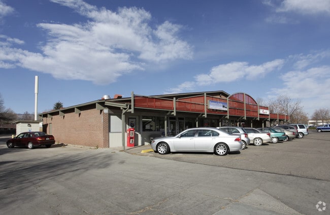


Property Detail
1031 S Taft Hill Rd
97164-40-002
LOT 2, REPLAT PART TR A OF REPLAT MILLER BROTHERS FOOTHILLS 6TH FTC; LESS ROW 20150022306
Commercialnec
Larimer
NC
Colorado
B and X Area of moderate flood hazard, usually the area between the limits of the 100-year and 500-year floods.
2
2024
0.40 AC
2025
Fort Collins
000506
Denver
5,000 SF
Fort Collins-Loveland, CO
NEARBY LISTINGS FOR SALE OR LEASE
DEMOGRAPHICS near 1031 S Taft Hill Rd
1 mile
3 mile
5 mile
2025 Total Population
21,640
92,291
150,216
2030 Population
22,530
95,911
155,483
Pop Growth 2025-2030
+ 4.11%
+ 3.92%
+ 3.51%
Average Age
32
34
36
2025 Total Households
8,921
37,262
61,665
HH Growth 2025-2030
+ 4.44%
+ 4.58%
+ 3.99%
Median Household Inc
$50,303
$65,738
$73,629
Avg Household Size
2.30
2.20
2.20
2025 Avg HH Vehicles
2.00
2.00
2.00
Median Home Value
$494,416
$561,018
$596,442
Median Year Built
1986
1985
1987
Nearby Places
Map Layers
Map Styles
 Street
 Aerial
Transit
 Traffic
 Biking
Places
Listings with unknown addresses are not visible on the map
- Restaurants
- Banks
- Shops
- Fitness
- Groceries
SALE & LEASE HISTORY
LISTING DATE
SALE/LEASE

Mar 15, 2023
For Lease
Nearby Properties
Address
Land Use
TOTAL SIZE
Lot Size
Zoning
Address
Land Use
TOTAL SIZE
Lot Size
Zoning
1,096,874 SF
72 AC
CSU
Address
Land Use
TOTAL SIZE
Lot Size
Zoning
219,925 SF
255.47 AC
FA1
Address
Land Use
TOTAL SIZE
Lot Size
Zoning
440,160 SF
29 AC
CSU
Address
Land Use
TOTAL SIZE
Lot Size
Zoning
397,677 SF
28.87 AC
FA
Address
Land Use
TOTAL SIZE
Lot Size
Zoning
521,085 SF
80.60 AC
CSU
Address
Land Use
TOTAL SIZE
Lot Size
Zoning
283,141 SF
24 AC
RL
Address
Land Use
TOTAL SIZE
Lot Size
Zoning
172,211 SF
1.92 AC
D
Address
Land Use
TOTAL SIZE
Lot Size
Zoning
281,945 SF
15.01 AC
NCL
Address
Land Use
TOTAL SIZE
Lot Size
Zoning
295,400 SF
429.46 AC
FA1
Address
Land Use
TOTAL SIZE
Lot Size
Zoning
170,119 SF
12.83 AC
C
Address
Land Use
TOTAL SIZE
Lot Size
Zoning
155,149 SF
3.67 AC
D
Address
Land Use
TOTAL SIZE
Lot Size
Zoning
290,000 SF
3.67 AC
D
Address
Land Use
TOTAL SIZE
Lot Size
Zoning
139,965 SF
8.62 AC
CSU
Address
Land Use
TOTAL SIZE
Lot Size
Zoning
191,673 SF
17.39 AC
I
Address
Land Use
TOTAL SIZE
Lot Size
Zoning
71,244 SF
5.96 AC
C
Address
Land Use
TOTAL SIZE
Lot Size
Zoning
400,000 SF
1.31 AC
D
Address
Land Use
TOTAL SIZE
Lot Size
Zoning
110,700 SF
44.74 AC
FA
Address
Land Use
TOTAL SIZE
Lot Size
Zoning
107,170 SF
14.61 AC
Address
Land Use
TOTAL SIZE
Lot Size
Zoning
189,920 SF
6 AC
E
Address
Land Use
TOTAL SIZE
Lot Size
Zoning
116,589 SF
0.87 AC
Address
Land Use
TOTAL SIZE
Lot Size
Zoning
94,079 SF
7 AC
NC
Address
Land Use
TOTAL SIZE
Lot Size
Zoning
363,294 SF
20.28 AC
MMN
Address
Land Use
TOTAL SIZE
Lot Size
Zoning
123,006 SF
10.27 AC
Address
Land Use
TOTAL SIZE
Lot Size
Zoning
367,359 SF
13.36 AC
Address
Land Use
TOTAL SIZE
Lot Size
Zoning
95,815 SF
7.46 AC
C
Address
Land Use
TOTAL SIZE
Lot Size
Zoning
61,248 SF
3.67 AC
D
Address
Land Use
TOTAL SIZE
Lot Size
Zoning
93,138 SF
14.45 AC
MMN
Address
Land Use
TOTAL SIZE
Lot Size
Zoning
400,513 SF
2.01 AC
The World's #1 Commercial Real Estate Marketplace
Connect with us
© 2026 CoStar Group
The information above has been obtained from sources believed reliable. While we do not doubt its accuracy we have not verified it and make no guarantee, warranty or representation about it. It is your responsibility to independently confirm its accuracy and completeness. Any projections, opinions, assumptions, or estimates used are for example only and do not represent the current or future performance of the property. The value of this transaction to you depends on tax and other factors which should be evaluated by your tax, financial, and legal advisors. You and your advisors should conduct a careful, independent investigation of the property to determine to your satisfaction the suitability of the property for your needs.