Property Record
10310 Auto Pl, Hagerstown, MD 21740
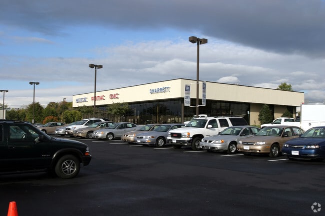

Property Detail
10310 Auto Pl
10-025443
LOT 3 10.30 ACRES 10310 & 10312 AUTO PLACE NR INTER RT40 & DUAL HWY
Vehiclerentalsvehiclesales
Washington
HI
Maryland
B and X Area of moderate flood hazard, usually the area between the limits of the 100-year and 500-year floods.
3
2024
10.30 AC
2025
Washington County
011100
Washington, DC
8,925 SF
Hagerstown-Martinsburg, MD-WV
NEARBY LISTINGS FOR SALE OR LEASE
-
-
View all Hagerstown listings for sale on LoopNet.com
DEMOGRAPHICS near 10310 Auto Pl
1 mile
3 mile
5 mile
2025 Total Population
1,705
22,757
77,135
2030 Population
1,731
23,136
78,644
Pop Growth 2025-2030
+ 1.52%
+ 1.67%
+ 1.96%
Average Age
44
42
40
2025 Total Households
750
9,197
30,857
HH Growth 2025-2030
+ 1.47%
+ 1.61%
+ 1.97%
Median Household Inc
$59,166
$76,253
$62,415
Avg Household Size
2.20
2.40
2.40
2025 Avg HH Vehicles
2.00
2.00
2.00
Median Home Value
$354,887
$283,980
$261,870
Median Year Built
1987
1985
1970
Nearby Places
Map Layers
Map Styles
 Street
 Aerial
Layers
 Traffic
 Biking
Places
Listings with unknown addresses are not visible on the map
- Restaurants
- Banks
- Shops
- Fitness
- Groceries
PUBLIC TRANSPORTATION
AIRPORT
Hagerstown Regional/Richard A Henson Field
Drive
Walk
Distance
Hagerstown Regional/Richard A Henson Field
18 min
9.2 mi
Nearby Properties
Address
Land Use
TOTAL SIZE
Lot Size
Zoning
Address
Land Use
TOTAL SIZE
Lot Size
Zoning
502,262 SF
36.64 AC
ORI
Address
Land Use
TOTAL SIZE
Lot Size
Zoning
1,236,085 SF
134.31 AC
IMU
Address
Land Use
TOTAL SIZE
Lot Size
Zoning
77,027 SF
310.67 AC
ERT
Address
Land Use
TOTAL SIZE
Lot Size
Zoning
1,247,111 SF
74.55 AC
IMU
Address
Land Use
TOTAL SIZE
Lot Size
Zoning
200,815 SF
9.14 AC
ORI
Address
Land Use
TOTAL SIZE
Lot Size
Zoning
76.18 AC
U
Address
Land Use
TOTAL SIZE
Lot Size
Zoning
290,600 SF
51.35 AC
IMU
Address
Land Use
TOTAL SIZE
Lot Size
Zoning
7,427 SF
79.25 AC
RS
Address
Land Use
TOTAL SIZE
Lot Size
Zoning
94,185 SF
9.25 AC
RMED
Address
Land Use
TOTAL SIZE
Lot Size
Zoning
88,116 SF
18.44 AC
RMOD
Address
Land Use
TOTAL SIZE
Lot Size
Zoning
67,434 SF
4.30 AC
RS
Address
Land Use
TOTAL SIZE
Lot Size
Zoning
80,816 SF
19.68 AC
ORI
Address
Land Use
TOTAL SIZE
Lot Size
Zoning
198 SF
7.04 AC
RH
Address
Land Use
TOTAL SIZE
Lot Size
Zoning
8,546 SF
4 AC
IG
Address
Land Use
TOTAL SIZE
Lot Size
Zoning
54,843 SF
3.08 AC
POM
Address
Land Use
TOTAL SIZE
Lot Size
Zoning
138,132 SF
22.90 AC
HI
Address
Land Use
TOTAL SIZE
Lot Size
Zoning
28,584 SF
4.13 AC
HI
Address
Land Use
TOTAL SIZE
Lot Size
Zoning
29,405 SF
29.47 AC
RH
Address
Land Use
TOTAL SIZE
Lot Size
Zoning
4,180 SF
244.75 AC
RT
Address
Land Use
TOTAL SIZE
Lot Size
Zoning
52,443 SF
2.19 AC
RH
Address
Land Use
TOTAL SIZE
Lot Size
Zoning
9.86 AC
CR
Address
Land Use
TOTAL SIZE
Lot Size
Zoning
154 SF
3.79 AC
RH
Address
Land Use
TOTAL SIZE
Lot Size
Zoning
8.01 AC
RS-PU
Address
Land Use
TOTAL SIZE
Lot Size
Zoning
45,305 SF
5.17 AC
RS-PU
Address
Land Use
TOTAL SIZE
Lot Size
Zoning
10,659 SF
142.91 AC
IR
Address
Land Use
TOTAL SIZE
Lot Size
Zoning
18,228 SF
7.75 AC
RS-PU
Address
Land Use
TOTAL SIZE
Lot Size
Zoning
30,660 SF
7.53 AC
RSPUD
Address
Land Use
TOTAL SIZE
Lot Size
Zoning
5 SF
5.94 AC
CG
Address
Land Use
TOTAL SIZE
Lot Size
Zoning
58,280 SF
20.16 AC
RS
Address
Land Use
TOTAL SIZE
Lot Size
Zoning
18,300 SF
8.76 AC
RS-PU
The World's #1 Commercial Real Estate Marketplace
Connect with us
© 2026 CoStar Group
The information above has been obtained from sources believed reliable. While we do not doubt its accuracy we have not verified it and make no guarantee, warranty or representation about it. It is your responsibility to independently confirm its accuracy and completeness. Any projections, opinions, assumptions, or estimates used are for example only and do not represent the current or future performance of the property. The value of this transaction to you depends on tax and other factors which should be evaluated by your tax, financial, and legal advisors. You and your advisors should conduct a careful, independent investigation of the property to determine to your satisfaction the suitability of the property for your needs.